Saturday, February 22, 2025

PA - York Heritage Rail Trail 2025 Spring Hikes - Northern Extension: Segments 1 & 2

Let's walk with spring on the York County Heritage Rail Trail over the next month or two and see what the Codorus Creek Valley holds in store. This is the best time of year to see ruins and old industrial relicts while the woods are bare. Geology (my favorite hiking hobby) is easy to appreciate and I'm always on the lookout for old quarries and mines. Lots of great birding, too. Amos the Minor Prophet, is my hiking partner. 


Codorus Creek 

Segment #1: John Rudy County Park to Emig Road Bridge (Feb 10, 2025) [Yellow on Map]

This was a 4-mile out-and-back starting and ending at the northern terminus of the York Heritage Rail Trail Extension in John Rudy Park. Once we walked out of John Rudy County Park  we came almost immediately to a beautiful winter vista of the creek, extra full with snow and ice meltwater, and a very broad flood plain. Cattle and horses grazed on a portion of the plain while another large section is farmed for crops. During large flooding events this landscape is underwater. 


Ruins of a smokehouse

The paved trail dips down along a cut-bank of the Codorus, past the present-day park administrative and maintenance buildings that were once the farmhouse, barns, and outbuildings of the Bixler Farmstead. The farm's smokehouse ruins are found right on the trail and contain a mix of red sandstone, limestone, quartz, and dolostone ( higher in magnesium than limestone). When these old farmsteads were built, stone was always sourced from fields or from pits nearby, so I kept my eye open for small quarries and waste rock piles. It wasn't long before I saw both. 


Limestone boulder

Amos was his usual 90-pound LOUD self as we turned a bend to cross over a small bridge to surprise a herd of Whitetail Deer. The gods were awakened! The deer vanished! A flock of Hooded Mergansers sprung from the main creek and Mallards dashed upstream to escape the commotion! I hung on for life as the coonhound sleigh ride dragged me along the trail to where he last saw the flashing white rumps enter the low woods. I grabbed a trailside bench to end the ride. There was a nice huge hunk of burrow-filled limestone to admire as I caught my breath. This section of the landscape along the Codorus is underlain by thick, massive beds of limestone that formed when warm, shallow seas existed here. This particular boulder is part of a large outcrop that has been quarried since the 1800s nearby at the Codorus Stone Company banks. 


Mundis Mill (1841) 


Two Kingfishers rattle-called up and down a big bend in the creek. These two may be resident, non-migratory birds enjoying the hunting opportunities on the now ice-free Codorus. We've had a more typical Mid-Atlantic winter with frequent ice-overs and freeze/thaw cycles this year so the cold water fishing has probably been very good for the Kingfishers and Herons. A gang of Turkey Vultures launched off the chimney of the 250-year old Mundis Mill/ Brillinger Mill as we came through a patch of invasive bamboo to leave us to gawk at the huge brick four-story structure. Though a tad neglected, it is still sporting its covered truck shed porch and arched millrace entrance, and a good roof.  


Grain/feed mill (left) with rubble ruin of Dam #5


It was here in this bend of the creek that the long-gone Codorus Navigation Canal had its mid-point Dam No. 5, where the mill's headrace received its water. The race flowed to the mill into the wheel pit to power the basement level turbines then flowed out to the tailrace and returned to the creek. I was able to find the tailrace by following a line of very old Red Maples that are growing along the slight rise of  race wall. Codorus Creek once had gads of mill sites from its headwaters to the mouth on the Susquehanna and this old grain/feed mill is the first one we encountered on the Heritage Trail Northern Extension heading south towards York City where there are many more. 


Massive Sycamore


Old Red Maples along a trace of the tailrace wall.

When we reached the modern green pedestrian bridge over the Codorus we looked downstream (north) across the wide floodplain. The rubble remains of Dam #5 were just visible near the beautiful old Yorktowne Farms hay barn. Not so beautiful was modern trucking warehouse on the rise above the creek, part of a large industrial center where truck traffic and interstate noise permeates the cold, crisp air all around. Here we made our turn-around for the 4 mile out-and-back to return the same way we came to John Rudy County Park. It was a short walk but it fit neatly into a busy day. 


Codorus Creek at Emig's Road Bridge


Segment #2:  Emig's Road Bridge to Loucks Mill Road Parking (Feb 22, 2025) [Green on Map]

I squeezed this walk into an early morning few hours before work for a 5-mile out-and-back to where we left off two weeks ago at the Emig Road Bridge. This is part of the 8-mile northern extension of the York Heritage Trail above the city of York. The original trail begins in downtown York City and ends in New Freedom, PA, 21 miles long. This 8-mile extension was completed only a few years ago and is still relatively new. 


This section of the trail passes through high bluffs of quartzite ridge and talus slopes where the trace fossil Skolithos are found in abundance. Named new to science in 1840 by our very own Samuel Haldeman, naturalist and geologist from Lancaster County, the appearance of these trace fossils represent a high energy beach front environment - think the Outer Banks and Cape Hatteras. Trace fossil burrows may have been made by marine invertebrates such as worms or arthropods at the edge of the sea along the tidal and surf zones. These bluffs are high above the trail and cast the creek valley into shadow until the sun rises above them. This morning it was frosty through this section! Brrrr!


Skolithos trace fossil burrows (Haldeman, 1840) 

Skolithos. 


Rolling trail.

Ice edged the Codorus below and patches of residual snow were still holding fast to shady banks. But signs of spring were beginning to show - fat red leaf buds of Red Maple, plump yellow flower buds of Witch Hazel, and an early morning chorus of bird song let me know that spring is fast approaching. Common Mergansers patrolled the creek while Red Bellied Woodpeckers, Northern Flickers, and a Pileated Woodpecker represented their clans setting up territorial boundaries and beginning work on nest cavities. Everything was very busy!

Quartzite ridges and Codorus Creek

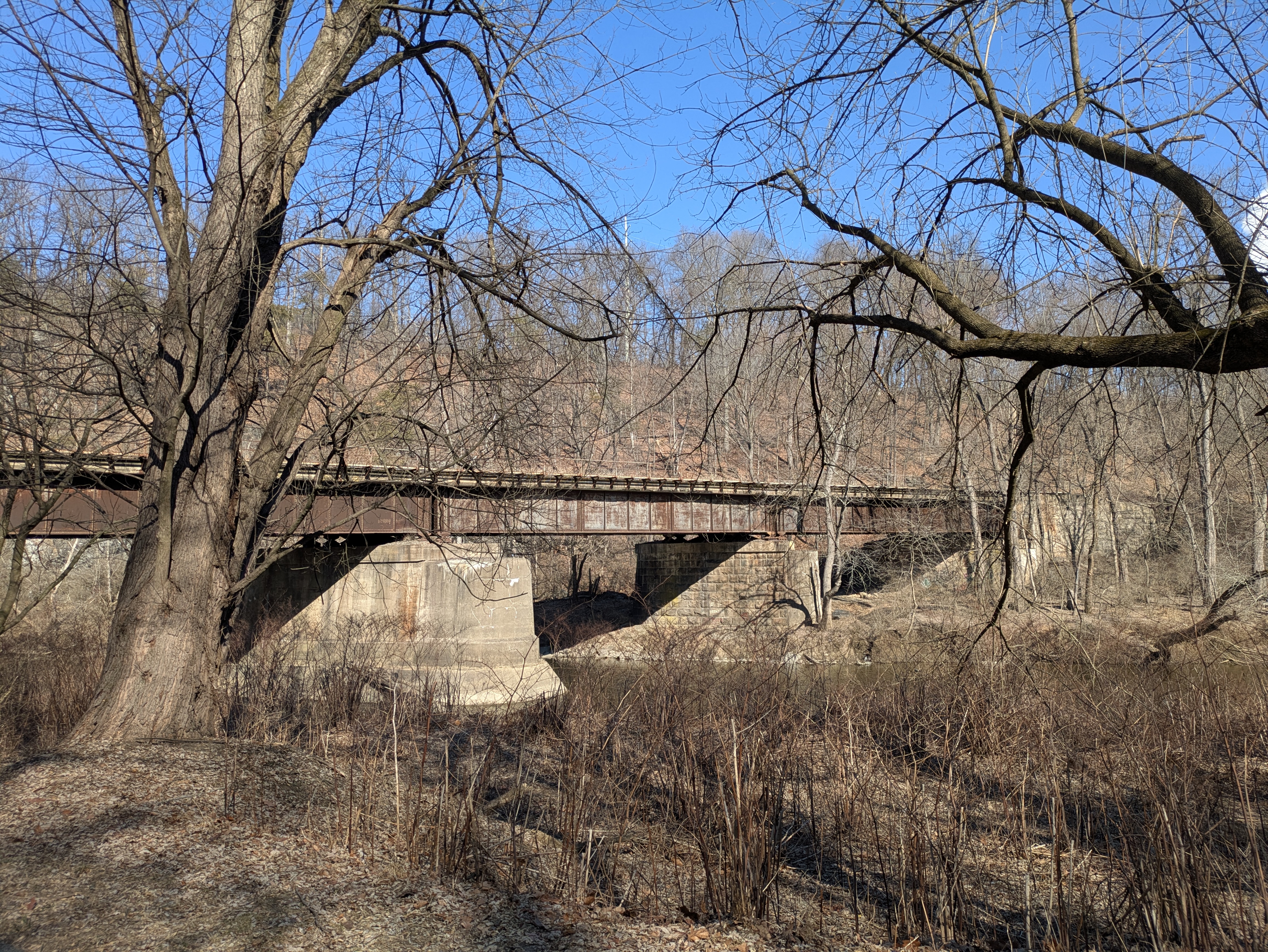
Black Bridge carries CSX freight to and from York


One of the things I love about the York Heritage Trail is that it follows active rail lines for much of its length. York City is served by Norfolk Southern and CSX both being essential freight lines that carry product and materials to and from the busy industrial fringe and heart of this once powerful manufacturing center. During the late 1800s and early 1900s no less than five rail lines utilized this valley including two trolley lines, two standard gauge railroads, and a narrow gauge railroad. I was hoping a Saturday train might come through but I guess they have weekends off. 


Ardent Flour Mills

The hum of the busy Ardent Flour Mills across the creek reminded me of how important this creek was to the dozens of mills that operated along these banks in the 1800 and 1900s. The bridges that crossed the Codorus out of York were in the crosshairs of Confederate raiders who, in June of 1863, blew up the Black Bridge to disrupt rail traffic and isolate the milling district that contained essential materials the southern army needed. Though the North Central Railway repaired the bridge within days, Black Bridge was placed under armed guard for the duration of the war. The North Central Railway was a prime target for General Early's raiders and the company lost twelve bridges between the Maryland Line and York. All were swiftly rebuilt by railroad workers but the constant threat of further attacks hung heavy along this creek. 

Cascade of Partridge Berry

Frost-curled fern

 
Flood levied and straightened Codorus Creek


Coming into the more industrialized northern edge of York City, the wild creek valley suddenly becomes an engineered flood-prevention project with levies and stripped banks. This is the start of a four-mile section of Army Corps of Engineers projects that began in the 1930s to prevent damaging floods from destroying industries, commerce, and neighborhoods. The project continues its upgrades and improvements to flood walls, a dam, upstream reservoir, and rip-rap diversions/banks in what seems to be a never ending years-long refurbishment of this aging flood control system. 

Urban eagles nest here

An active nest

Just before the parking area on Loucks Mill Road where I left the truck, we passed an active bald eagle's nest where I was able to see a sitting female and an attentive male nearby. Most eagle pairs have by now laid at least one, possibly two eggs, and are awaiting hatching. Their presence in this wild pocket of flood plain forest surrounded by industrial lands and busy roads is a good sign for the recovery of Codorus Creek as a reliable fishery. It wasn't too long ago that this creek was overwhelmed by industrial waste water and sewage. The creek was dead. Fifty years on and it is a success story for the urban wilds. 

The wild side.

I was surprised by how much wildlife Amos and I saw and heard on this little 5-mile O&B. Red Foxes, Red-Tailed Hawks, Mergansers, Mallards, all the Woodpeckers, Killdeer (lots of those on the flood control banks), Robins, White-Tailed Deer, a Meadow Vole, Great Blue Heron x 5, Grey Squirrels, and (my favorite) an American Mink, filled my species list. Never mind that Amos YELLED at the Red Fox (who cared less on the opposite bank) until he went hoarse, this little sanctuary at the edge of the city was full of life ready for spring. 

Notes:

Black Bridge and other North Central Railway bridges suffered damage during General Jubal Early's raids in June 1863 in preparation for General Lee crossing the Confederate Army into Pennsylvania. https://yorkblog.com/cannonball/rebel-destroy-the-codorus-brid/

Friday, January 31, 2025

Cold Nights with Two Masters - Outer Banks NC Sketches

My recent winter camping adventure over Christmas break to Cape Hatteras National Seashore NC has inspired a few January evenings of quiet work trying to interpret the many photographs and field sketches I captured there. Winter skies and the muted tones of marsh and dune challenged my perception of space and color so I looked to William Merritt Chase and Frank Dudley, to help me see and interpret differently. 


Known for his passion for teaching landscape and portrait, William Merritt Chase (1849-1916) spent summers on Eastern Long Island with his family in a home-studio in the Shinnecock Hills. A career art educator he taught at several art institutes during the school year, but come summer he devoted his time to his own painting, his family, and a small summer art school.  I looked at his cloudscapes and dune compositions for clues on how to see the colors hidden inside sand and sky. I experimented with his color schemes and design that added structure to my hastily done field sketches. 


Front dune path


I realized that part of the problem was that I had whisked through many of my sketchbook pieces so fast in order to keep my hands and fingers from freezing that I didn't really pay attention to powerful structure of the dunes. I was so rushed that I neglected to capture - even in notes - the weight of dark color against the lighter sand forms. Studying Chase gave me the courage to go dark and reserve the white for hints and highlights. Nowhere in his dune works is sand simply white. Sand reflects the colors around it and on dark, wintery days, my dunes were much improved by using the full palette of dark colored pencils from my field kit. 


Sunrise sketch


I took the bold color lessons and applied them to a sunrise sketch. Using two reference photos and my original scribbled field sketch (again, I was freezing!) I dared myself to save only a slim white rim of beach wash and pressed fully into the heaviness of the color scheme depicting an overcast sunrise where only a suggestion of sun leaked from the clouds. I'm really glad I spent an evening with this early 20th century American master as he's changed the way I see and use color in these small sketch renderings. 


Field sketch on a cold, wind-whipped day 


On another frigid January evening I decided to spend a few cozy hours looking at the work of Frank Dudley, a champion for the conservation landscape that is now the Indiana Dunes National Lakeshore. Through his art and advocacy he was able to spearhead a local and regional effort to protect the wild lakeshore along the southern coast of Lake Michigan. This is a place I love and have visited several times, and I always look forward to going back. It's as wild and crazy and dune landscapes can get, a real treasure for coastal naturalists like me.  I love hiking, botanizing, birding, and sketching through the traveling dunes as they roll inland through forests and grasslands and harbor their own unique wetlands, like I found on the Nags Head Woods Preserve on the Outer Banks


Back dune shrub wedge 

As I studied Dudley's dune works I was amazed at how he applied blues, greens, and violets not only as shadow and depth but as major composition components. These clues on how to pull out the monumentality of my own dune sketches launched me into two nights of working and reworking my stack of pencil sketches (not attached to my sketchbook) until I felt brave/determined enough to turn to two sketches in my book and give them the Dudley treatment.  


Alligator River National Wildlife Refuge 

This little multi-night expedition into Chase and Dudley's work really helped me see color as a dynamic force in the way field sketches can make big landscapes translate to the small space. A big lesson I learned from both artist's techniques and vision was to limit my use of the white paper as light within the sketch. Color is all, said Chase. The second lesson was to be bold in the use of color as design - use color like structure. Chase would make his students gasp with his boldness on the canvas. 


Notes:

Frank Dudley. "Inspired by Dunes" Indiana State Museum 2023 Exhibit 

Frank Dudley. "Painter of the Dunes" Indiana Historical Society IHS Blog 

William Merritt Chase. Parrish Art Museum "The Shinnecock Years" 2019 Exhibit

NPR "William Merritt Chase: The Man Who Taught America's Masters." Susan Stamberg, 


Monday, January 6, 2025

Reading Now - The Great River: The Making & Unmaking of the Mississippi


Upholt's 2024 book The Great River came via recommendation from Places Journal Fall 2024 Bookshelf selections that include a few more from their list I'd like to read this year. 

I chose The Great River mainly for my Christmas camping trip to the Outer Banks, NC, and found it a perfect long winter night's read tucked into my sleeping bag. It was a good learning companion for beginning to understand the mindset of mythology for engineering and controlling nature on the Outer Banks. 

I am very interested in the Mound-Builder Cultures of the Mississippi Drainage that include many found in the river valleys and floodplains of the Ohio River in West Virginia. I visit these mounds when I am traveling through the Mountain State and have the same questions as Upholt, why they were built and where did they go? What are they able to teach us today? 

I like that the questions of indigenous occupation of the Mississippi drainage runs as a throughline to the modern history of managing the river and its tributaries. There is the history of snagboating, steam dredging, upriver and downriver trade, the short age of paddle wheelers, and environmental commentary by Mark Twain.

The million-square-mile Mississippi Valley was the Wild West even before the Jeffersonian Expansion  and also the heart of planation and slavery culture as its floodplains were drained.  Upholt takes readers into the complicated origins of the rise of industrial agriculture, the petro-chemical sacrifice zones of Cancer/Death Alley, and gives voice to the many communities of color that suffer the brunt of government (federal and local) funding abuse meant to help river people causing them harm instead. He covers the complex sciences of engineering and water management and the grand map-making of Harold Fisk.


A chapter covers the most recent hurricanes to hit the Gulf States and the river's response to the massive floods of 2019 that, after two hundred years of fascinating yet troublesome history, the heralded Army Corps of Engineers barely managed. 

Upholt's writing is part historical chronicle of control and part testimonial (some of it personal) to our addiction for control, echoing and updating the story of the battle against the Mississippi begun by John McPhee's Control of Nature (1989). I have always wanted a continuation of that book to see what happens next and with The Great River the story does indeed flow on but with more muck, detritus, and mud. Climate change is an ever present character and while local and state governments and their various agencies cannot seem to utter the words, they do acknowledge that the weather patterns, flood patterns, water flow and volume is most definitely changed from what it was in the 1800s, happening so fast now that technologies and funding can hardly keep up. 

I like that Upholt concludes The Great River with the idea of the beauty of change. This includes ways to think about resilience for both river and people. He visits a modern but impoverished Native American community that for many generations has lived within the ever changing Delta and their advice for the rest of us comes from the deepest consideration of what it is to live with a river - to stop fighting nature because it will never be conquered. It's a war we cannot win.  Like the ancestors who built those mounds, there are ways to adapt and survive as real witnesses to change, they suggest, important lessons learned over thousands of years.

Except that our short-sighted, bottom-line, capitalist society hasn't really learned those lessons well enough. Not yet, anyway. Upholt, however, gives a glimmer of possibility.  

Upholt, Boyce (2024) The Great River: The Making & Unmaking of the Mississippi. W.W. Norton & Company.   (Local library copy - Paul Smith Library, York County, PA) 

McPhee, John (1989) The Control of Nature


Thursday, January 2, 2025

NC Alligator River NWR - Red Wolf Hike (5 miles)

The Red Wolf saved, America’s triumph; the Red Wolf lost, America’s shame

 Edward O. Wilson


In the mid-1980s I had the opportunity to join a USFWS team for few days. I was working as a ranger in South Carolina on one of the many barrier islands that was under conservation management. It was a perk of the job (there had been many!) to be asked to help out with special interagency projects and special events. This was one of those times. 


Coastal pineland grasslands, AGNWR

Three state folks, me included, had been invited to accompany federal Red Wolf biologists and a small gaggle of photographers across the sound to Bulls Island where the first experimental large predator reintroduction program was wrapping up. Since the 1970s, Bulls Island had produced 26 wolf puppies with healthy mated parents and with the new reintroduction site identified in coastal North Carolina at the Alligator River National Wildlife Refuge (ARNWR) it was time to bring the Bulls Island program to an end. Moving pups and adult wolves in their metal catch crates to the boats for transport to ARNWR and other reintroduction sites around the country was one of the last special perk jobs I did before leaving South Carolina for a DNR ranger job in Maryland.  


Freshwater wetlands on the Albemarle Peninsula 

I may have left South Carolina but the experience of that recovery and relocation opportunity never left me. I met the men (it was all men at that time) who created the first large predator reintroduction program for wolves in the US and I'd met the Red Wolf, an all-American endemic wolf species once found from Pennsylvania to the Gulf of Mexico to the Heartland. Before European settlement, the Red Wolf shared habitat with the Eastern Cougar and Wood Bison, all gone now. Settlement and industrial expansion eradicated all three species from the Eastern and Southeastern region as forests were logged off, wetlands were drained, and agriculture replaced rich biodiverse ecosystems with monoculture and livestock. By the mid-20th century, the Red Wolf was near extinction. 


18th century drainage ditch

For decades now I've followed the Red Wolf recovery story in all its drama, celebration, and sorrow. It hasn't been easy at all for both wolves and biologists. As a species, the survival of the Red Wolf continues to hang precariously in the balance. One of the other two state folks who were with me those few days back in the 1980s at Bulls Island, Paul, has since retired from public service and is now a full time USFWS volunteer who lives in his camper on the ARNWR with his wife who is also a volunteer. It was great to see them after so many years and talk about how that experience changed us. As his guest, he drove me down some non-public roads to see if we might catch a glimpse of one of the 16 remaining Red Wolves on the reserve. We didn't see any, but we heard some at a distance - a pack greeting of happy howls and barks. I was over the moon excited and couldn't help tearing up. I captured the very end of the greeting on my phone but it is very difficult to hear. I've listened to it a hundred times since last week.


Milltail Creek watershed- home to the famous Milltail Wolf Pack

As we returned to my truck at their campsite (where Amos had to stay) he suggested some places to hike with my dog that were open to the public and where I might - if I was very very lucky - see or hear Red Wolf activity. Bears were a certainty, he said. We had a late lunch on the picnic table by the camper and he told me about the tragic loss of a male wolf this past June that also resulted in the loss of 5 puppies. Six deaths in one summer had reduced the surviving wild population on the peninsula to just 16. I felt sure I would not see any wolves during my late afternoon hike, plus I was worried about Amos and bears. He looses his mind over bears. Off I went for a five mile hike and a promise to check back when I finished so we all could say goodbye for now. 


Sandy Ridge Trail 

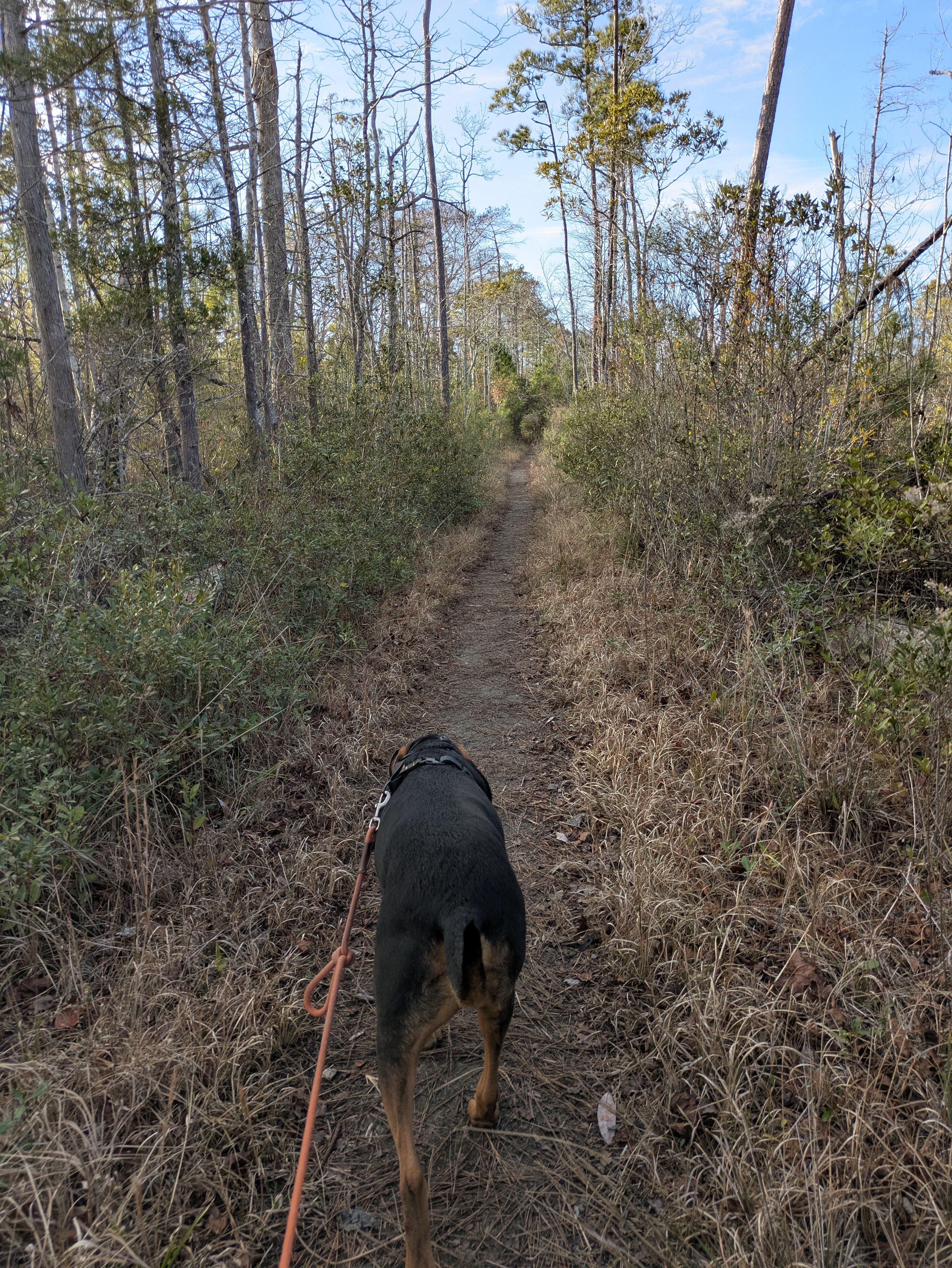
We hiked the out-and-back Sandy Ridge Trail and heard a rail - dare I say King Rail? Amos saw his first alligator, a four-footer floating log-like in the canal. We then moved on to the Wynne Road where "bears are everywhere" but saw none which I wasn't sad about since I was worried about being able to control Amos and had a death-grip on his short leash. We made a loop of it using the closed-to-vehicles Hook and Osprey Roads back to Buffalo City Road and the truck. I saw and heard barred owls and woodpeckers of all kinds, plus on Buffalo City Road watched a crowd of deer being chased by something. The something never crossed the road, however. 


Cattail and Pond Pine on Wynne Road

Back at the truck, another truck pulled in. The driver looked a little shook up. He'd just come down Sawyer Lake Road (which intersects Buffalo City Road). "I don't know how it will end up," he said, "but I just watched a collared Red Wolf chase a bird dog across the road. It wasn't playing. It was hunting that dog." I was so excited for this guy who, despite having a big camera and lens, hadn't the time to react to take picture. He'd been coming to the NWR all month hoping to see a wolf, but to see this was extraordinary. That explained the deer running out of that patch of woods across the road where I saw them, I said. 


Pond Pine


I found Paul at a parking area working on some invasive plant removals, a patch of non-native privet. I told him about the wolf-dog sighting and with that the photographer pulled into the same parking lot. We all talked a good while about what he'd seen and the paradox that predator conservation often presents us with. Night was fast coming on but we stood there a bit longer with the traffic along Rt 64 whizzing by.  "The feds have just approved the funding to build a wildlife corridor underpass here," said Paul. We all agreed that it was a long time coming, especially for the most endangered wolf species in the world. 


No bears today


When we first started working with this wolf, he was 99 miles down a 100-mile-long road to extinction. We now have him identified, and we feel we have him turned around the other way. It will be a long uphill push to save him.; I don’t know if we can do it. If we decide that it is feasible, we need you to help pull; we sure are going to push. 

- Curtis Carley, first FWS Red Wolf recovery project field coordinator, 1977


Notes: 

T. Delene Beeland (2013) The Secret World of Red Wolves: The Fight to Save North America's Other Wolf. University of North Carolina Press. https://a.co/d/5eK2eZf

Alligator River National Wildlife Refuge https://www.fws.gov/refuge/alligator-river

Eric Trefney's excellent piece for Rewilding Earth, "A Milestone in Red Wolf Country." 

Rewilding Earth podcast with Eric's update on the wildlife crossings in NC and other amazing rewilding efforts. Episode 139: Year-End Recap 

Wednesday, January 1, 2025

NC Outer Banks - Three Maritime Forest Hikes (11.5 miles)

Live Oak, Buxton Woods

Unlike in the heavily forested landscape of Pennsylvania it was hard to find a long trail through the woods anywhere in the Outer Banks. So over the course of three days I cobbled together a few shorter woodland trails to explore what remains of the coastal maritime forests. 

I wouldn't do these trails during warmer months as biting insects (flies, mosquitoes, chiggers, ticks) are a real problem here - one of the reasons I prefer to visit the coastal areas only in winter. It was warm enough, however, for the deer and dog ticks to be active. I did spend a bit of time after each hike removing 2-3 crawling ticks from my pants legs and the dog. 


Fort Raleigh National Historic Site:  Thomas Hariot Trail (1 mile) and Freedom Trail (2.5 miles)


Late morning and early afternoon spent at Fort Raleigh National Historic Site on Roanoke Island offered two nice short woodland hikes. Being the day after Christmas, we almost had the whole place to ourselves. I met a fellow UGRR researcher at the Visitor Center who helped establish the Freedom Trail here and though she couldn't hike with us, she was very excited to share some history of the Freedman's Colony that was located on this site after the Union Army took control of Roanoke Island


Restored ramparts of Fort Raleigh, 1585

For the first English settlement in the New World, nothing much is here. The original fort and settlement site is the stuff of archeologists doing ground surveys and given that entire colony of settlers disappeared between 1587 and 1590, it all seems a bit mysterious. Included among the original expeditionary party were three naturalists, John White, Thomas Hariot and Joachim Gans. Thanks to the surviving field journals of John White who returned to England, we know something of the people they met here, animal and fish life, botany. The trail, however, is named for Thomas Hariot, a medicinal botanist and was a pleasant mile-long loop that wanders the maritime woods to the Roanoke Sound shoreline.


Erosion cuts into the maritime forest ...


...as Roanoke Sound rises

The most striking spot along this trail was the ruins of the grand Elizabethan Garden gate that once marked the grassy, grand entrance from the once long distant shore of the sound. The original shoreline as the settlers would have known is now over a mile and a half out.  Rising seas and heavy storms over the last century are steadily encroaching on the forest and the historic grounds of the Fort Raleigh National Historic Site. 


Powdered ruffle lichen

Bark Rash Lichen

Best described as an evergreen maritime forest, Yaupon Holly, Live Oak and Laurel Oak, Magnolia, and Loblolly predominated throughout the mile-long loop. Mosses and lichens added to the color and texture of the twisted limbs of the oaks while the more lateral and substantial branches held small gardens of fern and moss aloft. Partridge Berry blankets the forest floor while thick stands of Dwarf Palmetto blanketed the soft swales. 


Yaupon Holly

Laurel Oak

Spanish Moss on Live Oak

We moved across the historic site to connect with the Freedom Trail that follows an old pine woods road to the Croatan Sound. This was a nice stretch-your-legs and walk fast trail where we met a lot of dogs and their humans. Amos met lots of new friends. We rested on the pocket beach for snack break before turning back and enjoyed some birding. A series of  interpretive signs with metal shadow figures helped me learn the history of emancipation and the Freedman's Colony on this site. It was very moving. 


Interpretive signs and metal shadow figures on the Freedom Trail

On the Croatan Sound

Loblolly Pine

____________________________________________________


Nags Head Woods Preserve (5 miles) 


Owned and managed by the North Carolina Nature Conservancy, Nags Head Woods Preserve was hands-down my favorite hike. It was also longest hike of my visit to the Outer Banks. It was such a pleasant surprise to find this mature maritime woodland tucked behind the island resort town of Kill Devil Hills. It the largest surviving maritime forest tract on the Eastern Seaboard, a real gem of conservation stewardship. 


Nature Conservancy Education Center

The Education Center was closed for the holidays but maps were well stocked at the kiosk on the porch and after checking to see which trails were dog friendly, off we went. We combined the Old Nags Head Road with three of the trails for five miles, but could have done more.


Trail Kiosk 

Black Oak, Quercus velutina

Oaks predominated along the trails with some very impressive Black Oak stands. American Beech, Hornbeam, Maple, Laurel Oak, Magnolia, Hickories, Black Gum, and other hardwoods typical of the Piedmont. Swamp Sweetbay, Yaupon Holly, and Dwarf Palmetto thickets grow along the ridges and down the slopes. Placed along the Roanoke Trail are QR-coded interpretive signs that link to the Roanoke Trail Audio Tour with oral histories given by community members who once lived here when it was still a dispersed farming & fishing community. It was so cool to hear the voices of the people who lived among these woods while I hiked. We came across several old cemeteries walking along Old Nags Head Wood Road (dirt) and found plenty of interdunal ponds to explore along the trails. I listened to it again when I got back to the campsite at Oregon Inlet. Well done, NCNC.

Interdunal freshwater pond


Over 60 species of freshwater fish, reptiles, mammals, and amphibians are found in and around the many ponds formed in the swales between the high standing ancient dunes. Though some of the ponds are dry, being vernal or affected by the drought, there were so many that were holding water and covered in bright green duck weed that I could see them at some distance from the top of the hills. 


Old Nags Head Road cemetery

Tillet Family cemetery

The woods here are very much protected from the salt spray winds by the high dune field (60') at Jockey Ridge State Park just to the southeast. Here the trees stand tall and spread comfortably out into sunny patches without the forced flagging and wedge-shaped behavior of trees directly exposed to the harsh sea winds. Many of the trees are quite old, two hundred years or more. Pileated woodpeckers, sapsuckers, and flickers were everywhere tap-tapping and chattering. 


Magnolia and Sweet Bay under the Loblolly Pines

Tillet Farm site


Marsh on the Sound

We hiked out past the old Tillet farm site across a boardwalk over cordgrass marsh to the edge of the Roanoke Sound to a beautiful little pocket beach. I listened to the audio tour a little more while having a snack with Amos. The interview of Evelyn Gray's Christmas memories seemed especially poignant since today was only a two days after Christmas Day. 

__________________________________________________________


Cape Hatteras National Seashore:  Buxton Woods Coastal Preserve & Buxton Woods ( 3 miles) 


With the famous Cape Hatteras Lighthouse ensconced in heavy scaffolding for its renovation (after being moved further inland to the new Visitor Center site) we easily found the trails that led from the new main parking area to NPS Buxton Woods Trail and NC Buxton Woods Coastal Preserve (along Open Ponds Trail). Interdunal ponds are thick with cattail and common reed. Being so close to the ocean and its punishing winds, the forest here is primarily Live and Laurel Oak, Loblolly Pine, and Sweetbay. The forest was stunted, leaning landward, and flagged into wedge formation. 


Leaning landward

Dwarf Palmetto

Interdunal freshwater pond 

We made our way across a boardwalk where Amos alerted to something heavy moving through a sedge and cane swale. Whatever it was, it never showed itself. We connected to the Open Ponds Trail to access the NC Buxton Woods Preserve and made a stop at another cemetery which only contained two graves, both Royal Navy sailors whose bodies washed up on the cape after their tanker ships were torpedoed by German U-boats during WWII.  


British sailor's grave

Something big this way comes...

Southern Wax Myrtle

We walked the Old Doctor's Road to return to the truck at the main parking area and met the nicest backpacker, a gentleman in his 70s, who had started the Mountain to the Sea Trail (1,175 miles) on Christmas Day. The trail begins in the dune field at Jockey Ridge State Park near where we were at Nags Head Woods Preserve. He has already hiked three days and is being supported by his companion who is driving a camper van where he sleeps every night after she picks him up. He is prepared for the longer stretched inland where day hiking is difficult and he is prepared for tent camping when he gets to those sections. As we stood there talking, his companion pulled in to pick him up for the night. They were headed back to a private campground for the night and invited me to come along to join them for dinner. I don't know why I declined but I did. They were the nicest people. Good luck, "Pop-Pop-Hikes" and "Slackvanner Anne" on your big adventure! 


Notes:

Nature Conservancy of North Carolina, Nags Head Woods Preserve provides basic information on the site but the onsite education center (which was closed when I visited) has a ton more information. Free in the kiosks are bird, reptile, and plant lists as well as a general trail map. The Outer Banks Visitor Center website has more information on the history of the site. See the Nags Head Woods Ecological Preserve page.