Saturday, December 31, 2022

PA Enola Low Grade Trail: Night Hike

 #51  2022 52-Hike Challenge: Enola Low Grade Rail Trail Night Hike: 5 miles

Every river is a character, a living, breathing being. Some say they have spirits or souls. Some say rivers should have rights and be treated as people, as a nation of living things. All I know is that the Susquehanna will let you know who she is and how she wants to be treated. She is a Grandmother, an elder among rivers, one of the oldest rivers on the continent. A survivor of glacial floods, rising mountain ranges, and the insults of industrial man. The best time to meet with her is at night and listen for her advice. 


Susquehanna River at Safe Harbor Dam, 12-30-2022, sunset.

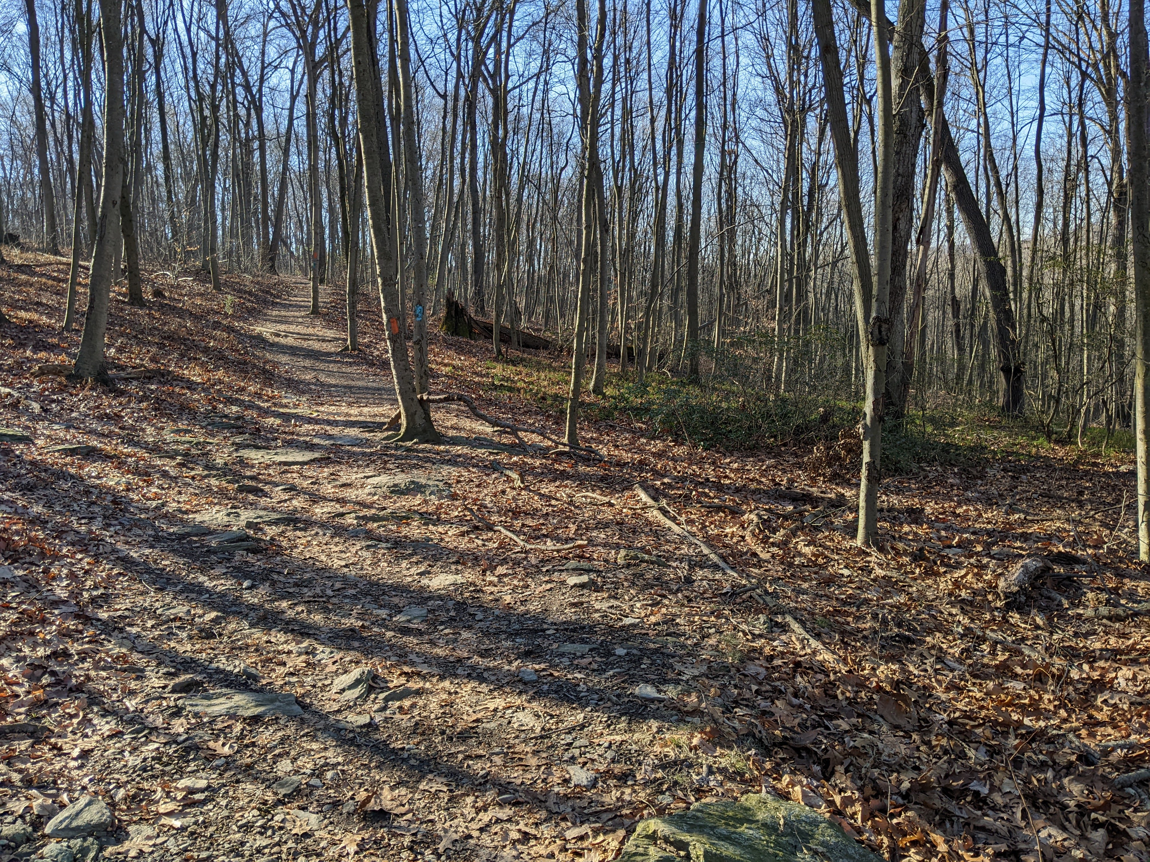
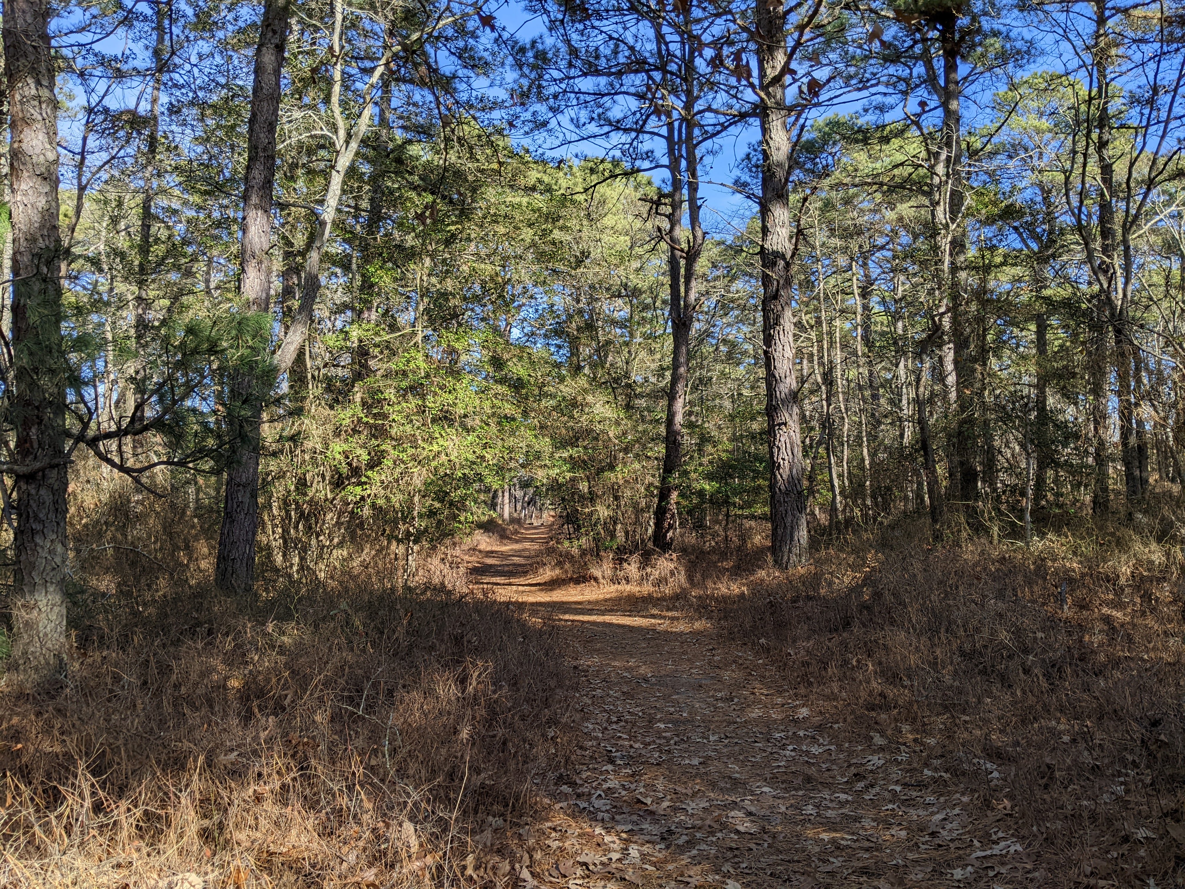
Ever since the completion of the enormous trestle bridge at Safe Harbor Dam over the mouth of the Conestoga River this year, this section of the 30-mile long Enola Low Grade Rail Trail has become a favorite for night bikes rides and evening strolls. The sunsets can attract crowds and many linger well after last light fades. Looking down at the confluence of these two historic rivers is mesmerizing in the dark. The creature sounds from the islands, eagles, gulls, herons can be heard above the rapids and deep swirling eddy pools below the dam. Clouds of gulls circle the outflow. Eagles sit on boulders in pairs. Courtships have begun.


Last light of the last sunset of 2022

I walk with Amos a five mile out and back north from the trestle bridge, past the Peregrine cliff. In a few months she and her mate will be back and the "Warning!" signs will go up again not to stop or stand too long below the eyrie.  A few unlucky walkers and bike riders this past year can tell you why. The river above the dam is a solid mass of ice and it pops, groans, and cracks like a rifle. It's here below the scrape of a nest that I send a little prayer of thanks to one of my heroes, Rachel Carson. In her time and to her alarm, many of the great birds of prey found on this river were nearly gone from exposure to toxic chemicals dumped, leached, or leaked into the Susquehanna. Now they are all back, breeding, recovering - Bald Eagles, Peregrine Falcons, Osprey.


Peregrine Cliff

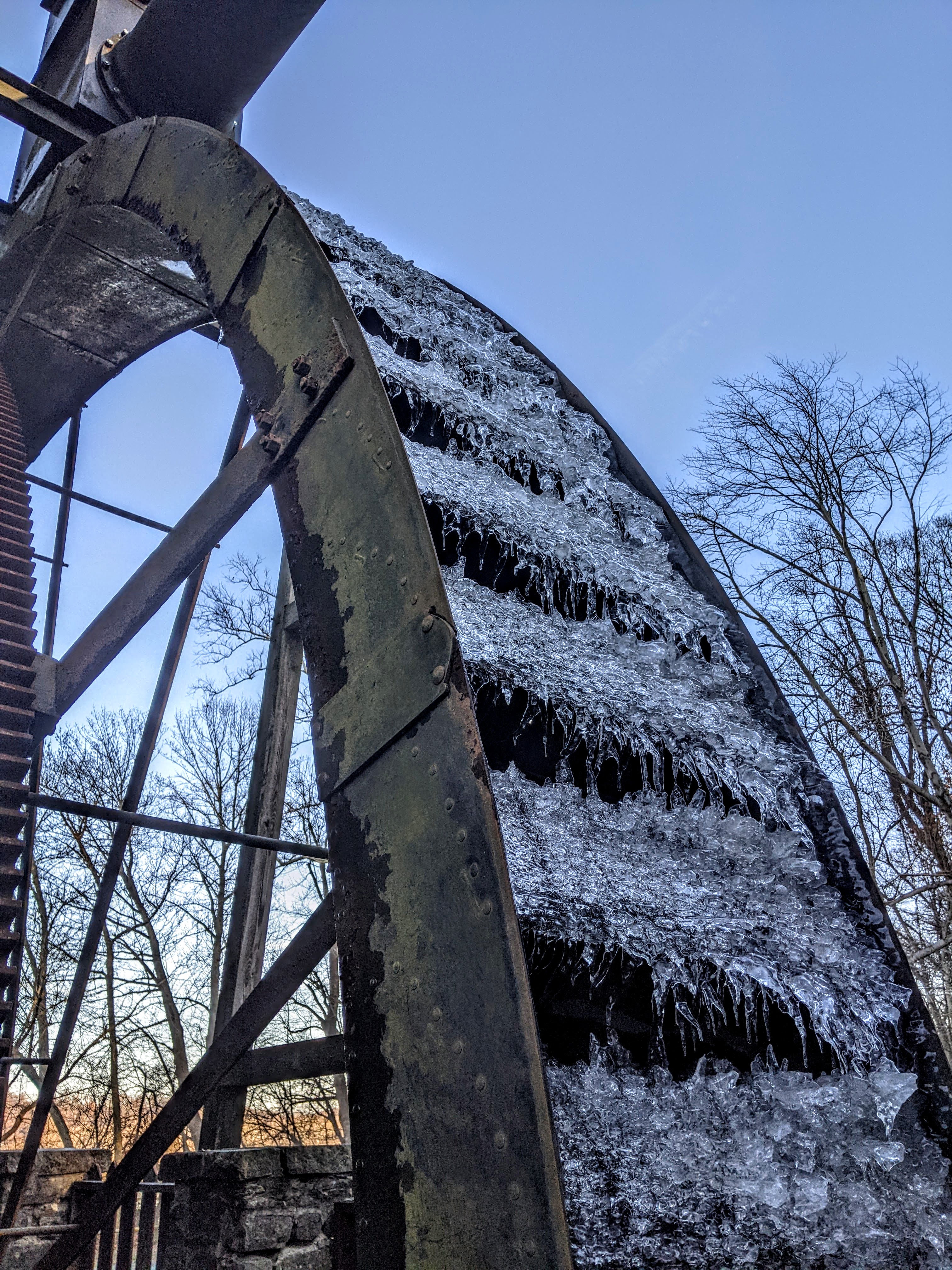
Dams are still an issue, even as I admire Safe Harbor Dam, an antique yet elegant hydro-plant that stands iconic, even beautiful in the night. I will never forget the hospitality and wonderful evening I spent here with plant staff who held a pizza party in honor of our headwaters-to-mouth paddle to the Chesapeake. We were cold and soaking wet from a downpour that lasted hours. Our two canoes had gallons of water sloshing around in them from the rain. Everything froze on contact. It was late winter, early spring. The river was running hard, wide, fast, ice-filled. The dam minders came and got us at the take-out and drove us in their big truck to the park to pitch our tents under the pavilion. They came back to get us an hour later. "Come get hot showers. We've got pizza, too!" It was the most wonderful night of our month on the river. I say a little prayer of thanks to them, even thirty years on wherever they might be now.  I pray, too, that someday the fish will pass by here again. Restore the Shad, Eel, Sturgeon, and all the Fish Nation that for millennia came home to this river from the Atlantic to spawn, I say out loud. 


Safe Harbor Dam


A line of night riders approaches, blinking white lights from handle bars and steady beams of helmet headlamps twinkling down trail. My headlamp is lit as well and they slow down as they get close. "The best time to be out here!" one calls to  me, and I agree! Amos gives them his famous "whisper howl" and wags his tail. We make it to the two-mile marker and turn around to head back to the trestle bridge. Another lone biker comes up from behind and rings her bell. "Enjoy your evening walk! Can you believe how beautiful it is tonight?" she calls as she rolls by. I say a little prayer of thanks to the people who made this trail possible. It has been a blessing to the communities who have benefited from all  the new visitors (some who come from far away) who stop for a coffee, lunch, or a B&B, who call for a shuttle (I did four transports this year!), and visit the villages and towns.  


Our distance tonight


As we come back across the trestle bridge it is almost completely dark except for the light the half moon provides and the last light of the day that tints the western sky.  I think about the family and friends we've lost this year and how I wanted so badly to get Poppy up here on the trestle because he loved big views, trains, rivers, but both its immediate inaccessibility (steep stairs from the parking area below) and his rapid decline from Parkinson's this summer made it impossible. He was an avid reader of this blog and loved to look at all the pictures I took after every adventure, every hike, paddle, bike ride. His leaving this year has put a heavy hurt into this family.  I say a prayer for him and his family who miss him so much. I say a prayer to all the caregivers of people with Parkinson's. It is truly God's work and there are angels among them. 


Nightfall 2022


I stood awhile at the rail of the bridge and asked the river "Where to now?" and waited for an answer. A fox screamed from the hillside. The river is hungry and is making its fast way around boulders and snags caught on gravel banks. The big smooth rocks that hold the petroglyphs shimmer under the moon. The river makes a game of dragging slabs of ice across the gravel edges of the rookery island. The ice screeches and a Bald Eagle cackles. Water domes up from deep currents and the eddyline marks the Conestoga meeting the Susquehanna burbles and sings. "Onward," says the river. "Don't stop moving. Keep going. Make a good song as you go." And strange as it seems, I hear distant voices and people singing and music. I first I think it is coming from a car way down there in the park, but the sound is coming from the islands and there is no light to see by. No fires. No beams of light. Then it fades and is gone. 

Sunset...


Goodnight, 2022. I say a prayer for you, dear reader, that 2023 is full of discoveries, laughter, music, and light. May all your endings be new beginnings on new journeys. God bless dogs!

Above the mountains
the geese turn into
the light again

Painting their
black silhouettes
on an open sky.

Sometimes everything
has to be
inscribed across
the heavens

so you can find
the one line
already written
inside you.

Sometimes it takes
a great sky
to find that

first, bright
and indescribable
wedge of freedom
in your own heart.

Sometimes with
the bones of the black
sticks left when the fire
has gone out

someone has written
something new
in the ashes of your life.

You are not leaving.
Even as the light fades quickly now,
you are arriving.

- David Whyte, The Journey


Happy Trails!


Friday, December 30, 2022

PA Kelly's Run: Turn Around, Don't Fall Down

 #50 2022 52-Hike Challenge: Kelly's Run Nature Preserve: Alternate Loop/ 2.5 mi

Last week's flash freeze certainly did a number on some of our local trails, so much so that even in 50-degree weather hiking the deeper ravine trails can be treacherous.  I've tried this loop six times in winter over the years and only twice have I actually completed all four miles around, both times wearing micro-spikes. All the other times I simply turned around when I encountered dangerous ice and did alternate trails rather than risk a bad fall. Today was one of those turn around days. It was also a bad fall day.


No matter how bright and sunny up top, prepare for ice below.


Conestoga Trail pole

The main section of the Kellys Run loop trail  is also a section of the Conestoga Trail, so hikers will see both orange and blue blazes as they go from the bright sunny meadow on top of the hill into the shadow-filled and cold ravine below.  I knew there was a good chance that I would encounter dangerous ice, so I planned ahead of time to backtrack and loop around on the red blazed connector trail and return through the warm, sunny woods. But even before the descent began, the trail was icy-covered or deep mud. 


Frozen trail 

We wandered down the hill past charcoal hearths and across slab-rock slopes, through mature Chestnut Oak forest and down into the dense rhododendron. Amos was picking his way carefully and a few times he whined with concern. Listen to the dog. He's done this trail enough in winter to know what comes next and he seemed hesitant to begin the steep descent towards the stream.  He does not like ice. 


Common Haircap Moss, Polytrichum commune

As we neared the first stream crossing, crowded in by a narrow trail against a massive rock wall, we stood aside as a large hiking group of 15-20 people passed us coming up from the ravine. They all looked a little weary.  Several folks stopped to pet Amos and ask about the trail further up. I told them that for the most part it was clear of ice and they seemed relieved. Just then I heard the trip leader call "Turn around!" and people looked a little confused. As he came past me again on his return, I told the trip leader about the red blazed connector on the hill that leads to the old Holtwood Road section. I said that if he needed a safer way to loop around without having to do the icy ravine twice, it might only add a mile and a half to their loop from the Pinnacle where they were parked.  He assured me he knew all about the trails here and soon the group was headed back into the ravine.  Amos and I followed very slowly down into the high-walled canyon behind the big group. I had a bad feeling about this. 


Traffic jam as an injured hiker is tended to 

Sure enough, the whole group came to a stop at the first treacherous crossing as a hiker had fallen hard and hurt her ankle and leg.  Amos and I lingered in the creek - me studying moss and he taking a refreshing drink. The  group stood around as the trip leader assessed the situation and the injury. I asked the folks in the back of the group if I could help in anyway  as I carry a full kit with elastic wraps and a wire mesh splint, but they thought everything was being taken care of. That was my turn around. 


Heading back up

The thing about these ravine trails is when they become ice covered they tend to stay that way even through warm stretches. The ice melts a little during the day then refreezes and glazes over at night. The ravine is always shady and cold. Leaves and mud soon cover the icy sections and this tricks the unwary hiker into thinking the trail is solid and safe. Even when the stream is running ice-free, the trail can be tricky, especially steps and inclines that are muddy and skim-iced.  Other people came up from the ravine having passed the large group still in the ravine. They said the further down the worse it was getting as the daylight was waning, and that the injured hiker was still being treated. 


Happy Amos on a warm, ice-free trail

I hate second guessing any group leader but as I hiked back up the steep rocky pitch to the red blazed connector trail (and the warm dry woods) my "situation debrief mode" went into full drive. If a safer alternative to a dangerous section of trail is available, even if it adds a mile or two - or an hour or two - to the hike, wouldn't that have been the wiser thing to do? There should always be an emergency bail out or alternative trail on any hike and more than just the leader should know about it. In addition, if a sudden change in plans like "Turn around!" is called, it should be the decision of a leadership team to make, not just one person's decision, especially for such a large group.


Orange and Blue

We arrived back at the parking area safe and sound but I had to turn my brain off as I was going through so many scenarios in my head that I completely forgot to enjoy the trail as Amos had enjoyed it - warm and dry and peaceful.  He was soon fast asleep on the back seat without a care in the world. I hope the injured hiker is okay and that the group was able to navigate again the treacherous ravine trail and return safely.


Notes:

Kellys Run Nature Preserve is popular and beautiful any time of year, but needs to be given an extra ounce of caution when hiking the ravine section in winter or in flood/high water. Plan for alternatives or turn arounds in icy conditions!  https://www.lancasterconservancy.org/preserves/kellys-run/


PA Martic Forge

 #48 2022 52-Trail Challenge: Martic Forge/Conestoga Trail Section/ 2 miles

A pair of trails within two miles of each other made for a perfect pairing of morning and afternoon hikes. The Conestoga Trail section in Martic Forge is now within a protected area called the Fox Hollow Preserve and though some improvements have been made to the parking situation, it is still best to get there early to avoid now illegal roadside parking and try for a spot in the small 3-car lot where the old Martic Tavern used to be. My daughter-in-law Rachel and I each scored a parking space and with grandson Sawyer snug in his backpack, we were off to see how far we could go on  this cold, icy day.


Pequea Creek 


I love hiking here in the deepest cold of winter as natural springs and rock seeps create some spectacular ice formations and the creek flows greenish-blue the colder it gets. There were sections of trail that were solid ice but walking on the leafy edges worked well enough, until we got to a steep descent that crossed a small feeder stream. We decided steep steps and ice-slick stepping stones weren't worth the risk and turned around for a mile out and back on the old trolley bed.


Pequea Trolley rail bed is our trail


Rapids through the canyon squeeze at Susie's Hole


This is one of my favorite sections of the Conestoga Trail, especially in winter. The deep canyon and whooshing drops of Susie's Hole catch just enough winter sun to throw some awesome golden light, but not so much as to melt skirts of ice on the creek and curtains of thick icicles that ornament the rock walls. With our recent deep freeze, every little ledge seep and spring had turned to into ice sculptures. Sawyer had his first taste of a fresh-picked ice dagger and smacked his lips in approval.  


Resinous polypore, Ischnoderma resinosum

Winter color change

Pequea Creek makes a dramatic drop through a canyon, the rapids adding extra oxygen to the cold water and causing fine bottom sediments to become re-suspended after a good tumble. In cold winter weather, with the creek approaching freeze-over, we can catch the sweet spot of river color change as low sun, fine limestone suspension, and cold water combine to turn the deep holes a glowing aqua green. An observant winter hiker can witness a range of vivid colors as the coldest season progresses and this little spot on the Conestoga Trail never disappoints. 


#49 2022 52-Trail Challenge: Martic Township Trail/ 2.5 miles


Navigate carefully!

After our morning hike, Rachel and Sawyer headed for home and a good, warm lunch. I continued on to the next hike of the day by driving just up the road a mile or so to the Martic Township Park and trailhead. This is one of those trails I've put off so long because I live close by and always figure I'd get to it someday. Today was the day. I was surprised by how quickly I was off-trail, bushwhacking my way through the woods. What happened to the trail?


Choice #1 - icy tree trunk bridge

The blazing on this trail system needs work and so trails of convenience have flourished across a great ridge of Chestnut Oak and Red Oak. I had to consult an AllTrails app several times to get  myself unlost, but it was clear that the crowd-sourced map also had people wandering around the woods to find their way. When in doubt, head downhill. I soon found a trail of yellow tape except that it was on the other side of a happy little coldwater creek. Being solo, I had to decide which option for crossing offered the least amount of risk. I hopped up on a well-used but high crossing log and found it to be slick with a skim of ice. So, I bushwhacked upstream until I came to a shallower but broader reach and just waded across. Brrrrr! I actually waded the creek three times to stay on trail. Note to self: best do this trail in summer. 


Lots of wet-foot crossings

The yellow trail followed the stream as it tumbled down its steep gradient through a deep ravine. A few more wet-foot crossings and I came to the pinch-point where a set of splashy ledges invited a beautiful rest.  I found a great patch of Tree Moss growing in its favorite environment of spray-soaked rocks. Tree Moss is widespread in the Northeast and Eastern Canada, but an uncommon find unless you find a place like this that fits exactly its preferred habitat. Tall (by moss standards) and luxuriously soft, Tree Moss does indeed look like a small forest of pines.


Tree Moss, Climacium dendroides

In gratitude to Robin Wall Kimmerer

I sat with the Tree Moss in the warm sun and cold spray for a long time and thought about how I came to love the mosses thanks to Robin Wall Kimmerer, bryologist and author of Gathering Moss  (2003). In Potawatomie  stories, the moss beings are the keepers of the memory of the water world before land was created with Turtle Island. As a member of the Potawatomie Nation, Dr. Kimmerer weaves science and indigenous understandings of nature in her writing, blending scientific and cultural knowledge. She is one of my favorite naturalists and writers. I gifted Rachel with her book Braiding Sweetgrass ( 2015) this Christmas Eve.


Splashy ledge 

A world made by moss, water, and stone

It is so easy to miss the mosses and easier still to miss their meanings. They invite us to sit quietly among their ledges and logs and marvel at their complexity and superpowers. They are makers of immense landscape and healers of broken lands. They have a lot to teach us about persistence and patience, sharing and community. 


Yellow blazed trail (can you spot the tape?)

Last crossing is dry but beat up

As I said goodbye to the Tree Moss I continued on down the yellow-taped trail to the only bridge across the creek, crossed it, and began the long steep climb up out of the ravine and across the oak ridge to the parking area. Not a high mileage day, but a day filled with beauty and reflection, shared in part with the people I love and a community of tiny green beings that so inspire me. 


Notes:

Robin Wall Kimmerer reading from Gathering Moss for the excellent podcast for Emergence Magazine. Here she blends scientific and cultural knowledge of transient states of moss and climate change. https://lithub.com/robin-wall-kimmerer-on-what-mosses-can-teach-us-about-persisting-amid-climate-change/

Martic Township Park and Trail  https://www.martictownship.com/_files/ugd/c2837e_3505a9472c834831afc3e71edaee34b6.pdf

Fox Hollow Preserve managed by Lancaster Conservancy contains this beautiful ravine section of the Conestoga Trail (often referred to as Martic Forge Trail - though the remains of the old foundary are not on this section) . Note that on the map here it shows the trail crossing Pequea Creek using the old trolley line path, but the old bridges have been gone for some time now and the hiking trail continues on the south side of the creek. https://www.lancasterconservancy.org/preserves/fox-hollow/


Thursday, December 29, 2022

DE Henlopen State Park: Fort Miles and Walking Dunes Trails

 #47  Henlopen State Park, Lewes, DE: Fort Miles and Forest Trails/ 4.5 miles


Battery 516, Fort Miles


Grandson Aiden joined me on this hike in Henlopen State Park to stitch together two trails through  maritime forest and a coastal defense fort from WWII. We had fun exploring the artillery pieces and climbing Watch Tower #4 (of 11 on the Delaware coast) and enjoying a cold but beautiful walk through the Pitch and Loblolly Pines. 


Buried forest


The Walking Dunes Trails loops through an active moving dune area where rolling hills of sand pushed inland by ocean winds bury and expose maritime forest as they go. We walked through the treetops of 20 and 30-foot trees that had only their tops exposed. We were lucky that the frigid wind had slacked off from the past few days and we could actually endure the open spaces. Only hours before our hike, the temperature was 5 degrees but now it was a toasty 18 F. 


Climbing the watch tower


Fort Miles is a historic military installation, one of many that survive in various states of neglect or preservation along the Mid-Atlantic coast. Like many others, it  helped defend vulnerable areas against enemy attack, specifically Nazi U-Boats that threatened ship traffic to and from the refineries on the Delaware River. The fort's above-ground buildings are low and small, placed well into the Great Dune area and hidden from Atlantic view. Much of the base operated from secured positions buried beneath the sand in artillery and command batteries.. It was fun to walk along and see random air exchange pipes emerge from  the forest floor. "Oh! There's something buried under us!"  We found all of the main bunkers along the Walking Dune path and guessed at what kinds of shells and explosive things may have been stored beneath the surface. 


Watching for U-Boats!


To get the only view in town, we climbed Watch Tower #4, the only tower at this time that is open to the public. It was a long spiral walk up and Amos did not care for it. At our first slit window view, he sat down and refused to go any further, so Aiden completed the tower climb on his own and took some great pictures from the observation deck on the roof. 


Maritime forest


16-inch gun (one of two) that guarded the mouth of the Delaware River


Forest trail


Our walk continued into the woods and out to a frozen marsh where ice shone like crystals under the sun. To avoid the people who were beginning to fill the main trail, we took a spur trail through the forest. So many twisty trees, spun and shaped by the wind, that we began naming them: Twisty Timmy, Bent Barb,  Sideways Sam...


Frozen marsh

It was fun to see how the enclosed forest and the open sand plains compared to each other in the frigid temperatures. The forest seemed almost warm as we unzipped out jackets and pulled off our mittens. But as soon as we emerged on to an open sand plain, zip went the jackets and on went the mittens! Aiden was excited to learn that Prickly Pear Cactus is a native eastern cactus and we had fun checking out how this plant deals with frigid cold. Wrinkled and puckered in the cold, the lobes of the cactus are still bright green, photosynthesizing their food under the harsh, low sun. 


Prickly Pear Cactus


Walking Dunes Trail


At four miles we turned on to a bike trail for the half mile walk to the truck. We heard a Pileated Woodpecker and the squeaky toy call of a White-breasted Nuthatch. Try as we could, we never did see either bird. So we counted them for birding-by-ear. We said hello to American Holly, Sweet Gum, and tough little oaks on the edge of the forest where the dune threatened to overrun the path. 


Ocean view from the top of the Watch Tower. Photo credit: Aiden


Fort Miles and the Atlantic. Photo credit: Aiden


Notes:

Fort Miles is has a museum inside Battery 516 but today it was closed. I hope we have a chance to go back and see it. https://fortmilesha.org/ 

Henlopen State Park has year-round camping, but be prepared for frigid winter temperatures and cold winds along this exposed coast. https://destateparks.com/Beaches/CapeHenlopen

Though focused on the maritime ghost forests of North Carolina, this is a good paper that describes factors like salt spray, storm surges, wind, and human interference on the boundary of sea and woodland. https://foresthistory.org/wp-content/uploads/2016/12/Blegen-2004_Senter-Jim.pdf

Thursday, December 22, 2022

MD Susquehanna State Park: Winter Solstice Circuit Hike

 #46 2022 52-Hike Challenge: Susquehanna State Park Circuit Hike / 7 miles

I'm heading towards completion of the 2022 52-Trail Challenge with only a few more hikes to go before the end of the calendar year, but today we hike to celebrate the end of the solar year! Happy Solstice! Only a few miles south across the Mason Dixon Line in Maryland is Susquehanna State Park which is home to a few old friends. I used to work as a park ranger in SSP when I served with the Maryland Park Service, so this seemed a good choice for the shortest day and a bit of a reunion. 


Mason Dixon Trail at the fork to Deer Creek Trail 


I watched the sun rise over the river hills across the Susquehanna River and sat with Amos in the truck for a nice breakfast of egg sandwiches. My old friend, Dean, met me soon after for a huge hug and a little run with Amos. We waved him off to finish his trail run and began our road hike from Rock Run Mill along the river to the confluence with Deer Creek, then up up up a talus slope on the Mason Dixon Trail. I told Amos to keep an eye open for Dean on his loop run of the same trail we were now on. Dean has been trail running since he turned 65 - he is now 75 - and runs almost every morning in the park.  


Confluence of Deer Creek with Susquehanna River at the trestle


The trail was frozen solid so we sped along without slipping or sliding. Yay! But there are so many deer in the park that it seemed every five minutes Amos caught scent and tried to back track on leash to locate a crossing, then tangled me in the leash and sent me tripping. Luckily, I never hit the ground but I did learn a few new dance steps. 


Looking down at Deer Creek and road from Deer Creek Trail


We rounded the ridge on  the Deer Creek trail to meet up with old friend #2, a very old and spready American Beech tree, a Maryland Champion. This poor old tree has suffered so much carving over the years that it now appears sickly and in decline thanks to numerous open wounds and fungal infections. Beech bark is thin and a favorite target for people to carve names and dates which is considered in Maryland parks, vandalism. This tree, however, is so deep in the woods that no one ever really gets caught, although I do remember Dean lying in wait one night for a group of rowdy campers who were making their way by headlamp out here. Busted!  Now looking this old soul, I was a little (a lot) sickened by the heights to which people climb into the canopy on any limb that will support them - just to leave their ugly mark in carving.


Maryland Champion American Beech, vandalized by carving and in decline


We left the old Beech and continued on towards old friend #3, a champion White Oak, a mile further on. Dean came jogging up and stopped to share a story about the time he was making his daily run and found a guy stuck in the old Beech tree, unable to get down. I would've paid money to see that, I said. "He paid a fine!" said Dean, who (at age 69 then and long retired from the park) ran double time to the park office to get a ranger. We talked a little about how the park service has changed after we both left - some for the better, some not so much - and where some of our old friends from those days went. Then he told a dad joke, we hugged, and said our goodbyes until the next hike/trail run when we meet up again. "Happy Solstice!" he called. Amos gave him his best ARROOO and off we went.


Maryland Champion White Oak


The enormous White Oak is much more accessible from the campground and it seems better cared for than the isolated Beech tree. Benches offer seating so one can take in the full spread of its enormous canopy and in summer, its cooling shade. We did a quick round the trunk measure and estimated it to be 300 years old, a real sentinel in what would have been open pasture where it received ample sun and grew in rich soils, spreading out in every direction. No doubt both trees held flocks of Passenger Pigeons that fed on beech nuts and acorns, quiet witnesses to the passing of a once abundant species, now extinct. 


Scary Wrapped Hay Bales


Farm Road Trail

The trail opened out on  to the hayfields, leased by local farmers to grow high quality forage. We were really moving along! Until we weren't. Amos stopped dead in his tracks when he spotted a group of round bales lying in the field. I have no idea what he thought they were, but he refused to walk past them. He growled a little. When I tried to coax him on, assuring him everything was okay, he dug in and refused to move. We had to turn around and hike to the woods edge to cross the field! Poor Amos. He kept an eye on those hay bales from a distance as we walked along frozen wetlands just inside the woods, cracking and creaking on ice as we went. 


Frozen wetland


Once past the scary hay bales and the main park shop and office complex - he didn't like that either (bad vibes?) - we were safely back in the woods on the Ivy Branch Trail. For a few more miles we hiked across rolling hills, crossed creeks, and enjoyed the path. I did a little dance with the leash as Amos snapped a back-track for a deer crossing while I spotted a large buck in an open pasture staring right up at us. We passed a hiker, the only other person besides Dean on the trail today, who wished us Happy Solstice. He warned me that the trail was defrosting up ahead. "A little slippery!" as he showed me his muddy knees and rump. 


Stream crossing on Ivy Branch Trail


Ivy Branch Trail

The hiker's warning was heeded and I walked just off trail in the leaves to avoid steep slippery patches all the way to the road crossing that would lead us back to the truck. As we kept to the side of the narrow road we stopped to admire the mill dam that fed the mill race to Rock Run Mill. I spotted a mylar balloon caught in some stickers on the crest of the race. As I was coming down the embankment with my silver and purple ribbons and busted Ravens football balloon, I was stopped by a park employee driving by in a park truck. "PLEASE STAY ON  THE TRAIL!" she shouted pointing to a sign that asks hikers to walk the road.  I was standing ten feet away. "No need to shout," I said, "Just picking up litter." She seemed a little embarrassed and instead of saying anything, gunned the truck up the hill. 


 Rock Run Mill Dam on Rock Run


So that is how my Solstice Day Hike almost ended, me being a little angry. I didn't like how that encounter made me feel and I wasn't about to let it ruin my day. As we walked the quarter mile down the road towards the mill, I continued to pick up bottles, wrappers, plastic bags, and other plastic trash along this well used park road. Another mylar balloon (Happy 16th Birthday!) and a full shopping bag of trash later, I packed out the garbage others tossed and felt pretty good about keeping at least a little bit of plastic out the creek, the river, and the Bay. 


Frozen overshot wheel, Rock Run Mill


Notes:

There are actually several other current and former Maryland Champion Trees in the park including a Black Walnut, American Sycamore, Tulip Poplar, and White Pine. Our trek today took us past just two of them. https://www.mdbigtrees.org/

Susquehanna State Park in Harford County, Maryland, is sometimes confused with Susquehannock State Park in Lancaster County, Pennsylvania. Full disclosure, I worked here and at Rocks State Park nearby from 1990 - 1994 as a commissioned law enforcement ranger which Maryland Parks no longer employ, with all enforcement duties now given over to the Maryland Natural Resources Police and local enforcement agencies.  https://dnr.maryland.gov/publiclands/pages/central/susquehanna.aspx