Wednesday, July 27, 2022

PA Mason-Dixon Trail and Otter Creek Loop

 2022 52-Hike Challenge #18 - 7.5 miles (counter-clockwise from Urey Overlook parking)

The Otter Creek ravine is one of my favorite local places to explore but sadly I haven't been here to hike since the terrible 2018 flash flood which destroyed much of the lower creek including its fishery along with people's cabins, cars, boats, and household belongings. Thankfully no lives were lost. My last foray into the ravine was in 2019 with the Mason Dixon Trail Club  help to haul out flood debris. Still, even with the dogged efforts of the MDT and Lancaster Conservancy, there is still much to be removed. Yet despite the occasional pile of trash and twisted, mashed metal, Otter Creek seems to be making a full and beautiful recovery. It was good to be back.


Otter Creek Preserve is a new member!


Amos and I started this loop on a cool cloudy afternoon from the Urey Overlook parking area. We ended in a light, cool rain, back at the car seven-plus-miles and four hours later. This loop uses a combination of existing blue-blazed Mason Dixon Trail, a short section of road walking and Game Commission roads to complete. Thankfully the latest heat wave ended so my dear coonhound, Amos, who has been housebound since our last camping trip to the mountains was super ready for a cool day in the woods. 


The Otter Creek Preserve, managed by the Lancaster Conservancy in York County, has been recently added to the Old Growth Forest Network, a national organization, in  April 2022.  It's a nice designation that hopefully points to other deep ravine creeks in our region as holding large tracts of old growth/ mature forest. Eastern hardwoods and giant hemlocks predominate on the steep hillsides while the plateau above and especially on the climb to the Urey Overlook some incredibly impressive Tulip Poplar tower above the trail.  


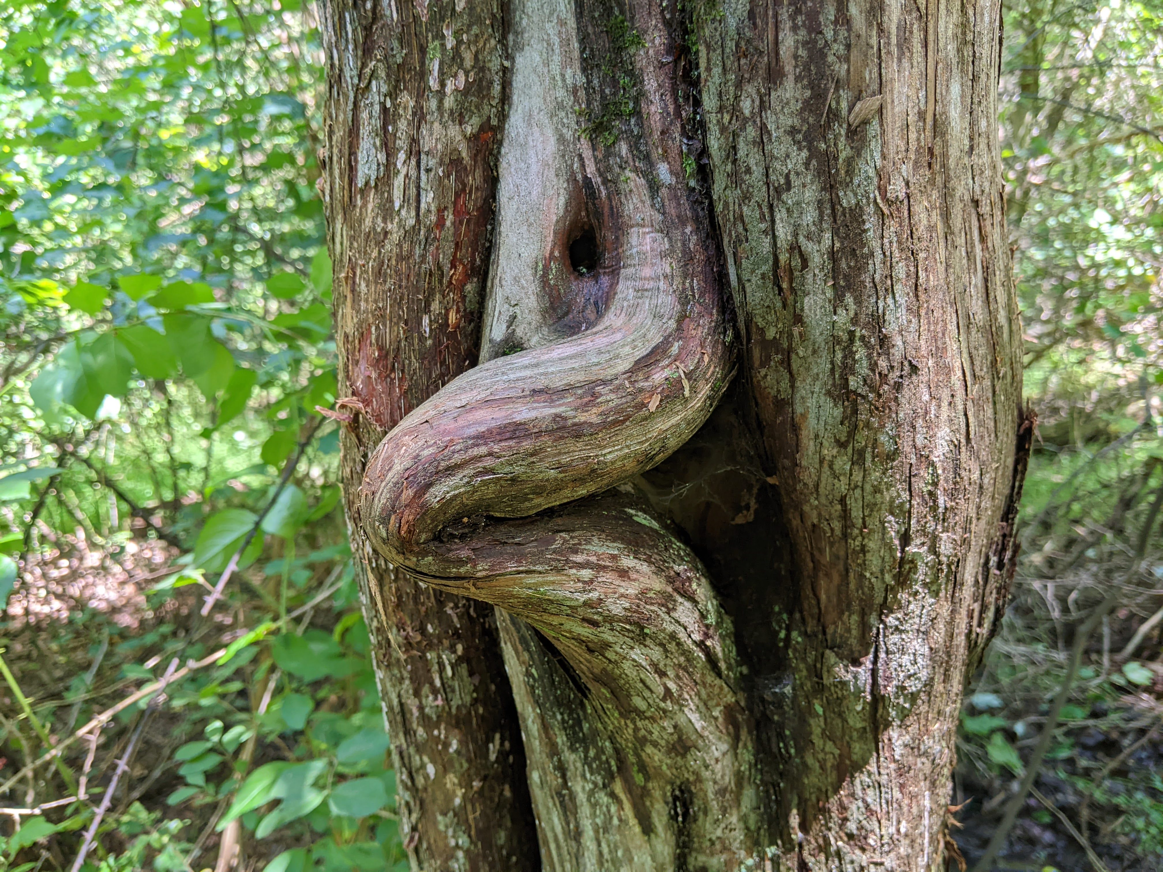
Steep forested slopes!

The creek may be clear of log jams, but along the banks they are still huge!


This was a two-pole hike, though I admittedly only brought one. I found, however, that with Amos' ten-foot lead buckled into my backpack waist belt I could use  my free hand on the line as a rope assist when needed. He seemed to know when I need a bit of a pull up the hills! We walked up and down for a few miles until we came to a beautiful camp site and took our first break. From the corner of my eye I saw a flash of white and, just in time to hold on to Amos' line to keep him from chasing, saw a Striped Skunk skedaddle into the brush. No spray (this time) but the sight of the skunk running away was a fun surprise for both of us.


Rockhounding the creek.


The geology here is the heavily foliated schists made of metamorphosed slates and micas interrupted by intrusions of white quartz. The rock weathers into plates in the creek and on outcrops it forms shelves and stacks. The creek has carved a classic Susquehanna Riverlands ravine and the walls of the canyon are lined with stacked layers of rock, some tumbled and some in resistant formations. This is great bedrock that forms deep pools in the creek where further upstream, including and beyond the game lands, Otter Creek is designated a cold water fishery. I wonder how the flood affected the trout fishery and if have they returned to upstream pools and holes?  I'll have to cast a few flies this fall and see what I can catch to answer that question. 


One of several large debris piles yet to be removed from 2018.

Rock Polypody, Polypodium virginianum

Spore-producing sori on the underside of a frond


I was happy to find a few Rock Polypody fern gardens growing atop tables of schist. These ferns seem to thrive on the thinnest smattering of soil and even when everything else on the forest floor is dry, Rock Polypody is green and soft and happy. They make me happy, plus, I just like saying their name ten times fast.  We climbed up and up out of the ravine and on to Kline Road. Warning: To do this loop, DO NOT cross the Kline Road to continue following the MDT! Turn left instead and road walk up to the "tarp house" with a bunch of chickens roaming around and turn left again on to a gated fire road that leads into the game lands. 


Meadow blossoms!


These are some of the game lands I love to hunt and fish, so I won't give away my favorite places to explore except to say just follow this gravel road, past the place where I normally park and on into the restored glade and meadows. I had to stop for a full serenade gifted to me by a Field Sparrow. A Scarlet Tanager sang from the woods edge. The meadows are now fully mature and a riot of blossoms attracts so many butterflies. I stopped counting Tiger Swallowtails and Monarchs. There were just so many! Among them were Zebra Swallowtails, a Buckeye, several Red Admirals, and a smattering of Tailed-Blues and some Whites. Then from a distant meadow corner there was a Bobwhite Quail calling! I did a silent fist pump for that. Yessss!


A Mink bound across the road a minute after this shot was taken.


Brown-Eyed Susan growing in the middle of the road


I had just taken a picture of Amos with his nose to the road when a Mink bounded across in front of us. Amos' nose immediately caught scent of this guy and I had to hold on for dear life as he did his classic coonhound zig-zag run back and forth as he tried to pinpoint the Mink's crossing trail. This fun last all the way down to where the road becomes a single wide path so imagine the Mink must have been traveling on the trail coming up from the creek to rejoin it further down the slope. His sharp scent continued to drift in the humid air which kept Amos dancing his zig-zag all the way to the campground. 


Road turns to trail on the decent into Otter Creek Campground.


Bathrooms!


Otter Creek Campground was quiet and still. The clouds got a little lower and darker. A soft drizzle began. We walked along the paved road that leads past the fenced maintenance area and some really interesting summer camps. We visited with some forest gnomes. This old campground and its companion across the river at Pequea, were once part of a vast recreational landscape built by the power company behind Holtwood Dam that created Lake Aldred in the 1940s. Much of this company-owned and operated landscape has passed on to other managers, but Otter Creek Campground still has its 1940s feel. The pit toilets certainly did. 


Hello forest gnomes!

Otter Creek empties into the Susquehanna at the base of the hill. We walked past the camp store and gave a wave to the nice couple that runs it. With the rain starting, I did not stop for my usual ice cream sandwich and we kept on going to the river's edge. Remnants of the old Wrightsville/Tidewater Canal can still be seen. Bald Eagles circled over the closest island and I suspect they may have a nest there. The old boat launch is closed and the fishing dock looks like it has weathered a few additional floods. So we continued on to cross the Rt 425 bridge (careful on weekends as this road gets crazy busy) and rejoined the MDT on the opposite bank of Otter Creek to finish our big loop.


Quartz intrusion near the old canal bed

Two juvenile Bald Eagles circled over the island (left)


Just past the bridge duck under the guard rail to find the MDT


Ups and downs continued as well as meeting various piles of flood debris that still need a lift out. I folded and lashed two pieces of wood and a strange cross-shaped metal thing to my pack and did my part to carry some of it out. Amos' leash rope assist came in handy on the ups as the extra weight slowed me down. Beneath the thick canopy of Hemlock and Oak the light rain didn't make it to the ground, but the sound of the shower hitting the leaves above made the air sizzle with sound. We recrossed Rt. 425 and wove our way through great stands of Tulip Poplar and up the final hill to the Urey Overlook. What a spectacular finish to our hike. 


Edgy business!


I tried to sit on the bench at the overlook and enjoy a small snack before walking the last ten minutes back to the parking area, but with rain touching his back - EEEEK! - Amos wanted to keep going. He seemed to know the car, warm and dry, was not far off. So I zipped up my snack bag, hoisted my flood debris, and let him pull me up the old fire road. But just before we got there a small herd of Whitetail Deer burst from the cornfield that lines one side of the fire road. Amos truly Did. Not. Know. What. To. Do. They bounded down the hill, bellies full of corn, and scattered rug of corn leaves in their wake. So he stood there and let out a huge coonhound bay for good measure. 


Looking north - the Safe Harbor Dam and newly opened trestle rail-trail bridge.

Looking east - the river village of Pequea and the mouth of Pequea Creek

Back at the car 


I was unloading my pack into the back of my Escape when a car pulled in. They were older and worried about a possible long walk (for them) to the overlook in the rain so decided against it and stood to chat. He is a rabbi who tends to a synagogue in New York near Syracuse and they told me they were traveling back roads on their way to attend a grand daughter's summer college graduation in Baltimore. Rabbi watched me untie the flood debris from my pack, first the sections of two-by-four and then the strange cross-shaped metal thing. He made a face. "Rabbi," I said, "What can you tell me about this cross-shaped thing?" He let out a great big laugh and said "I never met anyone until you who hikes with a 1986 Ford truck universal joint!" 


AllTrails Map for Mason Dixon Trail/Otter Creek Loop
AllTrails incorrectly logs this loop at five miles but as many reviewers note on the app, it is in fact seven and a half miles. A good catch by the crowdsource!


Notes:

The 2018 Flash Flood was one for the record books, but the clean up continues six years later. https://www.yorkdispatch.com/picture-gallery/news/local/2019/01/11/photos-volunteers-take-massive-cleanup-effort/2546160002/

Old Growth Forest Network summary of the newly designated section now managed by Lancaster Conservancy https://www.oldgrowthforest.net/pa-otter-creek-nature-preserve  is a very welcome recognition for our older forests in York and Lancaster Counties. https://www.lancasterconservancy.org/news/otter-creek-nature-preserve-joins-the-old-growth-forest-network/


Wednesday, July 20, 2022

PA Greenwood Furnace State Park - Ore Banks Trail

2022 52-Hike Challenge #17

Three miles from the ruin of Greenwood Iron Furnace Stack #2 (pictured below) are the ore banks where men, boys, and mules labored to mine and transport iron ore from the mountain. I followed a combination of industrial town roads and a tramway - a small mule-powered wagon railway - to make a six-mile loop. By the late 1800s, after almost a century of operations to supply the furnace with ore, this mountain was every bit as industrial as the furnace complex in the valley. Today it is cloaked in Chestnut Oak, Hemlock, and White Pine forest.

Greenwood Iron Works mining crew c. 1890, children and adults


I didn't have far to travel to get from my most beautiful campsite at Greenwood Furnace State Park to the start of the Dogtown Road trail. The trailhead was literally yards from my basecamp. Many of the trails contain "town" in their names here. The trails map lists a dozen that travel through and within the park, which is embedded in Rothrock State Forest just south of State College, PA.  


My favorite site at Greenwood Furnace State Park campground! 


The start of our hike just yards from our campsite.


These trail names attest to the many communities that formed to support the raw resources needed by the furnace and the required labor to run multiple operations manned by both adults and children. I couldn't help but think of the children who worked here and what a different life they led compared to the family with children hiking ahead of me.  At the intersection of Dogtown road and Brush Ridge Road the family turned right towards the furnace ruins - still a mile off - while I turned left to walk the ridge road several miles further to the ore banks. 


Crossing Standing Stone Creek that once supported a large grist mill 


The communities in and around the Greenwood Furnace continued to gather at the park long after the furnace closed in the early 1900s and many were glad of the preservation efforts by DCNR state parks and the National Historic Site program under the National Park Service. A nearby community church is still in use and ancestors are buried in the cemetery kept up by volunteers along the road into the campground. It seems all the ground within park boundaries has been worked, managed, cultivated, mined, or utilized by the Greenwood Furnace complex and its supporting communities. Now, like most of PA's 18th century industrial landscapes that helped build our nation, it has converted to forest and wildlands. 


Shale fields at the trail intersection with Dogtown Road and Brush Ridge Road Trails.


Brush Ridge Road Trail

The rain tipped down for brief periods but between showers the sun tried to break through the mottled cloud deck. I pulled my pack cover over my pack but I didn't wear a rain jacket. It was just too hot and muggy for that. I was drenched head to toe and so was Amos. Oh well. Summer in PA. The road passed several mysterious pits and trenches that, for the hiker who concentrates only on the trail in front of them would have been easy to miss. I explored several of these pits and found wagon paths that seemed to connect all of them back to the ridge road. In all the greenery and lush forest, it was hard to imagine the mountain cleared of trees, raw and cut open on a hot, exposed slope in summer. 


Bank quarry

Despite some sections of Brush Ridge Road Trail being overgrown, the path was very beautiful with a ravine falling off to one side and the steep ore-rich slope spreading down on the other side. The road stayed true to the ridge and made a beeline along small outcrops of shale and sandstone, plenty wide for two wagons to pass each other coming and going. Every now and then the forest opened into glades of grass and meadow flowers before plunging into back pockets of young, stunted forest so thick and dark that I hurried through not being able to see more than a few feet into the gloom on either side of the trail. 


Ebony Spleenwort

I had just been reading in camp the book Windswept (2021) by Annabel Abbs. In it she explains that xlophobia is the fear of the forest, especially the dark and foreboding woods, a throwback, she supposes, to a time living on open savanna or along wide steppes where forests were distant and out-of bounds. These places contained predators hiding in wait for hapless human wanderers. Folktales and stories persist even today of the dark spooky woods where only bad things can come from entering them. Wolves. Great bears. Giant toothy wild cats. Wild boars. And demons. I found my heart racing a little as I urged Amos on ahead to get to the next clearing! 


Summit view from the Brush Ridge Road Trail - lifting clouds but still very dark

The clearings contained banks of ruby red wineberries, raspberries, deep blue-black raspberries, and carpets of blueberries.  We both enjoyed handfuls of sweet/tart rain-soaked juiciness as we sauntered slowly through the wet meadows, every now and then getting a peek at the mountain across the valley, its ridge crest emerging slowly from dreary scudding clouds. At that moment I thought "oh, yeah - bears" just when Amos perked up and began to do his circle dance sniffing the air with his coonhound nose to pinpoint the source of a scent. Even I could smell the scent of a bear recently in this same place, eating, no doubt, from the same berry patch. Once you smell a bear you never forget its earthy, rotten acorn and mossy-musk scent. I made some ridiculous bear whoops and we carried on our way but the bear was probably already long gone. The trail began to descend gradually and the woods opened up. So did the ground.


Mine shaft ramp. 

There were literally dozens of shaft ditches that led to ore tunnels deep inside the mountain. All are closed off now for safety but I did see one that had fallen open to reveal a dark hole and there the air spilled out cold and misty into the humidity. The ore mines sometimes reached hundreds of yards deep into the shoulder of the mountain. Men and boys worked the cramped veins to extract heavy chunks of rock then hauled it by push cart and mule wagon to the surface. The more I studied the landscape around me the more shaft entrances I saw with their wagon-wide ramps ending abruptly in walls of collapsed earth. 


Turn left down the Dixon Road Trail

At last I found the turn-off on to the Dixon Trail, also an old mining road. We descended along the pitted and gouged shoulder of the mountain. Everywhere were piles of mine tailings, waste heaps of rock, and wagon paths leading down the hill. All of it lay beneath a century's growth of old forest - Red Oak, Hemlock, and Yellow Birch. The ground was cloaked in fern and moss and dead leaves. I tried to imagine the sounds of the working landscape: the braying of mules, the hollering workers, and the clank of hammers, shovels, and picks. These banks were worked heavily until 1904 when the last blast was fired up at the furnace now three miles away but the final whistle to end the final day was heard all the way to this place as the miners and diggers put down their tools for the last time. 


Spoil heaps were everywhere

Turn left!

The Dixon Trail leveled out at the intersection with the Tramway Trail that follows the path of the mule-and-wagon railway that took us back to where we started our circuit. Again the rain poured down, but with more light than dark I spent time observing the plants along the old rail cut. In places the rails had been supported by sandstone columns through boggy hollows and spring seeps. I scraped some moss off a displaced block of stone and studied some fossil imprints: a crinoid stem section and worm burrows were visible beneath discs of lichen.  Amos took a break to snuffle around an upturned root ball and I watched a bumble bee pollinate a patch of Ghost Pipe. 


Dressed sandstone block complete with fossil imprints.

A bumble bee sipping from an inverted Ghost Pipe flower

We were very near Greenwood Road which ran parallel to the Tramway Trail. Trucks and cars zoomed loudly over the wet pavement below us and made more noise than I had heard all day. I could see the tops of a few camps and homes as the trail skirted the backs of properties, behind barns, and playing fields. A beeyard close to the trail lay in ruin from a bear visit with its hive supers and lids lying all about, clawed apart and rotting on the ground. The beekeeper must have given up after the raid and not come back to reclaim his or her yard last year. 


Following the path of the tramway 

Moss-covered sandstone piers that supported rails over seeps

Clymene Moth, Haploa clymene

We came to the intersection of the Dogtown Trail and Tramway and took a right, down again across Standing Stone Creek where the last Rhododendrons were blooming arching over the shady bank. Windswept was again on my mind as we ambled into camp. I changed out of my wet clothes, boots, and socks into drier garb and settled in to read more about women who walked. Amos dug a nest in the leaves and had a good earthy nap. 


Amos in a nest of leaves behind Site #50


Notes:

Greenwood Furnace State Park which is one of my favorite basecamps for exploring Rothrock State Forest. Purple Lizard Maps has an excellent map of the area which I use extensively.   https://www.dcnr.pa.gov/StateParks/FindAPark/GreenwoodFurnaceStatePark/Pages/default.aspx

Adam Cohen's article "Greenwood Furnace: Iron, Trees, and a State Park" presents the industrial history for the furnace and its surrounding town and community, all of which is now a National Historic Site.  https://pabook.libraries.psu.edu/literary-cultural-heritage-map-pa/feature-articles/greenwood-furnace-iron-trees-and-state-park  

Review of Windswept: Walking the Paths of Trailblazing Women (2021) by Annabel Abbs in MS Magazine. I really love this book. https://msmagazine.com/2022/02/04/windswept-walking-the-paths-of-trailblazing-women-book-review/


Sunday, July 3, 2022

PA Chrome Barrens Preserve

The Pennsylvania Nature Conservancy and Elk Township of Chester County, PA, work as management/ownership partners to protect this patch of several hundred acres of rare chrome serpentine barrens but on today's hike rather than grasslands and unique ecosystems, there was mostly greenbrier. I shed about a tablespoon of blood hacking a trail for me and Amos. Poor Amos. Without boots, his paw pads were pretty sore from stepping on thorns. 


American Toad Bufo Americanus

But...we persevered and limping and bleeding emerged into some excellent but muddy habitat where there wasn't any sense in trying to stay dry so we just plopped on through. Last evening brought some heavy storms and flash floods to the Chester County area and most of the Chrome Trail (yellow blazed) was still flowing with water. The rain, however, brought out the toads who were gobbling up worms that lay on the saturated surface of the trail. I stopped counting at 50 - all American Toads. 


This is the trail - four-foot high wall of Greenbrier. Just. Ouch. 

A yellow blaze and a faint path

The problem with Greenbrier is that it is incredibly invasive and without a rigorous management plan to include periodic burning, an important aspect of serpentine barrens ecology, it will take over within a few years. This preserve needs a burn so badly, it hurt worse than the thorns to consider all that is lost beneath the shade and tangle of thick thorny vine. I had a hard time reconciling the conservation value of this property without consistent management but I completely get that funding for these efforts is almost as rare as the ecosystem. I heard from another hiker that Pal's Trail on the other side of the road, also Nature Conservancy, is better managed, so I made a note to come back and try that short out-and-back another day. Still bleeding and limping, we crossed a series of small streams that had overflowed their banks the night before. Now we were bleeding, limping, and making slurping-sucking sounds. 


Serpentine rock with its unique weathering 

Stopping by the streams gave me the opportunity to observe how the serpentine rock weathers at the surface into blade-like shards. The ancient rock is high in toxic minerals like chromium. When combined with nutrient poor, thin top soils, a serpentine barrens is not a very hospitable home! But these unique ecosystems are celebrated for the rare plant communities that tough it out from grasslands to open glade forests. But here, everywhere, today was the ubiquitous Greenbrier. 


Flooded trail and Amos' bubbly paw print

According to my map and the AllTrails app, the Chrome Trail is only 1.7 miles in length. After an hour of hacking and slurping we had only traveled three-quarters of a mile.  I decided to stop worrying about time and trying to follow the nearly invisible and neglected yellow blazes and just follow Amos as he expertly found the trail at every overgrown turn. Eventually we turned through some open forest and I was glad of it. My legs were now streaked with blood. And there, a single new blaze hung trophy-like on a Black Oak. We finally made a solid mile. 


Suddenly a new blaze - the only one of the hike. 

The trail followed old roads that may have been associated with the many mines that were operating in the area. This is part of the historic State Line Mining District where local companies extracted feldspar, chromium, arsenides, and nickle from open pits and deep shafts. A quick look at Google Maps will show at least four flooded quarry pits as ponds or lakes near the preserve. It was a very busy industrial landscape during both World Wars and again during the Cold War as rare metals and minerals were needed for weapons manufacture. 


Note at least four quarry "lakes" around the preserve. 

Red Cedar branch wound

As we progressed through open woods it was easy to imagine the fields of grass pasture that followed the closing of the mines. Red Cedars stood dead or nearly so among Black Oak and a few dying Pitch Pine, signs that the open land was shading in. Amos tracked a beautiful male Box Turtle off trail for a few yards. I know that he he's found another when his tail begins to whip back and forth then stands straight on the point when he noses his hissing target. Number 12 for the year. 


Happy tail and a hiss!


Eastern Box Turtle, Terrapene carolina

We climbed through another patch of greenbrier into a small grassland that sadly is also at risk of being smothered by the stuff. Minus the thorny vine and with good management, this could be a few acres of serpentine prairie but for now these plants seem only to  survive only on trail edges and in wet seeps. 


Narrow-leafed Sundrops, Oenothera fruticosa

Pale-spiked Lobelia, Lobelia spicata

I found two small stands of the short-lived prairie flower Pale-Spiked Lobelia and wondered how much longer these little communities will endure.  With its blooming period so quick to come and go and a wall of greenbrier not too far away reaching towards this open patch, I know I won't see it here if I return next summer.  We turned back into an open woods, sloshing through mud and scaring  up a whole lot of frogs kerplunking into the bigger pools. 

Walls of greenbrier are closing in on this little grassland

Greenbrier is a native species that, given the right circumstances - like lack of a fire regime - can consume hundreds of acres of ground in just a few years. Serpentine barrens are unique habitats for grassland and glade forests that have long been associated with managed burns by pre-contact indigenous people. When settlement pressed into the region, farmers found these landscapes quite suitable for livestock which acted as consumers of both native and introduced species of grass and forbs and kept trees and other other invasives at bay.  The mining industries moved in and stripped much of the old pastureland to access to the rich minerals just at the surface. When these industries closed there was little to control the invasive take-over of the open land ecosystem. We turned again into deeper woods, Maple and Oak and a few American Hollies. Approaching the end of our hike, I began to hear the nearby gun range and a few cars on the road. 


Greenbrier slips behind Maple to capture the trail


These areas, if we want to maintain them for their unique flora and fauna, must have fire to reduce competition with aggressive invasive plants. For the Chrome Preserve serpentine barrens the most ecologically devastating consequence of the spread of greenbrier is the rapid modification of its entire matrix of habitats.  Eradication of an invasive plant requires an all-or-nothing approach ( I know this from personal and professional experience) and keeping an invasive plant at bay requires careful monitoring year-to-year. For indigenous land managers fire was an essential tool for creating habitat for elk, deer, rabbit, bear, turkey, and quail. For modern conservation purposes, fire is essential for the survival of rare and endangered plant and insect communities. I'm hoping management plans through the local township and PA Nature Conservancy can come quickly into play for the preservation of this site.  


A tiny trailside stand of Pale-Spiked Lobelia soon to be overtaken the Green Monster


We arrived back at the car muddy, bloody, and sore. As I was loading Amos, another car with prospective hikers aboard pulled into the small lot. The driver rolled down the window and looking slightly alarmed asked "How was the trail?" I told him about the trail conditions and that they may want to be prepared for mud and blood. Without taking his eyes off my bloodied legs he said "Oh, okay then. We'll try someplace else."  Therefore, I'm counting this short-in-distance but not in time trail towards my 2022 52-Hike Challenge #16  because we earned it. 


Notes:

Mindat.org is an excellent resource for finding mines and quarries and explore the historical data contained on various companies and what they were extracting. For this hike I consulted Mindat for the State Line Mining District details that includes a broad swath of Mason-Dixon Line landscape in Lancaster, Chester, and Cecil County on the PA/Maryland border. See https://www.mindat.org/search.php?search=State+Line+Mining+District+PA

Chrome Barrens brochure  https://www.the2nomads.org/FriendsWebSite/TrailBrochures/Chrome.html