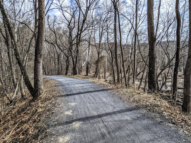
The Boulder Field Trail is a 7-mile out-and-back hike that starts just off Rt. 534, the main road that winds through Hickory Run State Park in White Haven, PA. I took my hiking buddy Amos the Black-and-Tan Coonhound along. This is #9 of our 2022 52-Hike Challenge. It was by far the coldest and windiest hike of the year.
An Ice Age experience
Honey Locust, staying safe from Giant Sloths
In this Northeastern region of Pennsylvania the most recent ice sheet receded about 22,000 years ago and while the climate stayed tundra-like for thousands of years and the present day forest is somewhat recent, the trail makes for a great opportunity to read the landscape for Ice Age history. It started almost right away with finding a Honey Locust with its inches-long purple spikes, standing alone in an old farm field. This tree developed super huge spikes to deter the Ground Sloth, a voracious herbivore. The sloth no longer survives but the Honey Locust persists in repelling browsers like deer.
Snow squalls and high winds roared through for the whole hike
High Arctic winds roared overhead and fast-moving snow squalls added an icy look to the forest. Our hike was made all the more Ice Age-y as we hurried to stay warm - the temperature dropped twenty degrees over three hours. Amos is not too keen on high winds and the sounds through dense Hemlock forest freaked him out a little - all the more reason to keep moving. Except when he scented his first Porcupine. While he sniffed and gobbled sweet treats of porky-poo, I examined the ground cover.
Porcupine chew and poop (which Amos ate)
Porcupine "leavings" after a Hemlock bud and twig feast
The trail was sopping wet in many places (ok, flooded) so we did a few bushwacks through the woods to work around the boggiest bits. The Pocono Plateau is full of water that fills bogs, swamps, and vernal pools. Its a landscape of waterfalls and fast water creeks and rivers. The park is at the boundary of the extent of that last ice sheet. It tells a part of the ice age story that combines all that water freezing and thawing over thousands of years to create this relatively flat landscape of shattered rock.
Close-up of red sandstone conglomerate boulder
Sandstone boulders dot the forest
This trail marks the nearby boundary of glaciated and unglaciated surfaces. The landscape that rolled, rocky and mossy green, from my ground-level view of the forest floor was the north-western extreme of unglaciated land. Taking trails further west in the park, like Shades of Death and Fireline, you will cross glaciated surfaces. Sitting here admiring mosses and clubmoss, I imagined that 22,000 years ago I would be at the base of a mile-high sheet of ice that had ground to a halt a mile before me. Nothing would have blocked my view. The forests were yet thousands of years in the future and the iconic Ice Age savannah and its voracious Ground Sloth and Wooly Mammoths had not yet appeared. Imagine the scene of an ice sheet boundary in Greenland. Whoa.
Sphagnum Moss
Flat-Topped Tree Clubmoss
Interrupted Clubmoss
Farther west in the park red sandstone boulders were dropped by the retreating glacier, most likely plucked from nearby ridges. Where we hiked on the Boulder Field Trail, ice-shattered rocks peeked out of the forest leaf litter, sharp and trip-worthy. Their appearance and shapes were affected but not touched by the ice sheet. I stopped to examine two kinds of Clubmoss that brightened the brown-gray day with bright green. These plants are from a most ancient lineage of vascular plants that evolved over 400-million years ago. They've seen ice sheets come and go during all those years on Earth.
The stump is gone, giving this young tree "legs"
The soil is shallow and nutrient poor, so the best place for a tree seedling to germinate is atop a nutrient-rich Hemlock stump. Given time, the stump completely rots away while the young sapling's roots, that once reached deep into the stump, are exposed to look like legs. As the tree continues to grow maturing roots grow together and outward into the rocky substrate, anchored tightly to the ground.
No longer "walking" but well anchored to the rocky soils.
Amos pulled me along the trail until we came to the 16-acre boulder field and the winds were wild. He did not care for that or the tricky footing of trying to walk out on the boulder field. With water beneath (I could hear the sounds of a below-surface stream) and thousands of years of moving and grinding ice-shattered rocks against each other pushed along by water and gravity, the boulder field rocks were polished and rounded. They teetered and tottered, clicked and clacked.
Hickory Run Boulder Field
Amos kept looking up at me as if to say "What hellscape have to brought me too?!" and he refused to venture out, even though the sounds of laughing families across the field made him curious. Another blast of Arctic wind and Amos had had enough. Back to the safety of the forest!
Feeling accomplished having met his fears of wind and wobbly rocks.
This trail traveled unglaciated land. Everything to the west and north of 476 was under ice!
He pulled me at a quick pace the three and a half miles back the way we came. Snow was flying and winds whipped the tops of the trees. Even with brief periods of sun, the snow flew and the temperature dropped. Amos was dead set on getting back to the truck - a real trick moving at fast speeds trying to place my feet carefully on the rockiest sections and working around the flooded parts. But we did it and he was pretty proud of himself and was soon asleep on the warm, swaying truck ride back to my cousin's house for a night of cozy rest.
Here's my hike video on my YouTube Channel Roamin' Bones. Amos is zonked out at the end. Happy snoozy trails, buddy.
As an environmental historian it is easy to come up with good reasons to hike in cold, blustery winds that scream hard across barren fields and knife through leafless forests. One reason is that a hike is good for you no matter the weather. Another is that you can see the lay of the land otherwise hidden under the lushness of a Mid-Atlantic spring, summer, and fall. Now is when you can see the ground and for interpreting the course of events on this battlefield, ground is all there is.
The Cornfield - limestone underlays this flat farming landscape
Part 1 of our history hike to Antietam was on this blustery March Sunday, the day after we walked 13 miles on the C&O Canal Towpath from Harpers Ferry to Shepherdstown (on the Maryland side of the Potomac). What's another three miles of hiking to study military geology of the battlefield? It was crazy fun but boy, did that super warm visitor center feel great afterwards! Come the fall, we'll make a 10 mile circuit hike of the battlefield for Part 2 of this exploration, the time of year when the battle occurred, to search for witness trees. Stay tuned for that.
Ranger Bruce and the South Mountain Complex beyond
So yes, military geology is a thing and its part of an environmental historian's toolkit towards understanding how environment and human conflicts interrelate. I couldn't help but think that at this time, as Russia's invasion of Ukraine grinds on, how environmental conditions and lay of land can make all the difference in military operations. I don't think Russia consulted with a military geologist, however, because mud. The famous American Civil War battle that occurred here, however, near the town of Sharpsburg, Maryland, on September 17, 1862, was determined by the topography and underlying geology and, minus mud, had everything to do with valley and ridge and two different bedrock types.
Slightly rolling terrain of the West Woods offered just enough cover to stage a brutal attack.
Shag-bark look of a young Black Cherry in the West Woods
The Battle of Antietam resulted in over 26,000 American casualties in the span of a day. Over 4,000 dead and nearly 20,000 wounded were the result of fighting on and for topography. Early pre-dawn light brought concentrated cannon fire into the West Woods where Confederate soldiers sheltering among rolling hills and trees were tending their cook fires. They ran to the protection of ridges and laid flat on their bellies just below the crest of low hills. When Union forces advanced from the flat limestone cornfield, the sheltering ridges allowed Confederate forces to surprise them with fire at close range directed straight into the oncoming lines. The result of this first phase of battle accounted for over 14,0000 casualties, killed and wounded, early in the morning of September 17.
A temporary grave on a bluff of dolostone bedrock.
The bedrock here is both limestone and more resistant dolostone. Due to differences in chemical composition, dolostone ridges stand slightly higher that the gentle flat limestone fields or slight valleys. From our view across the bare fields there was little ground shelter for the Union forces other than the green-gold stalks of harvest corn. The next phase of battle occurred from mid-morning until early afternoon that day, and we moved with the landscape east across exposed flat fields and began to encounter rolling ridges and valleys. By the time we reached the final phase of battle, we were tucked inside a deep ravine where Antietam Creek flowed south to the Potomac. We had crossed this creek the day before on the Antietam Aqueduct at its mouth on the river that divided North from South.
The view of the same rocky bluff today.
By mid-day on Sept 17, both armies were literally on top of each other in close quarters. The fighting in many places was at point blank range as each sought the high ground just yards from and protected positions within eroded wagon roads that followed limestone swales. Confederate troops trapped in the Sunken Road suffered debilitating losses as Union troops pushed them southward across a washboard of ridges and gullies. The second phase of battle that day claimed over 5,500 soldiers.
The Lower Crossing (Burnside Bridge) over Antietam Creek
1862 photograph
We hopped in the warm truck and headed south to the Lower Crossing or Burnside Bridge across Antietam Creek where the final phase of battle occurred. Almost 4,000 casualties happened here, almost evenly split at 2,200 and 2,600 between Union and Confederate. The back and forth assault and retreat of both sides to capture and/or hold the valuable creek crossing eventually pushed the Confederates from the bluffs. Against field stone walls that bordered the creek, the bodies of Union soldiers were buried. A giant American Sycamore tree still survives here, witness to the battle in 1862.
Witness tree - American Sycamore
I do not see the national flag flying from the staff of the sycamore,
Or any decree of the government written on the leaves of the walnut,
Nor has the elm bowed before monuments or sworn the oath of allegiance.
They have not declared to whom they stand in welcome.
Wendell Berry
View of the Sunken Road from above.
View from inside the Sunken Road
To really understand historic events one must walk the land on which they occurred. A colleague who works at the crossroads of ecology and landscape history calls her walking work "embodied research" and she says it is an essential aspect in her conservation work. The bare landscape all around us spoke volumes about how troops on both sides experienced the horrors of that day whether on flat fields, from the vantage points, or fighting vulnerable in ravines and valleys of eroded limestone.
As we climbed the bluff back to the truck, we were approached by an angry old man in a red baseball cap. "I am sodisappointed" he hissed "that there was no memorials to the brave actions of the Confederate Army in this spot." He was trying to either get sympathy or an argument from us. We didn't give him the satisfaction of either so off he went down the hill spouting what-ifs and what-abouts. I didn't make any videos of our walk but this video (1 in a series of 3 by Dana Shoaf) is a good substitute. He even stresses that y'all get our of your cars and walk!
Though Union forces did finally force Lee's Confederate Army off the bluffs and into retreat back across the Potomac, the war continued. Another bloody battle over three days would happen a year later, forty miles northeast within the same Valley and Ridge geological province. Confederate General Lee would claim high ground along Seminary Ridge to face Union General Meade who occupied high ground along Cemetery Ridge with mile-wide low, flat fields between them.
My sister and I headed out on this beautiful first spring weekend to hike another section of our ongoing C&O Towpath walk and to visit Antietam National Battlefield (NPS). We walked 13 flat miles from Harper's Ferry to Lock 38 at the base of the bridge over the Potomac for #8 of our 2022 52-Hike Challenge.
The shuttle into town was easy and nice
We left a car at Lock 38 and the other at the NPS parking area above the town of Harper's Ferry. We took the quick and easy Park Explorer shuttle from the parking area down to the town where we walked back across the bridge and down the spiral iron stairs to step on to the C&O Towpath, exactly where we left off last time. I wish there were more public transportation options along the C&O Towpath (like there was from the towns along Hadrian's Wall in the UK). The National Park Service has been making great strides in reducing crowded parking areas in many of its sites with Park Explorer shuttles. Acadia National Park is a great example of that - no need to drive at all. But to connect the entire linear C&O park with public or NPS transport would be so amazing. One can wish.
We pick up where we left off under the B&O RR Bridge
Maryland Heights and the Lock 33 lockhouse ruin
Spicebush is bursting out along the Potomac
This stretch of C&O highlights some complex canal engineering and with trees and shrubs not leafed out yet, we could see deep into the woods and down to the river's edge and saw all manner of small dams, inlets, outlets, culverts, and non-typical locks. Above the rapids north of Harper's Ferry there is a section of slack water that forms above the shelfy ledges in the river and behind low canal dams. In the 1840s the U.S. Government Armory at Harper's Ferry discouraged building these low dams closer to town as they were concerned that raising the level of the river would cause flooding of factories and warehouses and would destroy the arms manufacturing center.
Eastern Painted Turtles
As we listened to Spring Peepers, Leopard Frogs, and American Toads sing from the shallow canal and vernal pools, we wondered at the many engineering works we encountered. Was that a pumphouse in the middle of a drained holding pond? Could that oddly shaped inlet lock from the river accommodate bigger freighter canal boats or was it strictly for watering the canal? How did the Union and the Confederate Armies utilize the canal in their various periods of occupation? Where did the Confederate Army ford the river on their way to and escaping from the Sharpsburg and Antietam?
We wondered a long while about this structure - built to stand in water.
A dad and daughter explore a ledge habitat below a low dam
This inlet would have been too narrow to accommodate canal boats
We spent so much time around these curious places that we decided we had to get going if we were going to make 13 miles before sunset so off we went at a quicker pace. We are expert lollygaggers! We watched a kayak class learn how to use eddys to make their way upriver. We spotted house ruins deep in the woods. We commented at the white-walled tire caught up in storm debris. That's an old tire!
Sun-splashed towpath
Black Rat Snake
Bloodroot
We sped up the pace but we still - there were flowers in bloom and birds to watch. We held up bike traffic to provide safe crossing for a Black Rat Snake. "OH! A snake!" a biker yelled and that almost caused a pile up and everyone rubber necked to look back at what we standing over. It's not the first time I've played crossing guard for a snake but this one was very appreciative. We stopped to gawk at the double kilns at Shinham's Limestone Kilns and quarries.
Shinham's Lime Kilns
Dolomite
Limestone is plentiful in this region its occurrence near the surface explains the rolling ridge-and-swale topography of upland farmland north of the river. The rolling ridge and ditch lay of land is quite dramatic at Antietam Battlefield and was critical to the way that tragic day unfolded in 1862. Dolomite, a mineral relative of limestone, was used as an additive aggregate in the making of plaster and mortar. There were several mine shafts visible from the towpath and the largest was the most accessible so I went across to take a peek in. As we walked further on we gawked at the huge limestone quarries blasted out of the bluffs right on the inland edge of the canal. We heard a Raven calling and I wondered if these cliff faces might also support nesting sites. The Raven is making an impressive comeback to the Potomac River Valley because of this abundance of rewilding cliff habitat.
Lock 37 and its restored lockhouse
We took our snack break just down from the popular walk-in campground near the Antietam Aqueduct. As we continued on and passed what had to have been fifty tents and large campfire/camp kitchen constructions, I had to wonder what the impact of these large groups has on fragile riverside sites. Little wonder that there were no sites available for the solo or small group bike-packer or backpackers to use.
Bloodroot drifts along the towpath
Antietam Aqueduct approaching a large campsite
As we walked past the large spreads of tents, tarps, camp chair circles, and large outdoor kitchens, I was appreciative of the opportunity the kids had to enjoy the outdoors but I wondered about the sustainability of it - given it is only March and a whole summer of camping is yet to come. I wonder how the Park Service manages this kind of large group use? Is this a "sacrifice site" or was this a large group camping area by design? (I purposely did not take pictures)
Three miles to go!
We gauged our pace at 2.5mph which is close to my hiking pace with hills on more challenging terrain. By five 'clock we were shuffling into the parking lot at Lock 38 where the second car was parked. Both of us had developed some hot spots in the last mile of walking and I attributed that to the constant flat walking surface that offers little change in the way our feet land and push off. Of all the hiking I do, it is road walking that can make my feet sore if doing more than ten miles in a stretch. Next time, we'll have to remember to change socks at snack break. A little extra loft would have helped at the end of the day.
River Lock 38 across from Shepherdstown - one of the few river-to-canal entrances.
No Amos along today. Reading through comments on the Horseshoe Trail FB page for this section had me a little concerned about property dogs, both loose and contained, as well as a local gun club that has of late been very active. It lies close to the trail and is precisely where Amos turned around for an out-and-back from Scott's Run Lake when he heard shots fired. He doesn't do gunfire which is probably why he was dumped as a puppy being a gun shy hound.
Pelvic bone of a Whitetail Deer - notice mouse gnawings.
This is #7 of my 2022 52-Hike Challenge which started at the brand new parking area on Buck Hollow Road for the William Penn State Forest. Walking towards our turn-around point at Six Penny Creek and the gun club entrance I planned to make a loop via Geigertown and Hay Creek Roads to the (also new) state forest kiosk on Hay Creek Road for 12 miles.
Brand new!
The Horseshoe Trail depends largely on the good will of private property owners allowing hikers to traverse their land. Though the trail association has worked diligently over decades to foster good relations, there are some owners who challenge agreed upon permission-of-thoroughfare with intimidation and threats. As soon as the trail exited state forest land I was met with a No Tresspassing sign planted firmly in the middle of the path and I wasn't sure whether to continue. .
Right in the middle of the trail...
Ribbons and wires laced the trees on either side of the trail. The sound of constant gunfire coming from a target range nearby made my decision to a walk around the sign a little nerve wracking, but I did. The trail blazes are freshly painted and the path well cared for and I had just watched a mountain biker blow past the sign, so I did too. As my hike progressed, I was amazed at the amount of boundary marking whether with sometimes intimidating signs or blue/white/purple painted trees, including more wires and flagging tape augmented by the not-so-subtle signage indicating that surveillance cameras were in use.
...and all around the place.
Once past the stretch of private property - evidently a logging tract - I was able to really enjoy the landscape with views through the bare trees towards French Creek State Park and the rolling hills all around. Hay Creek flows in the valley and comes with its own historical association! This is the Iron Hills region, a long stretch ragged terrain that offered colonists abundant supplies of iron ore from Valley Forge to the Appalachian Front. The Horseshoe Trail never leaves the geology and history of iron production for its entire 140-mile length. Hiking historians, rejoice!
Brocade moss on red sandstone
Hay Creek Valley and French Creek State Park hills beyond.
The hills are pitted with small stone quarries and surface mines. I was surprised to see almost every large boulder along the trail with evidence of hammered star drills and feather-and-wedge splitting. For a while the path follows a narrow stone boat road where heavy horses pulled wooden sleds (called "boats") loaded with blocks of red sandstone to building sites in the valley. From the large stone dumps masons dressed and shaped the stone with hammers and chisels for building projects. One doesn't need to go far from the trail to see examples of fine red sandstone barns, homes, mills, and the nearby Joanna Furnace. I imagined the hills ringing with the sound of hammers on iron drills and wedges, very musical and a lot of work!
Hammered star drill and feather-and-wedge split stone (late 1700s)
Star drill holes and split faces
Check out this demonstration of star drill and feather-and-wedge stone splitting - truly a lost art! There are a few other nice demos on YouTube but remember that colonial stone splitters didn't have power tools so ignore the use of air compressors. The art of the stone splitter relied on listening to the changing sounds of metal in rock to determine the correct amount of force to make a clean break. This is the "music to my ears" way of hammered splitting.
I made my way down the quarried hill and crossed over Hay Creek Road to follow a dirt road that crossed the creek. I stopped to listen to a chorus of newly arrived Red-Winged Blackbirds on a cattail marsh, visited with some cattle and goats, and got barked at by a few farm dogs whose tails were happily wagging to see a hiker cutting through the farm. I had a chat with the farmer, a strapping woman my age, who offered me some tea from her thermos and a donut! That made up for all the angry No Trespass signs earlier on.
For my Camino friends who are going on pilgrimage this spring
HST is a NRT
Across the Pottstown and Railroad cut the trail climbed the next hill. It too was studded with surface quarries and split stone was everywhere. So was the sharp crack and bang of gunfire coming from the nearby gun range. Trying to speak with a couple and their remarkably calm Treeing Walker Coonhound was futile so we said our goodbyes.
Iron bridge over the Pottstown and Reading RR cut
Had the offer of tea and a donut visiting this bunch!
The rocky trail wound around the hill intersecting with a maze of popular mountain biking trails contained in the Birdsboro Preserve. A trail crew was out working on planting a new sign to warn bikers off the HST. There are dozens of Preserve trails for bikers here but they persist in trying to use the HST. Almost on cue I encountered two bikers pushing their bikes up the boulder strewn trail, frustrated that "this trail is shit" when it really wasn't made for mountain biking. After a steep descent to Geigerstown Road, right next to the gun club parking area, I was exactly where Amos and I had turned around last time we were on the HST. This time there was a brain-rattling amount of gunfire. I am so glad I did not take him along.
Finally on Geigerstown Road at Six Penny Creek
Part RR graveyard, part steam engine collection.
Wrecker crane - now a wreck on its own.
The road walk back to the state forest entrance on Hay Creek Road was pretty interesting but also pretty dangerous. I wore my brightest colors just for this portion of the walk as blind curves, no shoulders, and rolling hills made getting along with speeding cars pretty important. A few miles on the hardtop and I was blissfully back on the path to retrace my steps up into the Buck Hollow Track of the William Penn State Forest.
Wintergeen
Buck Hollow Tract entrance on Hay Creek Road - loop complete!
Woods road back to the car
I've been making my way up the HST for a few years now, slowly but surely. I'm at a third completed on a northwest track to intersect with the Appalachian Trail. It's possible to do a big loop using the AT, HST, and Mason Dixon Trail with a connector between Valley Forge and Chads Forge on the Brandywine Trail.
Today's loop included 8 miles on the HST and 4 road miles
Here's my hiking video for the day. You can get a feel for the background noise - it was either geese or guns. Amos would have lost his mind... (BTW you can find my videos at my YouTube Channel "Roamin' Bones" and while you are there, please subscribe!)
Notes:
For a look at the nearby Joanna Furnace (and the impressively beautiful red sandstone buildings) see the Hay Creek Valley Historical Associationhttps://haycreek.org/joanna-furnace/