My sister and I headed out on this beautiful first spring weekend to hike another section of our ongoing C&O Towpath walk and to visit Antietam National Battlefield (NPS). We walked 13 flat miles from Harper's Ferry to Lock 38 at the base of the bridge over the Potomac for #8 of our 2022 52-Hike Challenge.
 |
| The shuttle into town was easy and nice |
We left a car at Lock 38 and the other at the NPS parking area above the town of Harper's Ferry. We took the quick and easy Park Explorer shuttle from the parking area down to the town where we walked back across the bridge and down the spiral iron stairs to step on to the C&O Towpath, exactly where we left off last time. I wish there were more public transportation options along the C&O Towpath (like there was from the towns along Hadrian's Wall in the UK). The National Park Service has been making great strides in reducing crowded parking areas in many of its sites with Park Explorer shuttles. Acadia National Park is a great example of that - no need to drive at all. But to connect the entire linear C&O park with public or NPS transport would be so amazing. One can wish.
 |
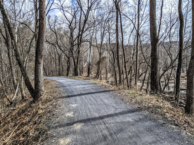
We pick up where we left off under the B&O RR Bridge
|
 |
| Maryland Heights and the Lock 33 lockhouse ruin |
 |
| Spicebush is bursting out along the Potomac |
This stretch of C&O highlights some complex canal engineering and with trees and shrubs not leafed out yet, we could see deep into the woods and down to the river's edge and saw all manner of small dams, inlets, outlets, culverts, and non-typical locks. Above the rapids north of Harper's Ferry there is a section of slack water that forms above the shelfy ledges in the river and behind low canal dams. In the 1840s the U.S. Government Armory at Harper's Ferry discouraged building these low dams closer to town as they were concerned that raising the level of the river would cause flooding of factories and warehouses and would destroy the arms manufacturing center.
 |
| Eastern Painted Turtles |
As we listened to Spring Peepers, Leopard Frogs, and American Toads sing from the shallow canal and vernal pools, we wondered at the many engineering works we encountered. Was that a pumphouse in the middle of a drained holding pond? Could that oddly shaped inlet lock from the river accommodate bigger freighter canal boats or was it strictly for watering the canal? How did the Union and the Confederate Armies utilize the canal in their various periods of occupation? Where did the Confederate Army ford the river on their way to and escaping from the Sharpsburg and Antietam?
 |
| We wondered a long while about this structure - built to stand in water. |
 |
| A dad and daughter explore a ledge habitat below a low dam |
 |
| This inlet would have been too narrow to accommodate canal boats |
We spent so much time around these curious places that we decided we had to get going if we were going to make 13 miles before sunset so off we went at a quicker pace. We are expert lollygaggers! We watched a kayak class learn how to use eddys to make their way upriver. We spotted house ruins deep in the woods. We commented at the white-walled tire caught up in storm debris. That's an old tire!
 |
| Sun-splashed towpath |
 |
| Black Rat Snake |
 |
| Bloodroot |
We sped up the pace but we still - there were flowers in bloom and birds to watch. We held up bike traffic to provide safe crossing for a Black Rat Snake. "OH! A snake!" a biker yelled and that almost caused a pile up and everyone rubber necked to look back at what we standing over. It's not the first time I've played crossing guard for a snake but this one was very appreciative. We stopped to gawk at the double kilns at Shinham's Limestone Kilns and quarries.
 |
| Shinham's Lime Kilns |
 |
| Dolomite |
Limestone is plentiful in this region its occurrence near the surface explains the rolling ridge-and-swale topography of upland farmland north of the river. The rolling ridge and ditch lay of land is quite dramatic at Antietam Battlefield and was critical to the way that tragic day unfolded in 1862. Dolomite, a mineral relative of limestone, was used as an additive aggregate in the making of plaster and mortar. There were several mine shafts visible from the towpath and the largest was the most accessible so I went across to take a peek in. As we walked further on we gawked at the huge limestone quarries blasted out of the bluffs right on the inland edge of the canal. We heard a Raven calling and I wondered if these cliff faces might also support nesting sites. The Raven is making an impressive comeback to the Potomac River Valley because of this abundance of rewilding cliff habitat.
 |
| Lock 37 and its restored lockhouse |
We took our snack break just down from the popular walk-in campground near the Antietam Aqueduct. As we continued on and passed what had to have been fifty tents and large campfire/camp kitchen constructions, I had to wonder what the impact of these large groups has on fragile riverside sites. Little wonder that there were no sites available for the solo or small group bike-packer or backpackers to use.
 |
| Bloodroot drifts along the towpath |
 |
| Antietam Aqueduct approaching a large campsite |
As we walked past the large spreads of tents, tarps, camp chair circles, and large outdoor kitchens, I was appreciative of the opportunity the kids had to enjoy the outdoors but I wondered about the sustainability of it - given it is only March and a whole summer of camping is yet to come. I wonder how the Park Service manages this kind of large group use? Is this a "sacrifice site" or was this a large group camping area by design? (I purposely did not take pictures)
 |
| Three miles to go! |
We gauged our pace at 2.5mph which is close to my hiking pace with hills on more challenging terrain. By five 'clock we were shuffling into the parking lot at Lock 38 where the second car was parked. Both of us had developed some hot spots in the last mile of walking and I attributed that to the constant flat walking surface that offers little change in the way our feet land and push off. Of all the hiking I do, it is road walking that can make my feet sore if doing more than ten miles in a stretch. Next time, we'll have to remember to change socks at snack break. A little extra loft would have helped at the end of the day.


No comments:
Post a Comment