Tuesday, June 13, 2017

Trip Log: Hadrian's Wall Path - Wylam to Chollerford, Days 2 & 3, May 2017

On Day 3 the Romans were everywhere!

Day 2: Wylam to East Wallinghouses, 12 miles.

Though our hike across northern England follows the route of Hadrian's Wall, we walked through landscapes that contained histories of conflict and occupation much older than the physical remains of the wall, forts, and turrets. A local historian reminded us that to the ancient tribes of the area - who had inhabited the northern territories for thousands of years before the Romans arrived - every natural landmark whether hill or outcrop, forest or single tree on the land, was significant and that we shouldn't overlook the relationship these tribes had with the land long before the Roman Period.


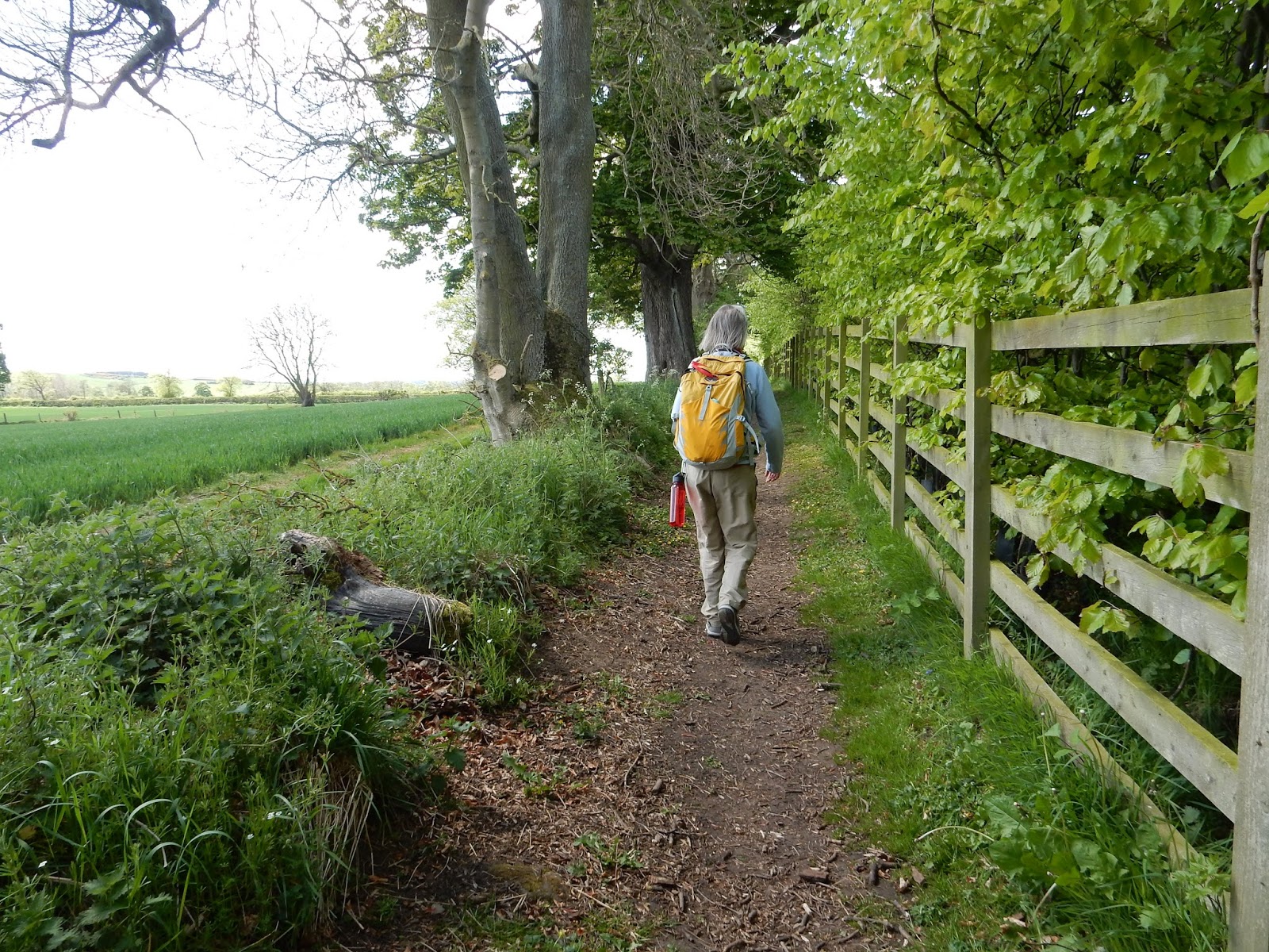
Leaving Wylam in the early morning. Wagon Way to Hadrian's Wall Path.

We were reminded, too, that the "Roman Period" of northern England/ southern Scotland was really a long period of military episodes rather than a continuous period of Roman rule. "People only look at the big interpretive signs as they come to them on the walk," he said, "And this is what they take-away. What people don't or can't see today are the timber frame dwellings, Iron Age hilltop forts, turf-built ramparts, dug-in-earth temples, and cult-worshiping sites that may or may not have been consumed completely by time. Some of these old places are still marked on the land. You have to train your eye to see them." 

HWP to Heddon-on-Wall. "Look beyond the big interpretive signs - train your eyes to see."

For hundreds of years the Roman occupation was in continual ebb and flow across this landscape, ground claimed by Romans for a generation or two, then retaken and reclaimed by a generation or two of Caledonians, Scoti or Picts. Scholars today debate whether the Romans actually had true control over any of the territory it attempted to claim for the Empire. 


Follow the acorns.

I began to detect the subtle knobs and vales of ancient earthworks. I realized that seeing these features was like learning to see in the dark. While other hikers passed by lumps, bumps, and humps - I stopped and studied every one. Earthworks were everywhere! Covered in sheep! Before we started seeing the impressive ruins of Day 3 we observed mile after mile of irregular land that, as our local historian at the Robin Hood Inn had told us - were defensive systems. Marching camps, the most mobile of the Roman invasion forces spread out across the frontier and wherever they stopped to probe the defenses of an enemy, they constructed square turf-built walls and ditches - essentially "digging in" - to protect their . Long before Hadrian ordered the wall built, Agricola's marching and cavalry forces had spread throughout the border country and had made deep forays into the Caledonia territories. There are relics of Roman turf defenses far to the north of where we were, even the remains of a northern defensive line at the Antonine ramparts. 


Earthworks and the military road.

By Agricola's sixth campaign into southern Scotland in 82 A.D. the Caledonians had figured out what tactics worked best against these defenses. Raids, often at night, brought horses racing towards the ramparts pulling flat-bed chariots manned by a driver, archers, and lancers who harassed and caused considerable  consternation among the Roman legions. The Roman preferred daylight battles, out in the open, highly organized, and well away from the marching camps. The Scottish tribal raiders learned the Roman vulnerabilities and applied the surprise, guerrilla attack at every opportunity. They especially appreciated the power of rumor and leaks of mis-information. Boy, some things don't change!

Contested landscape covered in canola.

The Caledonii got ready to fight with great preparation of equipment, all of which was exaggerated by rumor, as usually happens when real information is in short supply. They even launched attacks on large (marching) forts and taking the offensive, increased the feeling of panic.    - Tacticus, Agricola, 25.3


Paved road atop the Roman military road.

Another landscape feature we observed these two days was the Roman military road that in some places is built over by modern paved roadways. All Roman legionaries were highly skilled road builders and systems of roads ran every which way across England and southern Scotland. In fact, Roman soldiers were skilled in all forms of building. Building trades were an important part of military training since they were in the business of expanding empire. Wait - that sounds familiar too... 

Robin Hood Inn, Night 2 rest and amazing meals right on the Military Road. The pub manager is a local historian.

Day 3 East Wallinghouse to Chollerford, 14 miles.
 
The Auxila cohort or provincial members of the Roman military from different parts of the Empire, were highly valued (though paid far less than Romans-by-birth) for trade skills in building unique to their homelands. Auxila cohorts (300 - 400 men) were under the command of a centurion along with his full compliment of a Roman military garrison (3500 - 4000 men) and they were highly respected for their own fighting skills and weaponry. So a cohort of Syrian archers could also be utilized for their skills in metalworking. Iberian horsemen were known for their leather and tack work. Road building, however, was every soldier's business and it didn't matter from where in the Empire a cohort was from - everyone built and maintained roads. 

Camber of the military road is visible as we walk the path. Massive earthworks in the fields.
The Vallum ditch comes into view on Day 3!

We were all impressed by the size and scale of the Vallum, the great defensive ditch that runs south of the wall. It was a massive undertaking and ran almost 50 miles from Heddon-on-Wall clear through to Carlisle. It wasn't following exactly the course of the wall and was at some points quite a distance from it but always to the south. Some researchers suggest it was built to contain possible uprisings of people within the Roman territory - to slow an advance on the forts and wall from the interior. We could see how the edges of the Vallum were slightly raised as turf from the ditch was laid to create visual highpoints so that wall guards could see intrusions. It was suggested by one local historian that in times of domestic unrest, the bottom of the ditch was flooded or stockpiles of flammable liquids (oil) were at the ready to ignite, or that sharp stakes were embedded in the bottom like one giant pitfall trap. Eww.

Seven hundred year old tree astride wall stone.

It seemed everywhere we looked there mounds and ditches, earthworks with the Vallum not too far away, and it was on the third day in a rainy, windy squall we came to our first massive section of Hadrian's Wall! The massive square-cut stone was laid as two exterior walls with rubble, mortar, and gravel filling in the interior. Originally the wall was built to stand 12 to 18 feet high and guards patrolled the top but we never saw it at its full size, as entire sections had been badly scavenged for the cut stone. It wasn't hard to see where it went over the centuries - Roman stone could be seen in barns and farmhouses all along the Military Road, so it didn't get carted too far off!

Hill fort ramparts.
Hadrian's Wall at last!
St. Oswald's Farm barn and farmhouse both contained square-cut wall stone.

Our third day on the path was rainy and cold, typical of May in northern England, but at every turn (or over every stile) there was something new to see. These Romans were really serious about this wall! Hadrian visited this region on his years-long inspection of the Empire's boundaries and realized the constant attacks and badgering (we saw a badger, too!) by the Scot tribes had worn his troops down. The wall, he said, would help secure the northern line and provide a system of resupply roads and forts that would strengthen their positions against the "northern barbarians." The wall was built in six years and completed in A.D. 122.

The Vallum to the south of the wall. A constant companion for the next five days.
Following the military road.

During some short periods of rain I walked along shrouded in my rain jacket and hood unable to see or hear George and Molly ahead of me. All I could see was the Vallum to my left, old hedges to my right, the path underneath me, and pasture walls. I almost ran right into the next stile! From the top of the stile I stood in the mist and looked back over the fields we had just crossed. The grey skies were the perfect compliment to the pastures which seemed to absolutely glow vibrant green against heavy clouds. I stood there a long while and looked at the land. Undulating ground - the ditch, earthworks, walls, old road edges - were all draped in earth colors so rich and lush I had to catch my breath. The tops of stiles became my favorite vantage points from then on to look back and look ahead and take in the lay of the land.


Ladder stile look-out point.

There is an art to climbing ladder stiles. Especially with hiking poles and a backpack. I tried various ways to go over - climb forward, turn around at the top (enjoy the view), climb backward down to the ground, or sidestep up, straddle the top, sidestep down, or climb forward, step down facing the direction we're going (the fastest but slippery!).  Sheep and cows always watch the people going up and over. Maybe its entertainment for them, certainly when someone trips and tumbles - I can hear the sheep giggling even now as I recall a slip off a stile doing the forward down maneuver.  They really did giggle and the little ones wagged their tails.

Brunton Turret ruins near Chollerford with stair ramp up to the wall walk.

As we approached Chollerford for our third night's stay at Mingary Barn, we stopped to explore the Brunton Turret ruins. Inside was a hearth for cooking and the exterior wall contained a stairway for troops to access the top of the wall. Across the river was the beautifully excavated Chesters Fort. This deserves a blog post of its own, so I won't include it here other than to say that we stopped at the fort before heading up the hill to our B&B (which was fanstastic!) and dinner at a local pub. The fort visit was incredible, to say the least.

Night 3 at Mingary Barn - what a treat!
Dining with HWP hikers from Glasgow and Edinburgh.  Wonderful meal!

Notes: 

The English Heritage Society maintains a wealth of archeological and historic sites along the Hadrian's Wall Path, all of which contain excellent museums and offers the HWP hiker discounted admission with a nine day visitor's pass. It was well worth the $ to purchase this pass and we enjoyed every EHS stop along the way.  http://www.english-heritage.org.uk/visit/places/hadrians-wall

Night 2 - Robin Hood Inn is where we met a local historian who also happened to be the owner of this old but beautiful inn and public house. We had the most delicious meals here and a huge English breakfast included with our stay.   http://robinhoodinnhadrianswall.com/


Night 3 - Mingary Barn/ Chollerford B&B was a treat for all of us - we were a little cold, really tired (12 mile day in the rain) and so hungry. This old farm complex is now run as a guest house and B&B and the owners were so kind.  http://www.chollerfordbedandbreakfast.co.uk/


Friday, June 9, 2017

Trip Log: Hadrian's Wall Path May 2017 - Newcastle to Wylam

Dune restoration at South Shields on the North Sea.
This year's long distance hiking challenge was Hadrian's Wall Path in northern England. My son George and cousin Molly accompanied me on this trek of 110 miles from the North Sea to the Irish Sea with the theme of "Walls: What Are They Good For?" (sung to the tune War - What Is It Good For?) playing against the current political climate here in the States. Seems like some elements of admin feel its important to build a wall from the Gulf of Mexico to the Pacific to keep those south-of-the-border out. It's not a very popular idea, however, and it serves, at least rhetorically, as a monument to racism, isolationism, and nationalism for most of us here. But with walls as our theme, we set of on May 12 to look at why walls were/are built and how their purposes have changed over time. So off we went, long distance pilgrims on another quest!

Rough seas outside the sea walls.
Hadrian was Roman Emperor from 117-138 A.D. and a well-traveled emperor at that. He visited every corner of the Roman Empire during his reign. Northern England, the farthest reach of Roman rule, however, concerned him quite a bit. He was a military man through and through and understood the importance of highly trained legions and well-defended borders to the security of the Empire and he observed that constant conflicts with the northern tribes, mainly the Picts,  weakened and demoralized his positions throughout the island occupation.

First Day: Wallsend visit at Segedunum then Newcastle to Wylam.

The Empire was experiencing border troubles in a number of areas in Syria, along the Danube, and in the Eastern Mediterranean, and Hadrian, best remembered now for the physical wall that bears his name, spent much of his touring time fortifying or withdrawing from areas of constant conflict while working to improve infrastructure in the Empire's interior.  To secure the troublesome border with southern Scotland he ordered a high wall be built to shut out the "northern barbarians" and control crossings for trade and safe supply lines for troops and forts. Every ten miles or so, large enclosed forts were built to hold cavalry and infantry. At regular intervals there were turrets and mile castles. Key archeological sites along the trail reveal foundations and ruins of these structures. The path today roughly follows the course of the Roman wall and is a designated National Trail.

We start!
George and I visited the mouth of the Tyne River at South Shields on the North Sea the day before we struck out on Hadrian's Wall Path with Molly. Here we watched a stormy sea crash against broad and newly restored dune areas. A Roman garrison fort Arbeia was built here in 160 A.D. to house archers and spearmen. Later, during the days of frequent Viking invasions, this river offered prime access to the resource-rich interior region the Northumberland hill country 70 miles inland, provided ships could safely enter the treacherous mouth of the river where the shape of the coast seems to focus a fury of rough seas at the estuary port.  By the 9th century the Vikings had conquered the headlands at South Shields, and soon thereafter all the kingdoms of Anglia Northumbria fell to their control. Take note,  I wrote in my journal - this explains my 18% Scandinavian DNA. I noted, too, that a "good wall" was the double sea wall at Tynemouth that protects the river's harbors from the fury of the sea. 

Hadrian Wall remnant in Wallsend.

Next day we arrived by Metro to the museum and fort site at Wallsend, a shipbuilding town of some reputation although the famous Swan Shipworks is no longer there. We viewed the partial excavations from the museum tower and explored the exhibit halls. A tiny bit of restored wall emerged from the bank of the fort mound. It was a great way to orient ourselves to the time period, the building style of the wall, and the architecture of the forts, turrets, and mile castles all built on smilar patterns from one end of the structure to the other. 

Partial fort excavations at Wallsend with the remains of The Swan Ship.

Model of Segedunum Fort at Wallsend.

We skipped ahead by Metro to start at the Millennial Bridge at Newcastle to save several miles of hard surface walking. We found the acorn logo of the National Trail System on a sign nearby and dodged some fierce winds and squalls on our walk along a revitalized city waterfront. With twelve miles of hiking our first day, walking into headwinds at the start was the most difficult!

Millennial Bridge start in Newcastle.

High winds and bursts of rain slowed our pace up the Tyne River path.

Shipyards and naval arms factories on the Tyne, c. 1920.

Revitalized waterfront is beautiful and traffic free.

The path follows streets and a few wooded venues leaving Newcastle and we took our first rest at the monument at Scotswood Montague Pit Disaster Memorial. Mining has been a centuries-old industry in Newcastle and tales of colliery and pit mine accidents were plentiful.  This monument, however, memorializes the 1925 disaster with a hopeful look forward. Modern children hold their cell phones up for a picture with a pitman, while sitting playfully astride a pit pony. The pit pony has a smile! I thought - now that's interesting! I did a little research on the smiling pony when I crashed into my bed that night and discovered that pit ponies saved many lives by leading men and boys from the flooding pit into the daylight.


Scotswold Mine Accident Monument with smiling pit pony.

The smell of methane, the snuffing out of coal oil lamps as oxygen was sucked away, and the sudden gushes of water through the pit mine wall signaled to the ponies it was time to go. Just as the walls began their horrific cracking and buckling and flood waters filled the pit, miners were running for their lives up the dark passages behind the galloping ponies who knew to run to the tunnel end, towards the light. "Hundreds of children, grandchildren, and great grandchildren are here today because of the brave pit ponies," said one descendant in 2012. Still, 38 men and boys were lost in the disaster as the broken walls allowed the river to spill in, trapping and drowning those in the deepest parts of the mine. Broken walls. Broken lives. 

1925 funeral for those killed in the Scotswold-Montague Pit Mine disaster. This site is now a nature park through which the Hadrians Wall Way passes just west of the memorial. Photo courtesy of Sixtownships & Coal Mining Memories.

A nature park is where the Matague Colliery once stood.

The site of the Scotswold-Montague Colliery has been reclaimed for a park at Denton Dene. The plant and its pits closed for good in 1959. The miners village is still here sporting trendy homes in a neat historic area. It was a friendly and well kept park and people were walking their dogs and playing football as we walked through. All nature now. The old tailing pond is a refuge for amphibians and aquatic plants.It was hard to imagine such a dense and dirty industrial mine site ever having been there.

Denton Dene park path along a defunct rail line that served the colliery.
English Oaks on the way to Wylam.

Our walk continued across the pedestrian bridge high over the A1 then back into pleasant parks and green space. Our first encounter with English oaks happened in a small but busy little park along the Tyne. The river banks were no longer reclaimed industrial property, covered instead with lush forest and wildflowers blooming as far as the eye could see. Grey herons flew upriver. English Robins alighted in the path. The paved paths turned gravel then dirt as it followed the river bank. We were almost on the Wagon Way, a former wagon road and rail path turned bike trail to connect Hadrian's Wall Path with the small river town of Wylam. We met several birders, bikers, and dog walkers who assured us the town was just ahead.

On the river path coming up to the Wagon Way (looking back)

On the Wagon Way to Wylam!

Another hour and we found the small town of Wylam and uphill (of course, uphill) was the Ship Inn! Our first night's stay above a rowdy pub was an adventure in pub songs, the Geordie accent, and laughter but we were pretty tired so it didn't bother us for long. The pub owner was a delight to talk to and he took care of our every need. He invited us to stay longer downstairs for another round of beer and hard cider. We looked at each other with sleepy smiles and thanked him for his kind offer and headed upstairs to our rooms for hot showers and an early turn-in.

First night's stay in Wylam at The Ship Inn. Delightful!

Notes:

Sixtownships and Mining Memories is a treasure trove of local historical resources for the mining historian interested in The Great Northern Coal Fields. Most of the links at www.sixtownships.org.uk seem to work but there are some breaks and dead ends. The Scotswold-Montague funeral picture can be found here - http://www.sixtownships.org.uk/montagu-pit-disaster.html

Segedunum Roman Fort Museum in Wallsend (east of the city) was well worth the visit, but we did skip the six miles of industrial path walking to start in Newcastle proper. https://segedunumromanfort.org.uk/


Tuesday, May 30, 2017

Trip Log May 24 2017 - Doñana Natural Area and National Park, Andalucia Province, Spain

If there ever was a contested landscape in modern European conservation history, Doñana National Park (DNP) is it. Last week I attended a conference in Seville to present an environmental and conservation history paper. I had an extra day built in to meet up with a friend to go birding. Matu and I spent nearly 8 hours from early morning through late afternoon birding the vast wetlands and low dune forests that make up an enormous protected area - outside the park.

"Burn the Preserve"
The interior of the National Park contains 550 square kilometers of walking dine, oak and pine forest, and wetlands. It is closed to the public unless you book a special guided tour or if you are part of an scientific study. From our various vantage points (there weren't many because the land here is so flat) I saw more wetland than I have ever seen in my life. We looked in to National Park from the surrounding Doñana Natural Area (DNA), a very large protected area that serves as a regional buffer to the national park with a combination of conservation easement and working farms. There was plenty to see in the dozens of wetland ponds, lagoons, hedges, and tremendously large tracts of wetlands of the DNA. 

Vantage point from atop ancient dunes. Industrial rice fields stretch to the Guadalquiver.

Matu works for a river-keeper organization and conducts public education, attends hearings and meetings on behalf of river health, lobbies for ongoing protection, and is a biologist and birder highly respected in these parts. He explained that DNP has been a contested landscape for some time and since the early 2000s large multinational rice and mining interests have been the most persistent threats to both the national park and the natural area. "It's an ongoing battle for access to mineral rights and water," he said. "Add to that the very real effects of climate change - we have two additional months of summer now compared to when I was a boy - and the prospects for the wetland complex both in and outside the park are in question." As in some central and south American countries, there is the prospect of violence and political-corporate manipulation of local farmers. We drove past several (closed) gates and signs that had been defaced as warnings to those, like us, who support the park as a natural refuge.

Giant Prickly Pear cactus formed hedges around ponds and lagoons.

We visited the first of two DNA visitor centers and here was my first vantage point. "See the rice fields? They go on forever. Large-scale irrigation and taking water from the Guadalquiver. It's big business. Economy of scale. There's no way the local rice farmer can compete for this much water." We passed several enormous pumping stations as well as many small cisterns and holding ponds. Water is business here. It reminded me of water rights battles in the American West and how the interests of the more powerful and highly leveraged companies have made it very hard for independent farmers to access irrigation water. Cash-cropping of rice outside the park has made it difficult to maintain conservation priorities for migrating birds inside the park. These issues cannot be contained by political boundaries. To the local farmer the water restrictions seem arbitrary and unfair. For wildlife, including the rare Iberian Lynx, water provides the habitat in which populations can survive.

Black Kite - they were everywhere!
Cattle egret doing its job - with wild horses.

With this recent landscape history in mind, Matu explained how local people of hundreds of years ago managed their resources. A quick look at Google Maps of the area showed vividly where traditional cattle and horse grazing continues to this day. Compared to the immense flooded grids of the rice companies, the unencumbered traditional landscape of semi-wild herds of cattle and horses seemed penned in, small and fragile. I began to understand what it was that Matu actually does. He fights for this river and these wetlands, and the birds. He knew every bend in every tributary, the names of all the local farmers, and all of the ways local conservation efforts were threatened by multi-national pressure. He knew the names of every plant, dragonfly, reptile, spider, and bird. This is his home landscape.

Swamp Hen and chicks.

We visited many freshwater ponds and birded their shores. Where we could, we found small heights of land to see over the shoreline brush. I began to add dozens of birds to my list almost right away. Beyond the ponds were small herds of cattle grazing among the stands of Holmes Oak and willow. Matu jumped and pointed - a pair of Common Cranes, uncommon for this area this time of year - were flying northward overhead. The presence of cranes is a not only a good ecological sign for the landscape but holds strong symbolism for European nations. As a crane fan, I was thrilled to see this!

DNA freshwater pond.

And if that wasn't enough excitement, a pair of nesting marbled teal emerged from the rushes. "People come to Doñana just to have the hope of seeing these birds!" exclaimed Matu. There are only a few pair nesting in all of Doñana region and here they were, just yards from our high point on the cactus bank. As if we needed any more reason to cheer, a Booted Eagle flew right over us and circled once around. This gave Matu plenty of time to explain to me the field marks and habits of this magnificent raptor.

Booted Eagle!

We continued down dusty roads turning in and out of a maze of unnamed paths. I could see clearly the differences between the industrial landscape and the agricultural land use of traditional farmers and ranchers. Some of traditional methods date back to the Iron Age and include small free-ranging ranching that encourages livestock, adapted to Doñana's environment, to keep moving and not stay in any one place for too long. This was very different from the scale of cattle ranching back home in the American West.

Traditional thatch-roof barn and home.

A mounted herdsman could be seen in the far distance with his cattle dogs moving a small herd of tough-looking cattle out from an oak stand into a fringe wetland. He hugged his small horse with his thighs, no stirrups, somewhat like a Roman cavalry soldier. But I could see how his ranching options were decreasing as industrial rice fields ran right up to the low hill dunes eliminating the fringe wetlands so important to many bird and mammal species including his cattle. "These are traditional people," said Matu, "Most of them have jobs outside the Donana range. Some even work for the big rice companies. But many are charcoalers, fishermen, or work in nearby towns in service industries. There are few full time ranchers left." Each year, he explained, people of the Coto de Doñana who have ties to the farming and ranching here, return for a large religious festival. I was lucky, said Matu, that I came when I did because next week is the time of the Festival of Nuestra Señora del Rocío. "There would be no way to access the DNA. Roads will be clogged with horsemen, decorated wagons, pilgrims from all over Spain. There are parades through Coto every day that block vehicles for hours at a time. Nothing moves in or out when the Festival is taking place."

Andalucians protecting the Doñana.

We pulled in to the second visitor center, a beautifully large shady pavilion named aptly "The Ornithological Centre." It had been built to look like an enormous thatch barn, giving some deference to the history of traditional farmers of the past centuries.  Inside the deliciously cool pavilion we could see out in every direction but signs and chains prevented us from leaving the space on three sides. Ponds and marshes came right up to the breezeways. Birders had pulled chairs from the small cafe inside to sit at the openings with their scopes and binoculars. There was no view of rice fields or ugly pump houses.

Moorhen.


The pavilion serves an enormous hide for birders. You can't step outside!

We were surrounded by glorious wetlands loaded with birds. Here I saw Lesser Bitterns, Greater Flamingos, Spoonbills, and a Gadwall duck, a familiar bird from home. Overhead were Night Herons, Little Egrets, Great White Herons, Grey Herons, and Squacco Herons all headed in the same direction. A fellow birder described how to reach the heron rookery once we left the pavilion. "Don't exit your car," he warned, "The rookery is right against the road and goes back almost a mile into the marsh. You'll likely be drenched in heron shit."  Point taken!

Little Grebe.
I was thrilled to see a tree full of Bee-eaters in their festive colors, busy chatting with each other. I was disappointed that my small travel camera couldn't get a close-up of any of these birds. But through my compact binoculars I was very happy with watching the activity in and beyond the tree. We counted forty individuals! Happy with what we'd seen from the pavilion, we stepped up to the bar/cafe for a much-needed drink. The temperature was approaching 90 degrees and it was only ten in the morning! The barkeep spoke to Matu about the heron rookery. "The herons are far less this year. The rookery that was right here at the Centre moved many miles away. The water is leaving." As I tried to make out what she was explaining to Matu, I watched his face. He seemed troubled.


School students on birding walks at the Visitor Center.  White storks nesting everywhere.
To see the marshes and ponds from the pavilion was almost romantic and I couldn't imagine it any more spectacular. But obviously things have changed. A British birder next to me explained that the national authorities are trying very hard to protect the Donana inside and outside the National Park boundaries, but that regional and local agencies are often at odds with conservation aims. And there is the growing threat of illegal farming and water extraction. "They want more business. They want more jobs. Even if it puts the wetlands at risk."  DNP is a UNESCO site and recently was the first in Europe to receive an Endangered status. "In this part of the park, it's the massive greenhouse undistry that is draining groundwater from these wetlands." Matu finished his conversation with the barkeep and joined our chat. He explained that hundreds of illegal wells and holding ponds are pulling water from the wetlands. The government tries to keep up but the industry is growing faster and infiltrating the wetlands at such a pace that authorities are at a loss to stop it. (See the film clip below for more on the greenhouse industry in Doñana.) Add to that, said Matu, the fracking industry is having a serious impact on the park.

Spoonbill.

It was hard for me to look out at the wetlands and think that it might have been even more spectacular that what I was witnessing. There were hundreds of egrets and herons flying over, hundreds of waders in the wetlands. The Brit birder assured me that he's seen much, much more activity and that the herons in particular are indicating the change in the water table by relocating their famous rookery. "What you see today? Imagine numbers ten times as much for breeding populations in the park, even just a decade ago," he said.

Pochard Duck.

Back in the truck, we headed out to find the heron rookery. A dusty Land Rover pulled up next to us and there was Rafi, another biologist with the DNA and DNP. We chatted about exactly where the rookery had gone and which track to take. "Really all you need to do is follow the birds!" he said, pointing the a long line of birds flying towards the horizon. "They've moved quite a distance." Herons were streaming over us like a river current. A line of low trees in the distance seemed to be cloaked in fog that turned out to be thousands of herons circling the new rookery. This and other heronries located in the protected wetlands complex in Coto Doñana make up the largest multi-species rookery in all of Europe. The idea that it could be lost in my lifetime saddened me. I had read the expedition logs of Guy Mountfort before coming to the park. In his book Portrait of a Wilderness he described the rookeries in the late 1950s as "galaxies of birds" and "clouds of herons and egrets as black as smoke."

Rafi helps us find the rookery. It is so vast a place that distance is hard to gauge.

We followed Rafi for a time and watched as he checked on some Lesser Kestrel nesting boxes atop a drab Franco-era farm building. Lesser Kestrels are colonial nesters and on the overhead lines near the building and in the skies above us were dozens of these little falcons. Matu suggested I check out the Cathedral in Seville for an urban Lesser Kestrel nesting site. (Later I did and saw dozens of Lesser Kestrels hunting insects high over the church.)  As I looked up at the circling kestrels I could see hundreds of other raptors. Griffon vultures streamed north. Common Buzzard (looks like our Red-Tailed Hawk) circled in the heat. More Booted Eagle, Black Kites, Marsh Harriers, and birds so high that neither one of us would venture a guess as to what they were. I was quickly becoming overwhelmed with sheer number of birds I could see in every direction. "It's easy to be overwhelmed here," said Rafi, "This place shelters almost 600,000 birds during migration. You should come back in September when every bird from Europe is staging here to make the dangerous Mediterranean crossing back to Africa!"

An ugly Franco-era farm building now home to a colony of Lesser Kestrel where Rafi has set up nesting boxes on the roof.
Lesser Kestrel with a small snake to take home for chicks.

The approach to the rookery was thick with dust and crowded with cars. We decided not to venture farther and got out of the truck to watch procession of birders. One pale middle age British birder had forgotten his sunscreen and was walking the dirt path back to his car. He was a ridiculous shade of bright pink. "Uh-oh," laughed Matu. The draw for birders from all over the world is the regions great diversity of life. There's literally something here for everyone. I watched a young couple from Germany spotting butterflies and dragonflies, happy when they checked off a new species for the day. A family of grown sons and their older parents were identifying wildlflowers, oblivious to the birds and insects. A birder hollered out his window "Have you seen any Marbled Teal? I need a Marbled Teal!" We pretended not to understand him.

Marbled Teal - our secret find from earlier!

The very common Grey Heron wading near the new rookery.
Grey Heron and Great White Egret preening.
Greater Flamingo and Glossy Ibis.
Greater Flamingo.

The traffic seemed to disperse a little. The temperature was now over 100 degrees and people were calling it quits. Not us. We moved on to the rookery site and if I was overwhelmed before, I was thunderstruck now. Looking out across the landscape I had to redefine the word vast for I have never seen anything like it. I watched a Snake-Eating (or Short-Toed) Eagle circle overhead, then go into a spectacular dive as he nailed a water snake along the edge of the road.

Great Crested Grebe.
As far as the eye can see are birds.
My little camera could not capture the scene. Forests full of nests. Herons and egrets flying in every direction. Our necks hurt from whipping around to identify the species. Purple Herons were so plentiful that I stopped counting. Cattle Egret, Little Herons, Great White Herons, White Storks, Squacoo Herons, Grey Herons, Night Herons, and Glossy Ibis by the hundreds. I could understand why ancient cultures revered these birds as symbols of fertility and wealth. A herd of wild horses approached the rookery to drink and bath in the water. They rolled and splashed. Cattle Egrets quickly tended to them.

And then came herds of wild horses...

Matu explained how the Phoenicians, Romans, Greeks, and Etruscans have all left evidence of living and hunting in this area. The shifting dunes along the sea often expose ruins, foundations of homes, wells, and lodges. In Medieval times, the great scholar-king Alfonso X built a royal hunting place here that is now covered by walking dunes and forest. "Someday maybe we'll see it again?" Spanish kings and monarchs from all over Europe would come to the palace hunt birds and deer. We saw several deer herds grazing along the tree line into the tall grass marshes. Wild horses, descendants of Arab war horses, roamed freely across the wetlands. Many had foals. A small herd passed right in front of us, just feet away. I could have reached out and touched them. But we stood silent and still in the heat as they passed.

Matu scopes the distant tree line for signs of the new rookery.

I asked about how Coto Doñana became a park. Matu explained that King Alfonso had set a precedent by declaring the area a royal hunting ground. Full time game managers were employed to protect the marshes and forests. It was an early attempt at conservation, even if only for the benefit of a privileged few.  It reminded me of the game parks of Germany and England under royal protection during the Middle Ages. Without them many species would have been lost to us today. But modernity took the greatest toll on Doñana even as it persisted as a cherished landscape.

Storks and Herons everywhere.

By mid-century environmental concerns for the health and welfare of Doñana was a priority for many European and British scientists and authorities. By 1957, in the middle of the Franco years, the greatest threat to Doñana was a hard push for tourism to develop sprawling resorts along the coast. Hard paved roads began to infiltrate delicate and dynamic wetlands. The scientific community countered by organizing several large-scale expeditions that included conservation leaders Jose Antonio Valverde, Maricio Gonzaliz-Gordon, Guy Mountfort, and Roger Tory Peterson who all participated in several high-profile expeditions to bring attention to the fight to save the Coto Doñana. "It was a monumental effort," said Matu, "The World Wildlife Fund was born here. This was their first success in international conservation. They bought the place with money raised from contributors from all over the world!" It sounded like an early victory for bird conservation, but there was more fighting to come.

The biggest bird blind I've ever seen.

In 1972 the Guadalquiver was channelized to accommodate increased shipping traffic to Seville It is still an active inland port 60 kilometers upriver with plans to expand again. Polluted agricultural water, mining brine, and heavy dredge sediments killed tens of thousands of wetland birds in 1973 in  a series of unregulated releases and impoundment failures. Stunningly, it happened again in 1983 in nearly 100,000 birds. Public pressure and international lobbying pushed hard for better protection of the wetlands and coasts. Still, a freak mining accident in 1998 spilled thousands of tons of toxic sediments into the wetlands, killing so many birds that local and international cries for protection could no longer be ignored. The government finally began to sanction and fine mining and agricultural interests for pollution and resource regulation violations. With fracking and illegal wells taking a toll today, the rally has started again with school children, traditional farmers, townsfolk, biologists, birders, and conservationists from all over the world demanding that the degradation of the protected areas stop.

The National Park is closed to the public, with certain exceptions, unlike parks in the U.S. that are always accessible.
White Stork nests are in every tree on the lane into the DNP Visitor Center.

The DNP and DNA continue to add acreage to the protected zone even as new pressures for water rights and land use increase. The public may access the DNA but the DNP is off-limits except by special arrangement for guided-only tours, scientific work, or special exception. The DNA is managed by the regional-provincial  government of Andalucia while the DNP is managed by federal authorities. Matu explained that aligning the priorities of the two management agencies can be complicated. The race to save Coto Doñana is a serious issue, and one that the effects of climate change are only making more serious. As we sat in some rare shade at the close of the day we stopped talking and just listened to the sound of insects, birds, horses, and in the distance a cat-like yowl. An Iberian Lynx? Could we be so lucky? I'd like to think we were.


Panting in the heat, a young White Stork rose to poop and almost hit us!


Notes:

Huge fruit-growing greenhouse plantations have sprung up all around the National Park and the effect of illegal wells and holding ponds pulling water from the forests, dunes, and wetlands is becoming obvious and concerning. See this May 24, 2017 video from France24.com -


Guy Mountford (1958) Portrait of A Wilderness: The Story of the Ornithological Expeditions to the Coto Doñana. Hutchinson & Co., London. (Out of print but I found it easily on Amazon Used Books.)

There are numerous guiding companies to take birders into the DNA but many people chose to venture in on their own. I have to say, I was thankful for Matu's company and expertise, because I don't think I'd have ever found my way in or out of this vast, enormous, humongous place! It was a fortunate meeting on the Camino that brought me here to spend the day with him.

The Andalucian Birding Society website contains many suggestions for local guides. I've been a member for several years in anticipation of my visits to Spain to walk the Camino and visit Doñana. I can't wait to go back! http://www.andaluciabirdsociety.org/

UPDATE: June 26, 2017
The opening photograph for this post "Burn the Preserve" seems to have happened. Doñana is burning. Matu and others expressed concern during my visit that violence against the park would occur, given the high profile issues of industrial agriculture, mining, and water rights. As the sign says, and as my friends agreed, fire would be the weapon of destruction.
http://abcnews.go.com/International/wireStory/battle-resumes-extinguish-fire-spains-donana-park-48276836