Showing posts with label MD C&O Canal Towpath. Show all posts

Monday, March 21, 2022

MD C&O Towpath Section: Harpers Ferry to Shepherdstown

My sister and I headed out on this beautiful first spring weekend to hike another section of our ongoing C&O Towpath walk and to visit Antietam National Battlefield (NPS). We walked 13 flat miles from Harper's Ferry to Lock 38 at the base of the bridge over the Potomac for #8 of our 2022 52-Hike Challenge

The shuttle into town was easy and nice

We left a car at Lock 38 and the other at the NPS parking area above the town of Harper's Ferry. We took the quick and easy Park Explorer shuttle from the parking area down to the town where we walked back across the bridge and down the spiral iron stairs to step on to the C&O Towpath, exactly where we left off last time. I wish there were more public transportation options along the C&O Towpath (like there was from the towns along Hadrian's Wall in the UK). The National Park Service has been making great strides in reducing crowded parking areas in many of its sites with Park Explorer shuttles. Acadia National Park is a great example of that - no need to drive at all. But to connect the entire linear C&O park with public or NPS transport would be so amazing. One can wish.


We pick up where we left off under the B&O RR Bridge

Maryland Heights and the Lock 33 lockhouse ruin

Spicebush is bursting out along the Potomac

This stretch of C&O highlights some complex canal engineering and with trees and shrubs not leafed out yet, we could see deep into the woods and down to the river's edge and saw all manner of small dams, inlets, outlets, culverts, and non-typical locks. Above the rapids north of Harper's Ferry there is a section of slack water that forms above the shelfy ledges in the river and behind low canal dams.  In the 1840s the U.S. Government Armory at Harper's Ferry discouraged building these low dams closer to town as they were concerned that raising the level of the river would cause flooding of factories and warehouses and would destroy the arms manufacturing center. 


Eastern Painted Turtles

As we listened to Spring Peepers, Leopard Frogs, and American Toads sing from the shallow canal and vernal pools, we wondered at the many engineering works we encountered.  Was that a pumphouse in the middle of a drained holding pond? Could that oddly shaped inlet lock from the river accommodate bigger freighter canal boats or was it strictly for watering the canal?  How did the Union and the Confederate Armies utilize the canal in their various periods of occupation? Where did the Confederate Army ford the river on their way to and escaping from the Sharpsburg and Antietam? 


We wondered a long while about this structure - built to stand in water.

A dad and daughter explore a ledge habitat below a low dam

This inlet would have been too narrow to accommodate canal boats

We spent so much time around these curious places that we decided we had to get going if we were going to make 13 miles before sunset so off we went at a quicker pace. We are expert lollygaggers! We watched a kayak class learn how to use eddys to make their way upriver. We spotted house ruins deep in the woods. We commented at the white-walled tire caught up in storm debris. That's an old tire!
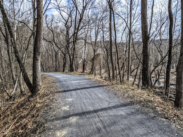

Sun-splashed towpath

Black Rat Snake

Bloodroot

We sped up the pace but we still - there were flowers in bloom and birds to watch. We held up bike traffic to provide safe crossing for a Black Rat Snake. "OH! A snake!" a biker yelled and that almost caused a pile up and everyone rubber necked to look back at what we standing over. It's not the first time I've played crossing guard for a snake but this one was very appreciative. We stopped to gawk at the double kilns at Shinham's Limestone Kilns and quarries.


Shinham's Lime Kilns


Dolomite 


Limestone is plentiful in this region  its occurrence near the surface explains the rolling ridge-and-swale topography of upland farmland north of the river. The rolling ridge and ditch lay of land is quite dramatic at Antietam Battlefield and was critical to the way that tragic day unfolded in 1862. Dolomite, a mineral relative of limestone, was used as an additive aggregate in the making of plaster and mortar. There were several mine shafts visible from the towpath and the largest was the most accessible so I went across to take a peek in. As we walked further on we gawked at the huge limestone quarries blasted out of the bluffs right on the inland edge of the canal. We heard a Raven calling and I wondered if these cliff faces might also support nesting sites. The Raven is making an impressive comeback to the Potomac River Valley because of this abundance of rewilding cliff habitat. 


Lock 37 and its restored lockhouse


We took our snack break just down from the popular walk-in campground near the Antietam Aqueduct. As we continued on and passed what had to have been fifty tents and large campfire/camp kitchen constructions, I had to wonder what the impact of these large groups has on fragile riverside sites. Little wonder that there were no sites available for the solo or small group bike-packer or backpackers to use. 


Bloodroot drifts along the towpath


Antietam Aqueduct approaching a large campsite

 As we walked past the large spreads of tents, tarps, camp chair circles, and large outdoor kitchens, I was appreciative of the opportunity the kids had to enjoy the outdoors but I wondered about the sustainability of it - given it is only March and a whole summer of camping is yet to come. I wonder how the Park Service manages this kind of large group use? Is this a "sacrifice site" or was this a large group camping area by design? (I purposely did not take pictures)


Three miles to go!

We gauged our pace at 2.5mph which is close to my hiking pace with hills on more challenging terrain. By five 'clock we were shuffling into the parking lot at Lock 38 where the second car was parked. Both of us had developed some hot spots in the last mile of walking and I attributed that to the constant flat walking surface that offers little change in the way our feet land and push off. Of all the hiking I do, it is road walking that can make my feet sore if doing more than ten miles in a stretch. Next time, we'll have to remember to change socks at snack break. A little extra loft would have helped at the end of the day.


River Lock 38 across from Shepherdstown - one of the few river-to-canal entrances.

 Notes:  We used the C&O Canal Trust mobile app to learn about the different areas of interest along this stretch. Informative! https://www.canaltrust.org/  then click into https://www.canaltrust.org/plan/explorer-mobile-app/ and use on your phone.


Sunday, February 13, 2022

MD C&O Canal Section 6: Brunswick to Bolivar Heights

 After many months of "too busy' to return to our ongoing C&O Canal Towpath section hike we said "Dammit!" and unbusied ourselves from teaching, office work, and communicating scientifically to walk this next section from Brunswick MD to Harpers Ferry WVa. Counting as #5 in my 2022 52-Hike Challenge, it was a great hike of about 10 miles total with 6.5 on the towpath and a little over 3 up from the lower town to the upper town of Harpers Ferry and Boliver Heights back to where we left a car at the National Park shuttle and parking area on top of the mountain. 


Picking up where we left off in Brunswick MD

The day was cloudy, a little blustery, and typical for February in the Mid-Atlantic, but walking kept us warm and happy. There were lots of people out biking, hiking, backpacking. With the Potomac on our left, ice-free and running fast, the low woods were full of vernal ponds - some frozen, others not - where soon there will be wood frogs barking, spring peepers peeping, and leopard frogs growling. I think of the C&O lowlands as one of the richest amphibian habitats I know about and this is due in large part to the river's penchant for heavy flooding and our neglect of the canal.


Tulip poplar shelter in a gullied flood landscape

Culvert collapse

When the canal was built, it was designed to allow streams and rivers to flow freely under the constructed canal bed, to keep it safe from flooding, and the canal watered. We've walked over impressive aqueducts and examined beautiful stone-built culverts, marveling at the ways water was engineered. In this section however, we observed many places where flooding has resulted in the loss of some of this historic passageway but big gains for wetland habitat. Now we are in the Appalchian mountains and the steepness of the terrain adds to the speed and force of runoff towards the river. Things wash out. Sometimes the river inundates the canal and the path. In many places we observed wash-outs of historic walls, two-hundred year old culverts ripped apart, and smaller feeder canals erased near abandoned locks. This is not a bad thing if you are a wood frog. 


Canal towpath trail

Lockhouse No. 51


Birdsong has returned to the river woods and we have now walked the C&O in all seasons. Hints of spring's return were everywhere. Titmice, chickadees, white-throated sparrows, Carolina wrens, cardinals, goldfinches, woodpeckers, kinglets, and juncos all had something to say. Red-shouldered hawks are returning to nesting sites in the heavy white limbs of sycamores and poplar. We checked for owls nesting in holes and snags. Great horned owls should be on eggs. Bald eagles and ravens are courting. 


Potomac River (pic by Amy)


MM 57 stands on a culvert over a local stream

Great white sycamores were really beautiful against the pewter hills.

As one of the last great water-engineering projects of the 19th century, the Army Corps of Engineers planners had envisioned that the canal would connect Pittsburg PA to Washington D.C. but their staggering estimates for over $22 million to build forced President John Quincy Adams in 1826 to turn to private canal building companies instead who low-balled Army estimates and won contracts to build it in sections. It may not have been the wisest investments considering two of your competitors the Potomac and the Shenandoah, which are famous for their flooding.


The AT shares a few miles of the C&O


See the AT? Hello AT! 

By the time the canal was completed to Cumberland in 1850 it had already exceeded original Army Corps estimates and canal transport companies entrusted to operate it were saddled with enormous debt. Flood repair was an expensive fact of life on the canal in this section. Marked by many historic flood disasters, we observed dozens flood-carved gullies and scoured stream beds from historic floods of the 20s, 50s, 60s and even Tropical Storm Agnes (1972).  Older flood gullies are sealed by more recent floods against the river by silt and sand deposits and are now vernal refugia awaiting the emergence of masses of migrating frogs and salamanders. Wood ducks, once considered uncommon, are now common here as the wooded wetlands offer plenty of hollow trees to lay (many) eggs. Herons have several impressive rookeries over the canal and turtle will soon emerge to breed and lay eggs in the soft sandy bottom woods. We can't wait for our favorite snakes to emerge - we love snakes. But it is still quite cold for them, though I was keeping an eye out for the cold tolerant garter snakes.


 The bend of the Potomac at Harpers Ferry and layers of flood repair to the canal wall.


Harpers Ferry Lower Town comes into sight around the big bend

Inside a giant sycamore snag

 Maryland Heights crossing, iconic B&O Railroad Tunnel, and faded 1920s toilet powder ad (!)

Crossing the bridge over the Potomac!  (pic by Amy)

We were awed by the massive Maryland Heights cliffs where Union troops were dug in on top and where enormous Navy siege cannon emplacements and tranches can still be explored by hiking up a side trail off the C&O. A lone solo climber was skirting across the faded 1920s painted ad for toilet powder. 


Union forces were entrenched with huge artillery pieces up there. Whoa. 

Maryland Heights from West Virginia. (Pic by Amy)

We hiked into Harpers Ferry,  where the U.S. Army maintained an enormous armory that manufactured over 600,000 rifles and muskets. It was a Confederate target and prize in the early years of the Civil War and lots of military engagements, including the build-up of troops and supplies for Antietam just upriver happened on the hill above us. John Brown carried out his famous raid here in 1859 and was captured and hung for his abolitionist activities that sought to arm slaves with weapons captured from the armory. They failed but his actions stood to fire up the anti-slavery movement that launched the American Civil War. This is what most people coming to Harpers Ferry National Military Park come for. But there is so much more.


Armory Provost Office


Storer College and Niagara Movement Museum

Walking up High Street to the Upper Town. 


Walking up the steep hill to the Upper Town Harpers Ferry and Boliver Heights we lost the park crowds below and learn more about Storer College and discovered Civil War sites that we'd never visited before. We picked up a map for the African American History walking tour and checked out some of its rich historic locations along the way. My sister and I have been coming to Harpers Ferry all our lives but only to the National Park location at the confluence and this walk up the hill opened a whole new history for us so we are excited to come back and explore some more.  Add to that Smith Mountain, our family roots in Appalachia, was visible to us from up here so we did a lot of reminiscing. 


Early caddisfly! Time for fly fishing! (Pic by Amy)


Smith Mountain was where uncles and aunts had their cottages and cabins, did their hunting, tended to their orchards and bees. We remembered those glorious summer reunions on the Shenandoah and (for me) adventurous winter visits to our beloved mountain family. We remembered drinking homemade sassafras beer, fly fishing, and arrowhead hunting. We learned to canoe on the Shenandoah and how to make the best chili dogs with venison sausage and long-simmered venison chili. It's where I learned to keep bees. I started hiking the Appalachian Trail with my uncles when I was very small and still hike it today in my 60s. 


Appalachian Trail Conservancy HQ (!)


Cannonball damage to St. John's in Boliver Heights (October 16, 1861) 


A peek of Smith Mountain to the left of the entrance sign!


We rounded the bend on Washington Street and began our slow road walk past the Boliver Heights Battlefield. It was the location for so much military action during the Civil War but few people come up here from the popular Lower Town attractions. We stopped to gawk where a cannonball pierced the wall of a hilltop church. We took a look at Stonewall Jackson's headquarters.  We said hello to the boneyard folks sleeping under the boxwood and cedars. We stopped at the wonderful Boliver Bread Bakery and snacked out on the last of the day's fresh baked cookies and scones. Soon we were back at the National Park main gate on top of Boliver Heights, back to the car, and in full view of Smith Mountain across the river. 

Here's our YouTube video for this hike:


Notes:

Army Corps of Engineers Vignette #70 "Early Army Corps Plans for the C&O Canal" https://www.usace.army.mil/About/History/Historical-Vignettes/Civil-Engineering/070-C-O-Canal/

The U.S. Armory at Harpers Ferry is what puts this formerly small Appalachian industrial town on  the map for Civil War historians - Historic Resources Study/NPS http://npshistory.com/publications/hafe/hrs-armory.pdf

Storer College celebrated its 150-year anniversary in 2017. West Virginia Public Broadcasting story - listen here:  https://www.wvpublic.org/news/2017-11-15/storer-college-celebrates-150-year-legacy

Boliver Heights Battlefield - so few people come up here as it seems the Lower Town gets all the tourist attention, but this is where repeated Civil War battles were fought for control of the armory below and served as a massive encampment for troops on their way to fight at Antietam.   https://www.nps.gov/places/harpers-ferry-bolivar-heights.htm