
 |
| On Day 3 the Romans were everywhere! |
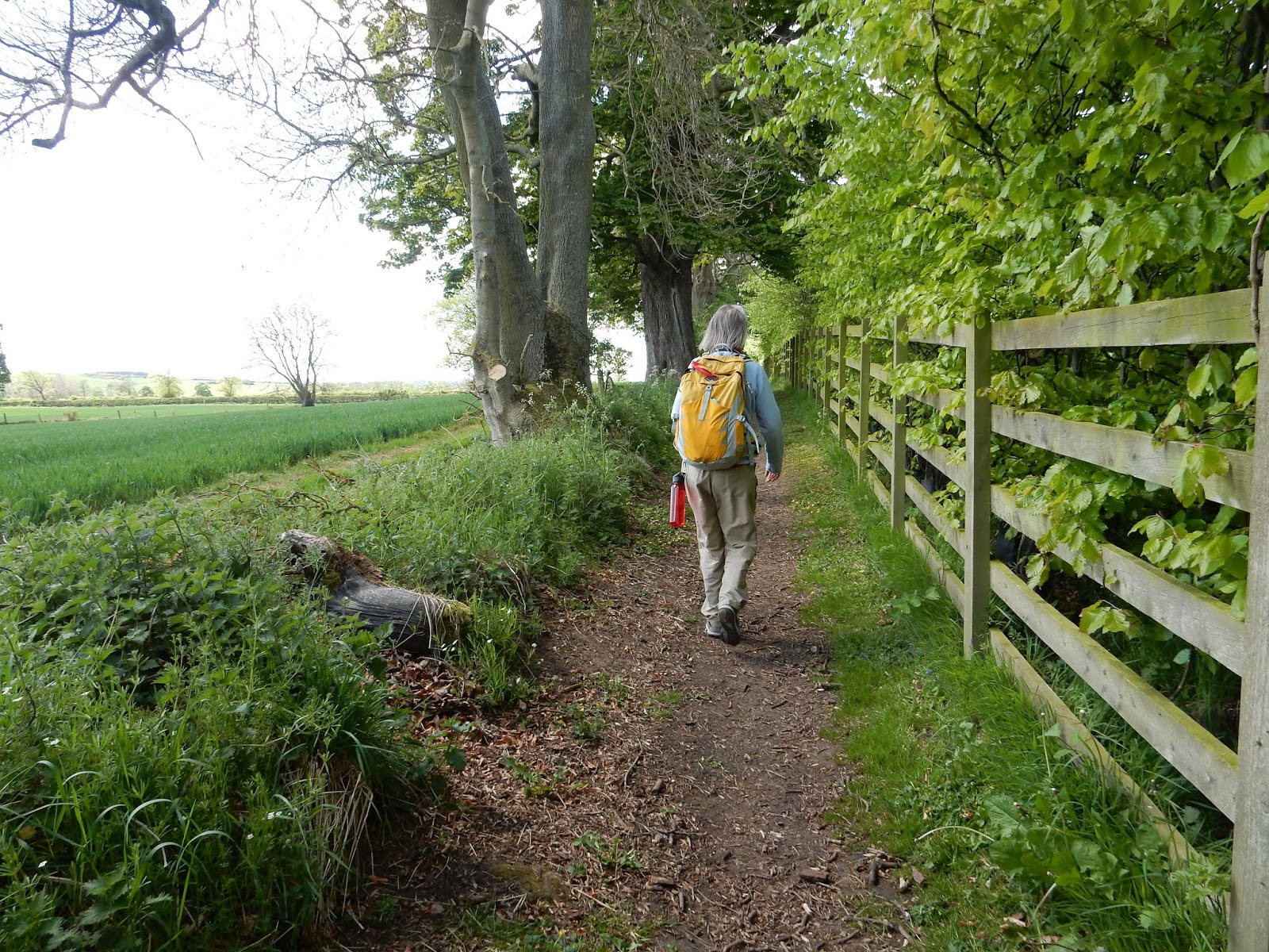
Day 2: Wylam to East Wallinghouses, 12 miles.
Though our hike across northern England follows the route of Hadrian's Wall, we walked through landscapes that contained histories of conflict and occupation much older than the physical remains of the wall, forts, and turrets. A local historian reminded us that to the ancient tribes of the area - who had inhabited the northern territories for thousands of years before the Romans arrived - every natural landmark whether hill or outcrop, forest or single tree on the land, was significant and that we shouldn't overlook the relationship these tribes had with the land long before the Roman Period.
 |
| Leaving Wylam in the early morning. Wagon Way to Hadrian's Wall Path. |
We were reminded, too, that the "Roman Period" of northern England/ southern Scotland was really a long period of military episodes rather than a continuous period of Roman rule. "People only look at the big interpretive signs as they come to them on the walk," he said, "And this is what they take-away. What people don't or can't see today are the timber frame dwellings, Iron Age hilltop forts, turf-built ramparts, dug-in-earth temples, and cult-worshiping sites that may or may not have been consumed completely by time. Some of these old places are still marked on the land. You have to train your eye to see them."
 |
| HWP to Heddon-on-Wall. "Look beyond the big interpretive signs - train your eyes to see." |
For hundreds of years the Roman occupation was in continual ebb and flow across this landscape, ground claimed by Romans for a generation or two, then retaken and reclaimed by a generation or two of Caledonians, Scoti or Picts. Scholars today debate whether the Romans actually had true control over any of the territory it attempted to claim for the Empire.
 |
| Follow the acorns. |
I began to detect the subtle knobs and vales of ancient earthworks. I realized that seeing these features was like learning to see in the dark. While other hikers passed by lumps, bumps, and humps - I stopped and studied every one. Earthworks were everywhere! Covered in sheep! Before we started seeing the impressive ruins of Day 3 we observed mile after mile of irregular land that, as our local historian at the Robin Hood Inn had told us - were defensive systems. Marching camps, the most mobile of the Roman invasion forces spread out across the frontier and wherever they stopped to probe the defenses of an enemy, they constructed square turf-built walls and ditches - essentially "digging in" - to protect their . Long before Hadrian ordered the wall built, Agricola's marching and cavalry forces had spread throughout the border country and had made deep forays into the Caledonia territories. There are relics of Roman turf defenses far to the north of where we were, even the remains of a northern defensive line at the Antonine ramparts.
 |
| Earthworks and the military road. |
By Agricola's sixth campaign into southern Scotland in 82 A.D. the Caledonians had figured out what tactics worked best against these defenses. Raids, often at night, brought horses racing towards the ramparts pulling flat-bed chariots manned by a driver, archers, and lancers who harassed and caused considerable consternation among the Roman legions. The Roman preferred daylight battles, out in the open, highly organized, and well away from the marching camps. The Scottish tribal raiders learned the Roman vulnerabilities and applied the surprise, guerrilla attack at every opportunity. They especially appreciated the power of rumor and leaks of mis-information. Boy, some things don't change!
 |
| Contested landscape covered in canola. |
The Caledonii got ready to fight with great preparation of equipment, all of which was exaggerated by rumor, as usually happens when real information is in short supply. They even launched attacks on large (marching) forts and taking the offensive, increased the feeling of panic. - Tacticus, Agricola, 25.3
 |
| Paved road atop the Roman military road. |
Another landscape feature we observed these two days was the Roman military road that in some places is built over by modern paved roadways. All Roman legionaries were highly skilled road builders and systems of roads ran every which way across England and southern Scotland. In fact, Roman soldiers were skilled in all forms of building. Building trades were an important part of military training since they were in the business of expanding empire. Wait - that sounds familiar too...
 |
| Robin Hood Inn, Night 2 rest and amazing meals right on the Military Road. The pub manager is a local historian. |
Day 3 East Wallinghouse to Chollerford, 14 miles.
The Auxila cohort or provincial members of the Roman military from different parts of the Empire, were highly valued (though paid far less than Romans-by-birth) for trade skills in building unique to their homelands. Auxila cohorts (300 - 400 men) were under the command of a centurion along with his full compliment of a Roman military garrison (3500 - 4000 men) and they were highly respected for their own fighting skills and weaponry. So a cohort of Syrian archers could also be utilized for their skills in metalworking. Iberian horsemen were known for their leather and tack work. Road building, however, was every soldier's business and it didn't matter from where in the Empire a cohort was from - everyone built and maintained roads.
The Auxila cohort or provincial members of the Roman military from different parts of the Empire, were highly valued (though paid far less than Romans-by-birth) for trade skills in building unique to their homelands. Auxila cohorts (300 - 400 men) were under the command of a centurion along with his full compliment of a Roman military garrison (3500 - 4000 men) and they were highly respected for their own fighting skills and weaponry. So a cohort of Syrian archers could also be utilized for their skills in metalworking. Iberian horsemen were known for their leather and tack work. Road building, however, was every soldier's business and it didn't matter from where in the Empire a cohort was from - everyone built and maintained roads.
 |
| Camber of the military road is visible as we walk the path. Massive earthworks in the fields. |
 |
| The Vallum ditch comes into view on Day 3! |
We were all impressed by the size and scale of the Vallum, the great defensive ditch that runs south of the wall. It was a massive undertaking and ran almost 50 miles from Heddon-on-Wall clear through to Carlisle. It wasn't following exactly the course of the wall and was at some points quite a distance from it but always to the south. Some researchers suggest it was built to contain possible uprisings of people within the Roman territory - to slow an advance on the forts and wall from the interior. We could see how the edges of the Vallum were slightly raised as turf from the ditch was laid to create visual highpoints so that wall guards could see intrusions. It was suggested by one local historian that in times of domestic unrest, the bottom of the ditch was flooded or stockpiles of flammable liquids (oil) were at the ready to ignite, or that sharp stakes were embedded in the bottom like one giant pitfall trap. Eww.
 |
| Seven hundred year old tree astride wall stone. |
It seemed everywhere we looked there mounds and ditches, earthworks with the Vallum not too far away, and it was on the third day in a rainy, windy squall we came to our first massive section of Hadrian's Wall! The massive square-cut stone was laid as two exterior walls with rubble, mortar, and gravel filling in the interior. Originally the wall was built to stand 12 to 18 feet high and guards patrolled the top but we never saw it at its full size, as entire sections had been badly scavenged for the cut stone. It wasn't hard to see where it went over the centuries - Roman stone could be seen in barns and farmhouses all along the Military Road, so it didn't get carted too far off!
 |
| Hill fort ramparts. |
 |
| Hadrian's Wall at last! |
 |
| St. Oswald's Farm barn and farmhouse both contained square-cut wall stone. |
Our third day on the path was rainy and cold, typical of May in northern England, but at every turn (or over every stile) there was something new to see. These Romans were really serious about this wall! Hadrian visited this region on his years-long inspection of the Empire's boundaries and realized the constant attacks and badgering (we saw a badger, too!) by the Scot tribes had worn his troops down. The wall, he said, would help secure the northern line and provide a system of resupply roads and forts that would strengthen their positions against the "northern barbarians." The wall was built in six years and completed in A.D. 122.
 |
| The Vallum to the south of the wall. A constant companion for the next five days. |
 |
| Following the military road. |
During some short periods of rain I walked along shrouded in my rain jacket and hood unable to see or hear George and Molly ahead of me. All I could see was the Vallum to my left, old hedges to my right, the path underneath me, and pasture walls. I almost ran right into the next stile! From the top of the stile I stood in the mist and looked back over the fields we had just crossed. The grey skies were the perfect compliment to the pastures which seemed to absolutely glow vibrant green against heavy clouds. I stood there a long while and looked at the land. Undulating ground - the ditch, earthworks, walls, old road edges - were all draped in earth colors so rich and lush I had to catch my breath. The tops of stiles became my favorite vantage points from then on to look back and look ahead and take in the lay of the land.
 |
| Ladder stile look-out point. |
There is an art to climbing ladder stiles. Especially with hiking poles and a backpack. I tried various ways to go over - climb forward, turn around at the top (enjoy the view), climb backward down to the ground, or sidestep up, straddle the top, sidestep down, or climb forward, step down facing the direction we're going (the fastest but slippery!). Sheep and cows always watch the people going up and over. Maybe its entertainment for them, certainly when someone trips and tumbles - I can hear the sheep giggling even now as I recall a slip off a stile doing the forward down maneuver. They really did giggle and the little ones wagged their tails.
 |
| Brunton Turret ruins near Chollerford with stair ramp up to the wall walk. |
As we approached Chollerford for our third night's stay at Mingary Barn, we stopped to explore the Brunton Turret ruins. Inside was a hearth for cooking and the exterior wall contained a stairway for troops to access the top of the wall. Across the river was the beautifully excavated Chesters Fort. This deserves a blog post of its own, so I won't include it here other than to say that we stopped at the fort before heading up the hill to our B&B (which was fanstastic!) and dinner at a local pub. The fort visit was incredible, to say the least.
 |
| Night 3 at Mingary Barn - what a treat! |
 |
| Dining with HWP hikers from Glasgow and Edinburgh. Wonderful meal! |
Notes:
The English Heritage Society maintains a wealth of archeological and historic sites along the Hadrian's Wall Path, all of which contain excellent museums and offers the HWP hiker discounted admission with a nine day visitor's pass. It was well worth the $ to purchase this pass and we enjoyed every EHS stop along the way. http://www.english-heritage.org.uk/visit/places/hadrians-wall
Night 2 - Robin Hood Inn is where we met a local historian who also happened to be the owner of this old but beautiful inn and public house. We had the most delicious meals here and a huge English breakfast included with our stay. http://robinhoodinnhadrianswall.com/
Night 3 - Mingary Barn/ Chollerford B&B was a treat for all of us - we were a little cold, really tired (12 mile day in the rain) and so hungry. This old farm complex is now run as a guest house and B&B and the owners were so kind. http://www.chollerfordbedandbreakfast.co.uk/
No comments:
Post a Comment