|
| American Toad - poison glands obvious! |
On a very rainy day my dog Amos and I hiked a circuit around the large impoundment lake at Gifford Pinchot State Park in York County. I am not a fair weather hiker. I go hiking no matter what. "It builds character!" a hiking friend once said (we were hiking in a hurricane) and that's sort of how I felt about this excursion. Amos and I harvested some more of that character on this 12-mile slog through flooded trails that, with one major road-walk reroute, ran and pooled with water the whole way 'round. It was a challenge - and a lot of fun!
 |
| We started at 9am when the rain did... |
 |
| ...and the mud became muddier... |
 |
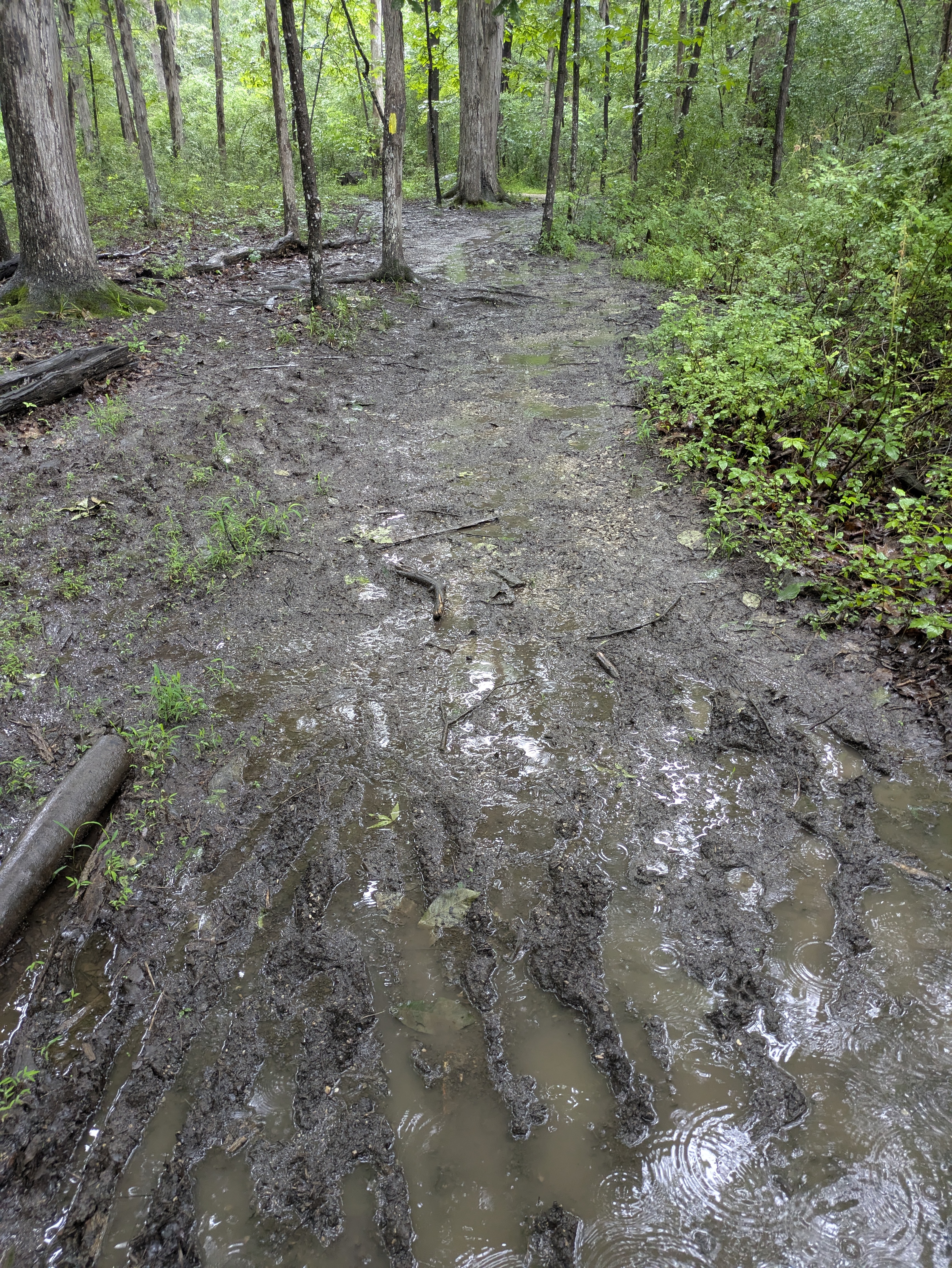
| ...then the trail ran like a river... |
 |
| ...until it became a lake. |
Amos will wade through any water AS LONG AS IT DOES NOT TOUCH HIS BELLY. That said, I tried hard to follow Leave No Trace principles and not hike around, but Amos and his belly dictated that at least two deep water go-arounds were non-negotiable, so a-bushwacking we went. Otherwise we waded and mucked and sloshed straight on through.
 |
| Oyster Mushroom |
 |
| Mullein |
 |
| Coreopsis |
A well-known wildflower photographer once gave a workshop at our local nature center. He stressed that cloudy, rainy days are the best times to go out and capture color. I remembered that little tip as we passed woods edges full of flowers so brightly beaming yellow despite the low light. Even yellow mushrooms were in on the act. Goldfinches and a Common Yellowthroat at the marsh twinkled in their intense yellow spring plumage. It all but made up for the absence of sun.
 |
| See the resemblance? |
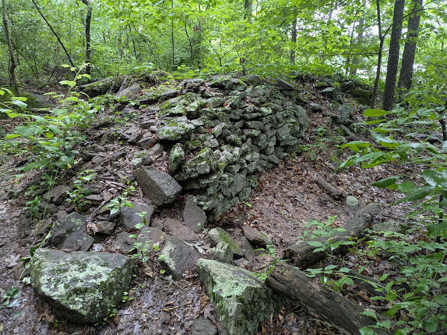 |
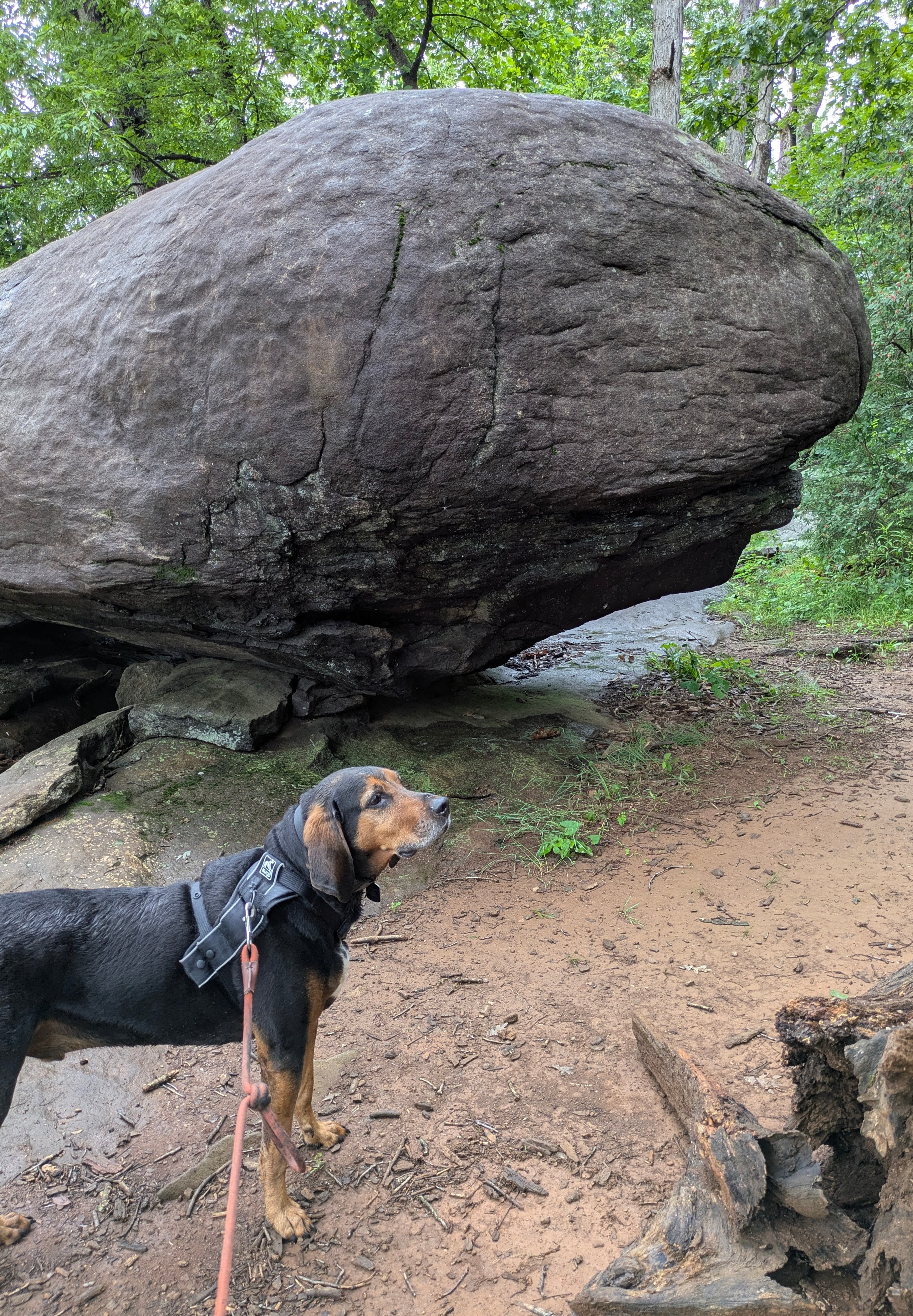
| Diabase rocks made monumental pasture walls |
 |
| Diabase boulder overlook |
 |
| Tessellated weathering (tiles) |
Diabase is the rock type here. It's a sub-volcanic rock that weathered out from buried plutons, underground chambers that cooled in place and never reached the surface as lava. Diabase is found throughout Northern York County in a belt of volcanics that stretches from Gettysburg in Adams County in an arc across the Susquehanna River east towards the Iron Hills of Lancaster and Chester Counties. It's hard stuff and farmers did everything they could to clear their fields of it or risk breaking plow blades. By the Depression Era, farmlands in the area had been exhausted and much of the landscape was secondary scrub, overgrown and run-down. In the 1950s the state acquired the farms and began constructing the first metropolitan part in the growing state park system. By 1960 it was open for business including public swimming beaches, trails, playgrounds, and small boat launches. It was a tradition growing up with "Pinchot" summers. See Notes (below).
 |
| Vernal pools and citizen science! |
 |
| Stopping by for a frog check |
 |
| Cattail and pond lily marshes |
By the time we reached the far side of the lake the rains were really pouring down. We checked out the marshes for ducks but could hardly see through the downpour. My binoculars stayed dry and unused in their drybag in my pack but everything else on me or inside my pack (even with a rain cover) was drenched. Oh well. It was warm enough not to have to worry much about getting cold as long as we didn't stop for too long. We crossed the bridge into the woods through the old Weller Farm wall gate and soon emerged into the day use area with its fields of picnic tables, grills, picnic lawns, and playgrounds. Time for a snack break in the pavilion but as winds increased even under roof, the rain found us.
As we progressed towards the ravine where the dam was built in the 1950s to create the lake, the trails became completely submerged. All that water was running down the same hill we were hiking down. I heard the wet-foot stream crossing long before I saw it. Normally this little stream is a hop-skip across smooth ledges to continue the trail on the other side, but not today! Amos was very nervous about approaching it, even if just for a minute to get a picture. Turn around! Don't drown! We high-tailed it back up the hill to the nearest intersection with a bridle trail and slogged through some very deep mud horse trails out to the road. We rerouted for a two-mile walk around the ravine valley.
 |
| Turn around! |
 |
| A little road walk... |
 |
| ... past the Maytown Schoolhouse... |
 |
| ...and Benders Cemetery. |
 |
| Died 1844, 80 yrs. |
Road walking has its joys, too. We found the Maytown Schoolhouse and explored the Bender Cemetery along the Alpine Road to the dam parking lot and the next access to the Lakeside Trail. In the graveyard we found many birthdates before 1776. Some of the markers had flags and I wondered if they were Revolutionary War veterans? A nice lady pulled up alongside and asked we if needed a ride. I told her no, thank you, we were hiking in the rain on purpose. She gave a big smile and said "Atta girl!" and waved goodbye as she pulled off.
 |
| Crossing over (not through) Beaver Creek |
 |
| Spill way into Beaver Creek |
 |
| Mason Dixon Trail and Lakeside Trail combine |
 |
| Alpine and Mason Dixon Trails combine |
The rain finally subsided after mile 8, which would have been mile 6 were it not for the 2-mile road walk (which was delightful) and we strolled past the great diabase boulders and rocky overlooks, slowly drip-drying as we went. Like meeting up with an old friend, the robin's egg blue of the long-distance Mason Dixon Trail joined the Lakeside Trail and I decided to stay on the MDT and divert off the Lakeside Trail. Around mile 10 we cruised through the disc golf area where we met a soaked but happy player who offered me a free throw (!!) and past a little boat launch where Amos told me he was extra hungry. At mile 11.8 were back at the truck with a deep toweling off for Amos, dinner, and a well earned hound's nap in the back of the truck.
 |
| Let's go eat! |
 |
| Amos snoring in his comfy bed by 5pm. |
Both the Mason Dixon Trail and Pinchot State Park are like old friends to me. When hiking pal Kim and I finished our MDT section hike in 2016, I remember coming through the park feeling like a homecoming. How many times have I followed the blue blazes through this park - first with my dad and then with friends and many dogs over the years. My first time to Pinchot was when I was eleven. Soon I'll be 65 and thankful I can keep coming out to walk these trails even in the pouring rain.