Wednesday, August 28, 2024

PA Poe Paddy State Park/ Mid-State Trail

This sweet little sneak-away for two days hiking a short section of the Mid-State Trail (MST) had me and my pup Amos camping at Poe Paddy State Park. We hiked (slowly for Amos) about four miles of this wild and remote trail mostly on an old forest road and railroad bed, but we did also did a three mile section of rocky uphill/downhill, too. This experience cemented for me the desire to hike this 300+ mile Northeast-Southwest trending trail through the heart of the Pennsylvania Appalachians/Alleghenies but the hard reality is that my seven-year old hiking pup would probably not be able to hike it with me. It's a tough trail for dogs and watching Amos struggle with paw-painful sections that included sharp road gravel and steep, exposed outcrops made the case that this is a trail I'll be careful about including him on. Still, he thoroughly enjoyed long soaks in Big Poe Creek and shady snoozes on his (new to him) Big Agnes expedition camp pad I got for $4 at a thrift store. 


Our remote basecamp

Amos on his Big Agnes pad 

A respite from the rocks

Ok, now that we've had our Amos fix, I'll say that camping at Poe Paddy was a remote experience. All roads leading to this campground, one of the smallest state parks in the PA system at only 28 acres, are gravel and not maintained during winter months. I spent half an hour+ on gravel making my way to Poe Paddy named for the two mountains that meet in this gap. Once I made it there, it was blissfully quiet and with so few campers in late August that I had the place almost all to myself. I did meet three people bike-packing who were staying in the small Adirondack shelters for the night and a lone Mid-State Trail hiker tenting by the creek, all of whom were exhausted but happy to have a little luxury for a night, even though that luxury included only (nice) pit toilets and potable water from two water pump stations. 


Crossing Penn's Creek on the MST

Rebuilt (2015) Poe Paddy RR tunnel ...

... includes access for bats only above the people-part...

...dividing the original tunnel for two separate user groups! 


Our first hike covered only about four miles for an out-and-back on mostly railroad ballast after crossing through the Poe Paddy Tunnel. On our way back, Amos decided the tunnel was cool enough to rest his aching paws and took a nap on the smooth cement surface. It's not a very long tunnel, so no need for a flashlight as you can see the other end.  It was a well-designed rebuild with a bat hibernaculum above the human passage.  I made a note to think about booties for Amos, if he would tolerate them. 


Devonian redbeds in steep anticline


The folded Allegheny Mountains of the Central Pennsylvania Wilds Region are part of the long Appalachian Mountain range that extends from Maine to Georgia and northern Alabama, an ancient mountains range that formed when tectonic plates collided to form the Supercontinent Pangea. In this section of the range the folded sedimentary layers seem extreme, almost fluid as pressures forced marine deposited siltstone, sandstone red beds, shales, and limestone almost vertical like the face of a steep wave, into an anticline.  I stopped to admire all the outcrops while Amos sniff-tested the beautiful talus-flood plain alongside Penn's Creek. Big Poe Creek which ran past our campsite and into Penn's Creek is the site of the magnificent Green Drake Mayfly hatch in the spring. I made a note to come back for that!


Penn's Creek 


Talus and flood plain


Our second hike of the day included a slog up the cobbly/talus/rutted unmaintained road that once led from the now extinct Poe Mills Village to town of Coburn. We found the trail near the crest of the mountain and took it to the summit at Raven Knob (1480'). Along the trail we found fresh bear scat and so many late summer blossoms like the delicate Panicled Trefoil and beautiful patch of Silverrod on a wet seepage outcrop that included lush mosses and lichen. The woods were filled with Bluestem Goldenrod and White Wood Aster as well as the foliage of Pink Ladies Slipper orchid and Round Lobed Hepatica. 


Flower rich wooded summit


White Wood Aster

Bluestem Goldenrod


Forkmoss


Brocade Moss


Cladonia sp. (lichen)


An open patch just below the summit crest came with a beautiful cool breeze.  I noticed yellow-tinged forest trees which is either a drought or heat response for water conservation or the beginnings of fall colors. It could have been either or both. Raptors were cruising at summit height heading south including an Osprey, a Peregrine (far overhead), Coopers and Sharp-Shinned Hawks, and a Broad Winged Hawk. 


A lone hiker passed us coming up on the old road as we headed back. He had just come across a big Copperhead sunning on the mossy edge of the trail where Amos was walking to save his paws from the gravel and loose cobble. "Biggest one I've ever seen, but really chill and friendly."  We didn't see it except for a very small and quick Brown Earth Snake. Once at the bottom of our three-mile out-and-back scramble he turned right into Big Poe Creek from the campsite and soaked his paws. Poor boy.   


Big Poe Creek


I felt really guilty about this rocky-double-day hike that seemed for Amos more of a painful slog. So, I took him over to the nearby Poe Valley State Park (3 miles away) the next morning for a little ramble on their nature trail. He looooooved it. So much soft mud and springy pine needle-covered trail to sink his paws into. Easy access to the creek and lots of shade. My seven year old hiking hound's experience on the MST made me think hard about when not to bring the big guy along. It tugs at my heart to leave him home, but for his own safety and mine (he's 90 pounds so I can't carry him out injured) if I'm to do the MST, I'll have to really research what sections are best for him. I may not have the ability timewise to do a 30-day thru-hike which is what I really want to do, but I have to be realistic. So in my trusty little notebook I wrote "Start planning MST day hikes/loops/2-3 night overnights. Be mindful of Amos."


Easy on the paws at Poe Valley S.P.

Nature Trail at Poe Valley State Park


Notes:

"A Tale of Two Tunnels" Coburn and Poe tunnel history (we only visited the Poe Tunnel) https://www.statecollege.com/town-and-gown/a-tale-of-two-tunnels/

Aug 6, 2024. Purple Lizard Maps Adventure Blog post by Katie Anspach. "Orange Blazes - Hiking the Mid-State Trail" https://www.purplelizard.com/blogs/news/orange-blazes-hiking-the-mid-state-trail

April 2, 2023. Purple Lizard Maps Adventure Blog post also by Katie. "I'm Section Hiking the Mid-State Trail." https://www.purplelizard.com/blogs/news/the-mid-state-trail?_pos=10&_sid=b20ce5c3d&_ss=r


Sunday, August 18, 2024

CO - East Dinosaur National Monument

Just across the Utah/Colorado state line, past the derelict town of Dinosaur, CO, we found the turn off  to the entrance of the East Section of Dinosaur National Monument. We'd driven past miles of industrial scenery, oil rigs and storage tanks, followed lines of double-tanker trucks hauling oil to processing sites, and through a Ute reservation that symbolized the demonstrated condition of many Indian reservations I've witnessed over the years. It's clear that the people on the reservation do not share in the oil wealth of this landscape. Past the third cannabis dispensary with no grocery store or shop of any kind in sight, we made the turn and pulled on to the single paved road into the monument.


Oil and natural gas is a growing industry in the Uinta Basin


This section of the national monument had a very different feel. Geologically it was more expansive and featured the great wide open spaces of the Colorado Plateau, overwhelming in its scale and beauty. Yet it felt a little sad, too. We got out to stretch our legs on a short trail that followed the rim of the Plug Hat Butte and began to feel the altitude almost right away. Huffing and puffing to follow a flat trail, my adult grandchild from Delaware realized the rest of our visit to this high, windy, even chilly country would be different from the dry, hot desert on the Utah side as they experienced their first real encounter with being nearly at tree line. 


Feeling the rise

We explored a Pinyon Pine forest and looked across broad canyons from the mesa top. We sat on a conveniently placed bench and caught our breath. We watched as a few cars wound their way down the park road to the bottom. Clearly this was the far less visited part, distinctly more remote. Even after appreciating the beauty of the red and yellow banded canyons and excited to see some wildlife, it still felt a little sad. Maybe some leftover feelings from driving through what remains of Dinosaur (the town) and the reservation's impoverished landscape? 


Mule deer buck

At this altitude we should have been seeing some wildflowers blooming but saw basically nothing. I follow some Utah hiking groups on social media and was pining to see the high mountains in bloom as people were posting this week of incredible flowering happening high up. Other than Greasewood, Sagebush, and scrub, however, there was very little color, let alone flowers to enjoy. Then I figured it out - this section of the park is grazed by a local ranchers large wandering herds of cattle - we stopped several times to let them cross the road. I have nothing against ranchers , don't get me wrong, but it was here I saw the starkness of close cropped grazing lands where all the tender grasses and wildflowers are nipped to the ground. 


At 8,000 feet

I was reminded of my travels in Wisconsin, near the home of Aldo Leopold in Madison, who travelled out into the landscape with his students to search for remnant prairies on the edges of progress and settlement. Finding only small patches of prairie wildflowers in the corners of fenced-in cemeteries or along the scrubby edge of railroad tracks, he imagined these places full of late summer wildflowers where once great herds of American Bison roamed. 

"What a thousand acres of Silphiums looked like when they tickled the bellies of buffalo is a question never again to be answered, and perhaps not even asked" (A Sand County Almanac)


Cushion Buckwheat

At various pull-outs we enjoyed the views but I also did some sleuthing. Cattle plops were everywhere and except for a few very small groupings of Cushion Buckwheat, the dusty ground offered mounds of Cheatgrass, a non-native invasive found across the Southwestern rangelands. Despite the NPS's attempts to eradicate it, Cheatgrass has taken over the high hills and slopes where non-native cattle graze everything else into oblivion. There was no perennial herbaceous cover that I could find at the four stops we made. 


Pinyon Pine

Though prescribed fire is one tactic we can take here in the East (where I live) to control non-native invasive plants, this same treatment in the West on rangeland can make the problem of Cheatgrass so much worse. Post-fire environments, whether prescribed or wild, in the DNM are predominantly overtaken by Cheatgrass on high slopes, south-facing hillsides, and open high plains. Sherill & Romme, in their 2012 study of the semi-arid DINO region within DNM, found in their baseline study that Cheatgrass is thriving under conditions of a warming world, and that increased wildfire risk is a recipe for increased Cheatgrass dominance over native plants, particularly wildflowers. (See Notes) 


From the Ruple Point Trail


In the midst of our wandering up the long road to Harpers Corner, we felt our altitude-induced headaches a little more with each mile. A small herd of Pronghorn and a magnificent 8-point Mule Deer emerged from the Sagebrush, but black Angus cattle were everywhere on their summer grazing land. We tried to imagine Native People coming to these highlands to hunt and gather in summer, a land not quite as barren like it is today, but definitely not livable come winter. I asked Koda to imagine the scene of a thousand years ago. Were they collecting cones and berries and sweet herbs? Were they hunting bison, who like the cattle of today, certainly wandered over these windy slopes for summer forage? 


Black-Eared Jack Rabbit dug out 


With Koda's headache intensifying we decided to turn around before reaching the end of the park road at Harpers Corner and luckily the pain and throbbing decreased with every mile down. We stopped at a pull out picnic area for a bathroom break and I wandered out to the Ruple Trail for a few minutes to stretch my legs. Western wildfire haze muted the view across the canyons but I did find a Black Eared Jackrabbit dug-out under a dead Pinyon Pine log and Sagebrush. When backed out of our parking spot, the Jackrabbit popped up from a nearby Sagebrush and leaped on to the trail I'd just left - no doubt headed back to the safety and warmth of his dug-out.


Having a close-up encounter with the Jackrabbit, I thought about Ann Zwinger (1925-2014), celebrated Utah nature writer who authored The Near-Sighted Naturalist (1998) that I had downloaded on to my e-reader for the trip out west. I was a little disappointed we hadn't hiked more on our last evening outing in Utah but Koda's first time elevation headache took priority. While we rested at the Visitor Center at the bottom of the hill (and Koda found the bookshop there to be excellent, btw) I tucked into Zwinger as we acclimated again to lower elevation. 

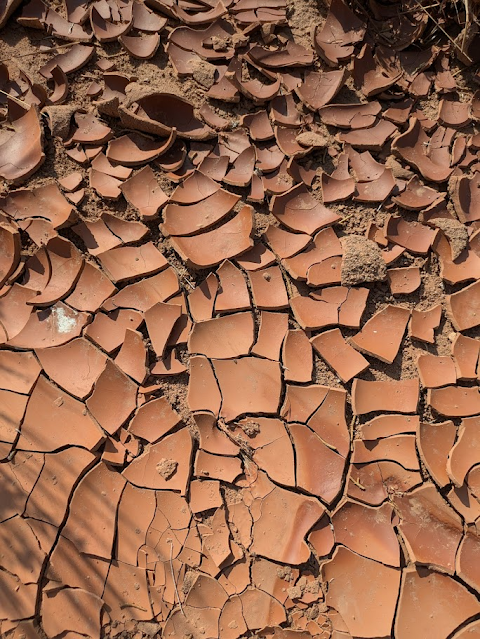
"In wandering there is great reassurance, for it is then that one fits into the continuum of a larger world, a world which for the naturalist has no beginning and no end. We all need to know there is purpose and worth and reason in living. A naturalist finds these in the sibilant logic of saltating sand grains spinning into a dune, in the spiked spoke pattern of a cactus, in the hexagonal mud cracks in a dry arroyo, in bee-beset willow catkins, and in the clouds that curtain a Western summer sky with virga."   


Virga beneath the clouds


The sadness lifted as I felt our afternoon of wandering had indeed held a deep sense of meaning to me and Koda, even if some of what we discovered was not an ideal find (the lack of wildflowers and abundance of Cheatgrass). But we learned so much about the landscape by just riding upon it that its past and maybe its future were somehow revealed and prompted new questions, that promised more wandering to find answers.

"Where else can one range so widely and wander so happily into archeology and anthropology, biology and botany, geology and history, taxonomy and zoology? This is precisely what makes natural history a far-ranging and fascinating discpline for its practitioners - those batty people who like to tie together yesterday and tomorrow within the framework of today's natural world in which man walks, crabs scuttle, lizard leaps, jackrabbit bounds, and beetle trundles." 


Notes:

Kirk Sherrill and William Romme (2012) "Spatial variation of post-fire Cheatgrass: Dinosaur National Monument." https://fireecology.springeropen.com/articles/10.4996/fireecology.0802038

Ann Swinger https://a.co/d/0xSh6qY


Friday, August 16, 2024

UT - McConkie Ranch Petroglyph Trail

McConkie Ranch, privately owned, permits hikers to explore two trails that climb out of Dry Fork Canyon onto the benches of a banded sandstone bluff. Just a twenty minute drive from our basecamp in Vernal, Utah, as soon as I heard about this place I knew I had to go. Koda, who had planned to walk down to the Utah Field House Natural History Museum in town later that morning, was still asleep when I crept out of the hotel room just as the sun was coming up. I said I would come pick them up for lunch around noon, so I had the whole morning to spend at this fabulous site hiking and exploring while also beating the heat.


McConkie Ranch Trail


I climbed up the steep, dry, dusty trail with some huffing and puffing and when I wasn't distracted by the beauty of the view up the canyon, with its green hay fields, small ranches, and horses grazing in their pastures, I was captivated by the very old Utah Juniper (Juniperus osteosperma) forest that twisted and spread out along the trail. Actually a pine, these conifers grow low and out, pressing close to the rocky terrain while massively deep root systems penetrate the bedrock for water. A fifteen foot high tree with a not-so-big-around trunk can be hundreds of years old as they grow very slowly. Utah Juniper offer islands of shade to animals in the heat of the day and lots of forage for browsers and birds.


Utah Juniper forest


Suddenly I looked up, face to face with the yellow-gray sandstone wall. The upward climbing trail stopped and took a hard turn to follow the base of the main ledgestone cliff. For a deliciously cool, shady mile I hiked along the cliff wall gobsmacked by what I saw. I'd read about the petroglyphs at McConkie Ranch while studying our own wonderful Susquehanna River rock art sites in Pennsylvania,  but to actually stand below the ten foot tall carvings in person was breathtaking - and no, it wasn't the altitude!


There were amazing figures, animals, and symbols pecked and incised into the sandstone patina at every turn as well as pictographs in red and faded black paint. Though we can never know what these figures represented, it was clear that they held shamanistic meaning. Figures in animal-type head dress, ceremonial regalia, and displaying body parts that were part beast, part human were stacked up and across broad sandstone panels. 


Some panels seemed to tell stories or map the area. Other panels seemed like fun collections of graffiti from a few thousand years ago whose artists experimented with forms and techniques. The Fremont culture was represented throughout large region that stretched into Colorado, Wyoming, and Nevada but here in Utah their rock art is at its most beautiful - and accessible - near the broad valleys where they grew farmed, hunted, and gathered.  As I hiked along the ledge trail I couldn't help but imagine the valley spread out below me as it might have been farmed two thousand years ago in the same space that is still farmed today. 


I was happy I'd brought my small binoculars along so I could study the cliff walls above me. There I saw more petroglyphs and faded paint patches and it seemed to go on high and higher. My favorite scene was of a hunter and a bear thirty to forty feet above. Spirals, checkerboard designs, celestial images, fanned out across the deep brown desert patina over my head. Standing on a section of steep trail I had to hold on to a nearby juniper to keep my balance as I craned my neck to look up and across. I found elk, bears, birds of prey, mountain goats, bighorn sheep, pronghorn, even songbirds. 


After a mile out, the trail abruptly ended but I lingered there looking up the broad canyon across green fields and cottonwood groves as the sun topped the cliff. I love ancient rock art and this experience at the McConkie Ranch just filled me with so much awe. As I turned to go back I literally ran into a gentleman and his friendly dog on the narrow ledge trail. He invited me to look into URARA (Utah Rock Art Research Association) as he was a member. He told me how the canyon came to be protected, about the McConkie family, and about all the cool field trips he'd been on. "We love to camp and hike together!" (When I returned to the hotel room later that morning, I looked URARA up right away!) 


Cliff Swallow nest and pictograph (paint)


On the way back I paid attention to all the other cool stuff happening along the ledgestone environment - packrat dens, ripple stone from oceans past,  a white streaked wall leading my eyes upward to a high sheltered nest site of some bird of prey. I admired the Utah Juniper, Mormon tea (a type of horsetail rush), Greasewood, and Prickly Pear Cactus. Magpies swooped through the trees below me while Chipping Sparrows foraged beneath the Mountain Mahogany shrubs. 


Ripple stone from a past marine environment 

As I climbed down from the ledge at a corner of stone I observed a single handprint "spray-painted" in silhouette with red paint through a straw. Careful not to touch the pictograph - oils from our own hands can damage the image - I raised my hand to compare a near perfect match. Somehow that little gesture made me feel connected in a deep way to the artist who left his or her mark in this place. The sun was arching now over the cliff formation and I could feel the heat begin to settle in. I stopped for a quick snack and a long drink next to a pretty big Western Fence Lizard that was as curious about me as I was about him. 


Mormon Tea ( Ephedra nevadensis)

As I sat admiring my snack break pal on his shady rock, I looked up again at the vast panels of rock art now above me and sitting still I could see "behind" the obvious and probably younger petroglyphs to layers of older carvings that had re-patinated over time, revealing with close study older and older figures of animals and human forms. More bears, more goats, more swirling birds. I noticed Cliff Swallow nests of this year's nesting pairs situated near very old, almost lost to time rock images of swallows diving and swooping beneath the same overhang. A rayed sun was barely visible beneath the veil of swallows under the dark brown veneer. I had to check myself - was I hallucinating or was there actually multiple layers of petroglyphs that emerged from the walls the harder I stared?


 Prickly Pear Cactus

Back at the parking area (please leave a donation to the McConkie family in the box inside the shed) I took the second trail and spent another hour a mile further into a box canyon where I stood in awe before 'The Three Kings" panel. Of course these were not "kings," no doubt named later by Euro-settlers for whom kings and queens were known titles for important people. My phone conveniently died on the second hike of the morning so I've included a YouTube slideshow someone put together of the box canyon petroglyphs below. 


Dry Fork Canyon valley


Desert Firedot Lichen

Now the sun was beating down on the trail and I knew I had to return to Vernal to track down Koda.  Turning back around I met, again, the URARA guy and his friendly dog. We chatted some more about rock art and he was very interested to learn about the Susquehanna River and its petroglyphs. We exchanged email addresses and I promised to send him information about how to get out to the rock islands by boat. Back to the truck, charge the phone, and meet up with Koda at the field station for lunch was the plan for the rest of the day. Then, off to Colorado for the a afternoon/early evening exploration of the east side of Dinosaur National Monument! 


Western Fence Lizard


Utah Juniper - an old soul


Notes:

Utah Rock Art Research Association (URARA) https://urara.wildapricot.org/

YouTube slideshow below of the Three Kings area box canyon at McConkie Ranch (Rex Nye) as posted to rock art enthusiast gkhikes blog (https://www.gjhikes.com


Monday, August 12, 2024

UT - Lapointe Trails - The Corkscrew


On a recent visit to the high desert region of Northeast Utah with my eldest grandchild, I had the opportunity to hike alone into the red-banded hill region of the desert west of Vernal. Koda was busy at the field station museum in town and I had the morning to explore. Hot and dry and at altitude, a mile was all I could manage as an out-and-back, and with no one knowing where I was, I didn't want to take chances so I kept this little excursion short.  Fully hydrated with a text message sent (but not acknowledged) with my location, I followed the hiking and single-track Lapointe Trail favored by mountain bikers. I could see the path flow up and around flat-topped hills of red sandstone and wished I'd had rented a bike! Named the Corkscrew Trail, it was one of two loop trails that make up the Lapointe Trail system near Lapointe, Utah. 


Sagebrush


The scent of sagebrush filled the air and with every step a cloud of red dirt dust swirled in the slight breeze. I looked for pottery sherds in the wash and found a few, left in place but sketched into my sketchbook as I went. Most were grey clay but one little piece had the black and white pattern so familiar to desert dwelling peoples of centuries ago. I admired the small artifacts where they lay and considered how the desert itself is an artifact of expired inland seas and of contemporary imaginings of the desert environment. This place checked the box for stereotypical desert, but of course all deserts are ecologically, geologically, and culturally different from each other. 


Mud-crack in a wash


I watched a little Whiptail Lizard wriggle-run her way across the bike tire tread tracks and into a shady hole. I studied her tiny trail thinking I'd found a real treasure only to look up to see a dozen baby Whiptails racing here and there, chasing flies, scurrying beetles, and big, fat Harvester Ants. They were everywhere all at once. Imagine them the size of a small Allosaurus, traveling in a herd like this. I wouldn't stand a chance! 


Whiptail Lizard tracks


I had only gone a half mile before I realized that there were no landmarks to navigate by, except to look back over my shoulder to see the rental truck parked in the distance at the trailhead. Everywhere else I looked, north, south, west - all looked the same. The same sagebrush flats, the same flat topped hills, the same red dirt, the same smoke-hazed horizon.  The ages and ages of sameness of this place, its thousands of years of head-splitting heat and bone jarring cold, flat, tedious, dusty - it made me feel very small indeed. Like a grain of red sand. I felt like I had been out here for a million years, yet it had been less than an hour. 


Prickly Pear Cactus

I wandered down the broad wash to look for more sherds when a mountain biker appeared out of nowhere pushing his carbon-framed bike down the single track and looking totally pissed off. I met him later in the parking area at the trailhead waiting for a ride to the trailhead miles away where he'd left his car and his extra tubes and patch kits. "Bloody cactus!" he said, smiling wryly. He looked like a god that had jumped out of a cliff carving, a petroglyph warrior wearing his head dress helmet and armored plastic shin protectors. 


This is the Hour of Land, when our mistakes and shortcomings must be placed in the perspective of time. The Hour of Land is where we remember what we have forgotten: We are not the only species who lives and dreams on the planet. 

There is something enduring that circulates in the heart of nature that deserves our respect and attention.


Terry Tempest Williams from The Hour of Land: A Personal Topography of America's National Parks 


Notes:

Steven Simms, (2016)   The Fremont Period   https://historytogo.utah.gov/fremont-indians/
Terry Tempest Williams (2016)  The Hour of Land: A Personal Topography of America's National Parks